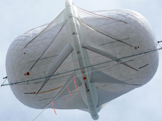
Wired comments on a topic — high-altitude wind power — that mammoth explored a couple years ago while developing a competition entry:
The wind blowing through the streets of Manhattan couldn’t power the city, but wind machines placed thousands of feet above the city theoretically could.
The first rigorous, worldwide study of high-altitude wind power estimates that there is enough wind energy at altitudes of about 1,600 to 40,000 feet to meet global electricity demand a hundred times over.
The very best ground-based wind sites have a wind-power density of less than 1 kilowatt per square meter of area swept. Up near the jet stream above New York, the wind power density can reach 16 kilowatts per square meter. The air up there is a vast potential reservoir of energy, if its intermittency can be overcome.
Even better, the best high-altitude wind-power resources match up with highly populated areas including North America’s Eastern Seaboard and China’s coastline.
“The resource is really, really phenomenal,” said Christine Archer of Cal State University-Chico, who co-authored a paper on the work published in the open-access journal Energies. ”There is a lot of energy up there, but it’s not as steady as we thought. It’s not going to be the silver bullet that will solve all of our energy problems, but it will have a role.”
…
During the energy shocks of the 1970s, when new energy ideas of all kinds were bursting forth, engineers and schemers patented several designs for harnessing wind thousands of feet in the air.
The two main design frameworks they came up with are still with us today. The first is essentially a power plant in the sky, generating electricity aloft and sending it down to Earth via a conductive tether. The second is more like a kite, transmitting mechanical energy to the ground, where generators turn it into electricity.
We thought that it would be fantastic to coat the sky above the city with thousands of these shimmering kites, the massed arrays glittering on sunny days and hidden — but for the long stalks of their slender tethers — above cloudy banks on others. As their tethers furl and unfurl to hold the kites’ positions in the windy altitudes, the kites would form a fluctuating map of the vectors and velocities unfolding above the city, perhaps also pierced by and hence revealing the aerial roads traced by the flight paths of jetliners and corporate helicopters. It might even be possible to program the surfaces of the kites, whether by adjusting the angle of the kites and altering reflection patterns or through some malleable and colored surface treatment, to serve as a massive, one-to-one diagram of the energy use patterns of the city. Like Positive Energy’s neighborhood report cards, but at an immense scale.

