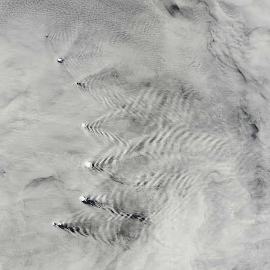
[Above, the volcanic peaks of the South Sandwich Islands distort wave patterns over the Pacific Ocean, through processes described, and, of course photographed, by NASA Earth Observatory:
…the islands disturb the smooth flow of air, creating waves that ripple through the atmosphere downwind of the obstacles.
The cloudy-clear pattern that is produced highlights the location of wave crests and troughs. The moist, cloudy air over the ocean (meteorologists call this the marine layer) is often capped by a layer of dry air. When the wave ripples through the atmosphere downwind of the islands, clouds form (or persist) at the crests of the waves because air cools as it rises, and water vapor condenses into cloud droplets. In the wave troughs, however, some of the dry air from above sinks into marine layer, replacing the cloudy air. In addition, as air sinks, it warms, causing clouds to evaporate.
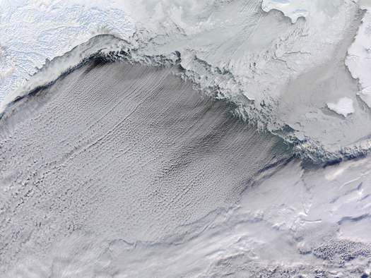
Below, “cloud streets” form south of the edge of the sea ice in the Bering Straits; as the chilled south-bound winds hit the edge of the sea ice, they encounter warmer and moister air, causing “cylinders of spinning air” to form and producing linear cloud streets as cloud formation is confined to the upward portion of these cylinders and inhibited in the downward portions; image also via NASA Earth Observatory.
Islands use the winds to produce textbook illustrations of fluid dynamics, and sea-ice alters the morphology of the clouds.]


