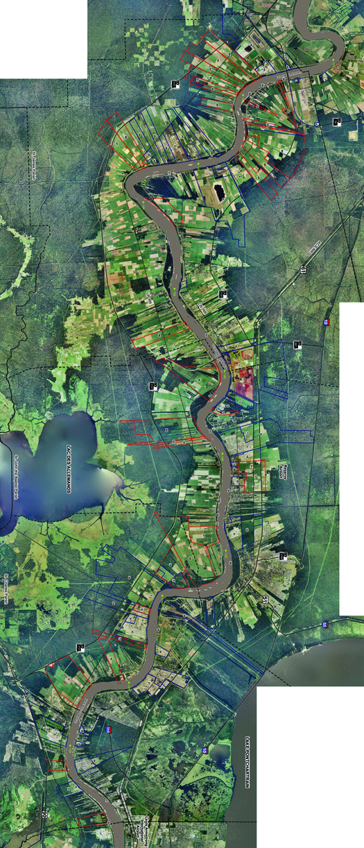
[A map of properties in the Port of South Louisiana (outlined in blue and red), via the Port’s website.]
One of the primary ways that the Mississippi River presently serves as an industrial infrastructure is by hosting the Port of South Louisiana.
There are several things that make the Port of South Louisiana unique. First, unlike most ports, which tend to be concentrated, most contiguous, and roughly bounded within a rectangular area — think of southern California’s Terminal Island, the Newark terminal of the Port of New York-New Jersey, or the emerging megaport in Savannah — the Port of South Louisiana is a distributed, linear port, stretching 54 miles along the Mississippi River between New Orleans and Baton Rouge. (It owes some further formal peculiarity — the distinctively long lots, which have a slim piece of river frontage but a deep extension away from the river, perpendicular to the river rather than parallel to one another, to Louisiana’s French history.)

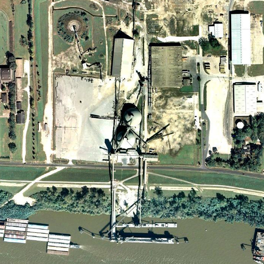
[The deep-draft bulk terminal at the Port of South Louisiana’s Globalplex Intermodal complex; it “is equipped with a Carlsen screw-type unloader for special handling of cement. The cement facility, which includes dome storage, is one of the largest in the United States. Cargo is quickly moved to and from landside storage via an extensive covered conveyor system.”]

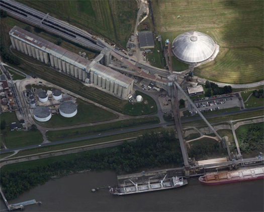
[Another bulk cargo handling facility.]

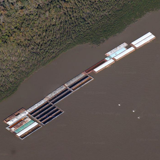
[Barge traffic on the Mississippi off the Port of South Louisiana.]
Second, again unlike those ports, the Port of South Louisiana primarily handles bulk goods — raw materials like oil, cement, woodchips, and mineral ores. (South Louisiana is the Western hemisphere’s largest port as measured by tonnage annually handled — some 192,853,000 metric tons in 2009.) This produces an entirely different spatial form. The landscape of the container port is determined by requirements produced by the dimensions of the standard shipping container (the twenty-foot equivalent unit, or TEU) and the Panamax freighter. The bulk port is more idiosyncratic — various unloading mechanisms and devices, such as the jumbles of unloaders, conveyors, and storage facilities seen above, are used to handle the vast area of materials the port loads and unloads — but it does fix on the dimensions of the “standard jumbo hopper barge” and the typical barge flotilla size (above St. Louis, 15; below St. Louis, 40-50).


This post makes me think about two somewhat related facts. The first is the recent FAD post on the Port of Portland’s Potash terminal in North Portland which generates it’s own land-use patterns dictated by rail and quarantine. Not as containerized/gridded as a say Long Beach but not as linear as say this, the Port of South Louisiana.
http://freeassociationdesign.wordpress.com/2011/05/13/the-longest-wood-structure-west-of-the-mississippi/
Juxtaposed by the news that the ports of Seattle/Tacoma were recently shut down as a result of union disputes. One question might be the relationship between port design/land-use/workforce. Or the link between commodities /modernization/labor.
http://www.nytimes.com/2011/09/09/business/union-dispute-near-seattle-turns-violent-and-idles-ports.html?_r=1&scp=3&sq=union%20port&st=cse
Agreed on both counts, especially the latter — global economic shifts (in the manufacture and movement of commodities, in the role of labor, in the technological effects of modernization) are spatially manifested in ports, which make them exceptionally interesting (and important) sites of study. And highly political spaces, given the intertwining of all those things with phenomena like the relative decline of the working class in the US under post-Fordism.