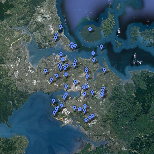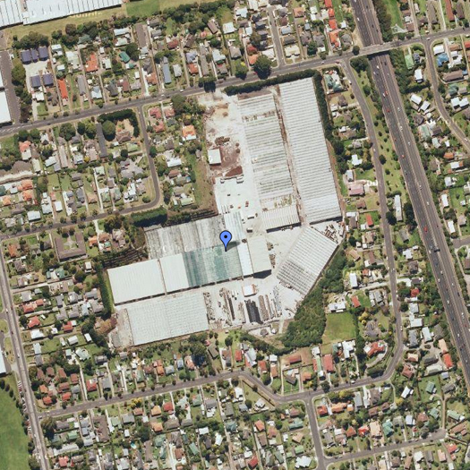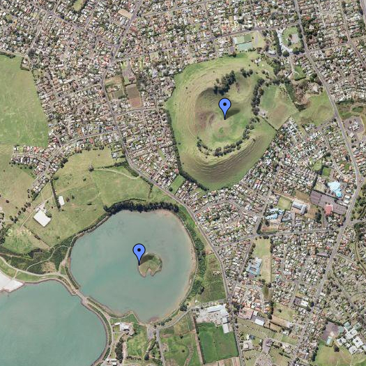
Above and below, snapshots from “Auckland Volcanoes”, a map by Carl Douglas.
Carl’s map marks the location of each of the volcanic craters that dot the surface of Auckland. The craters exhibit a fascinating variety: some have been heavily altered by mining operations (which particularly seek volcanic scoria, a type of rock suitable for use in landscaping and drainage construction); others have been “subsumed by suburbia”, as Carl puts it; still others are wholly or nearly wholly intact, protected by the 1915 “Reserves and Other Lands Disposal and Public Bodies Empowering Act” and their own insuitability for development.


A while ago, I wrote a post called “recreational volcanism”, about the possibility that there might be a
…city [which], being built atop dormant volcanoes, has reserved the most unstable districts of the city as municipal parks. Whose landscape architects have been called upon to design access systems for these geological freakologies, these unstable geysers, mud pots, fumaroles, and hot springs which sit between broad avenues, kvartals, dense clusters of towering buildings, and whose citizens frequent its public parks not for bucolic relaxation but for sublime thrills.
Auckland isn’t quite that city; but, perched atop its still-active volcanic field, it’s the closest thing I’ve seen.


Auckland sits on a monogenetic volcano field, meaning that it has a number of small volcanic vents, each of which will only erupt once. This, of course, increases the shakiness of the terrain: the next volcano will appear not within one of the city’s parks (former quarries, lakes, etc), but quite possibly in your own house.
Yes — I almost included one of the maps from the “Contingency Plan for the Auckland Volcanic Field”, like this one, which would have made that clear.