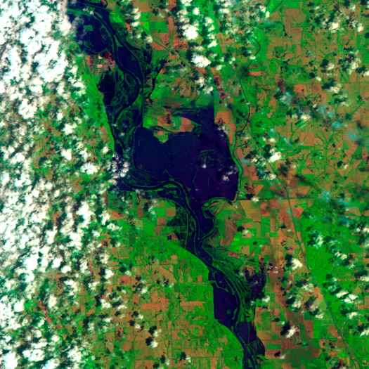
[False-color satellite imagery of flooding along the Missouri River near Hamburg, Iowa:
“On June 19, 2011, the AHPS reported, the Missouri crested slightly above the record level set for Brownville [Nebraska, about 15 miles downstream from Hamburg] in 1993. The record level was 44.3 feet (13.5 meters), and on June 19, the river briefly reached 44.62 feet (13.60 meters) before receding slightly.”
Hamburg was threatened by a levee breach on June 5, which prompted the evacuation of approximately half of the town’s twelve hundred residents, and the emergency construction of a secondary levee closer to the town. Fortunately — for the town of Hamburg, that is — another levee breach near Brownville has taken pressure off the secondary levee, and as the waters have dropped a couple feet, the town appears safe, at least for the time being. Flooding along the Missouri, though, is expected to continue throughout the summer.]

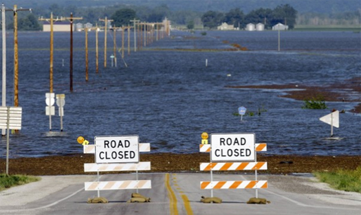
[Floodwaters cover a highway near Hamburg; photograph by Charlie Neibergall/AP.]


[…] photographed by the Army Corps of Engineers on June 16. Following the breach of levee 575 which prompted the evacuation orders for southern Hamburg, the Army Corps "immediately underwent further construction to raise the elevation of Ditch 6 […]
[…] on the Missouri River, up and downstream from Hamburg, Iowa. The distinct spray pattern produced by burst levees is visible in at least three locations, […]