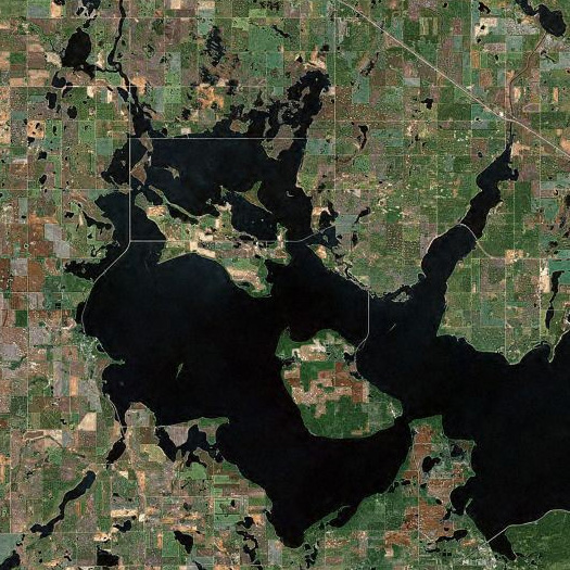

[Top, Devils Lake, North Dakota — a glacial lakebed which has been slowly rising since 1992:
“Unlike with a river flood, this water does not naturally recede after a week or a month. It has nowhere to go: The lakebed is the result of a glacier that melted roughly 10,000 years ago, and its only natural outlet is at 1,458 feet above sea level. Since August 1992, the lake has risen more than 29 feet. That would be a remarkable increase in nearly any body of water, but in the context of North Dakota’s famously flat topography it is extraordinary; here, the rising lake spreads across the land like water spilled on a table. At the lake’s current size, a one-foot rise consumes more than 15,000 acres of surrounding land. In 19 years it has grown from roughly 69 square miles to 285, an area about the size of Fort Worth, Texas.
In recent years the lake has become so massive that it has begun a sort of self-perpetuation through its influence on the local weather. The body of water adds so much moisture to the lower atmosphere that it may well be increasing the amount of precipitation the area receives. And on summer nights in Minnewaukan you hardly need the A/C anymore. Nice for sleeping, perhaps, but the cooler air means less evaporation, more standing lake.”
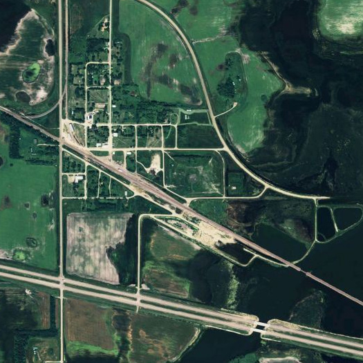
Above, the nearly abandoned town of Churches Ferry on the western edge of Devils Lake. In the late nineties, FEMA determined that the town would inevitably be swallowed by the lake, flood control measures or no flood control measures, and, rather than futilely build barriers, bought out every willing resident of the town. Leaving 12.
Read about Devils Lake and Churches Ferry in Lisa Hamilton’s two-part series for the Atlantic; link via Nam Henderson.]


Completely fascinating. One aspect of the satellite image that is particularly peculiar are the remnants of the older road grid on the expanding lake–especially the quadrant formed at the upper left center, with Route 19 intersecting other roads on the water’s surface. Oblivious to the lake’s shores, they appear unnecessarily engineered (or suggest dikes with public roads atop, as in the Netherlands).
Yet these are not causeways built over water, but somewhat the reverse–their really isn’t a term for this geographic feature or hydrological phenomenon, I don’t think, although I’d imagine it has occurred elsewhere in flooded or dammed areas, where transportation networks or other infrastructure has been “shored up” for continued use.
The northern side of this rectangle is a railroad line, used by Amtrak’s Empire Builder, which Wikipedia reports is disrupted by the lake’s unpredictability:
http://en.wikipedia.org/wiki/Devils_Lake_(North_Dakota)#Railroad_Problems
Devil’s Lake, indeed.
Excellent point. A particularly unusual (haunting, even) instance of the reification of the public land survey system.