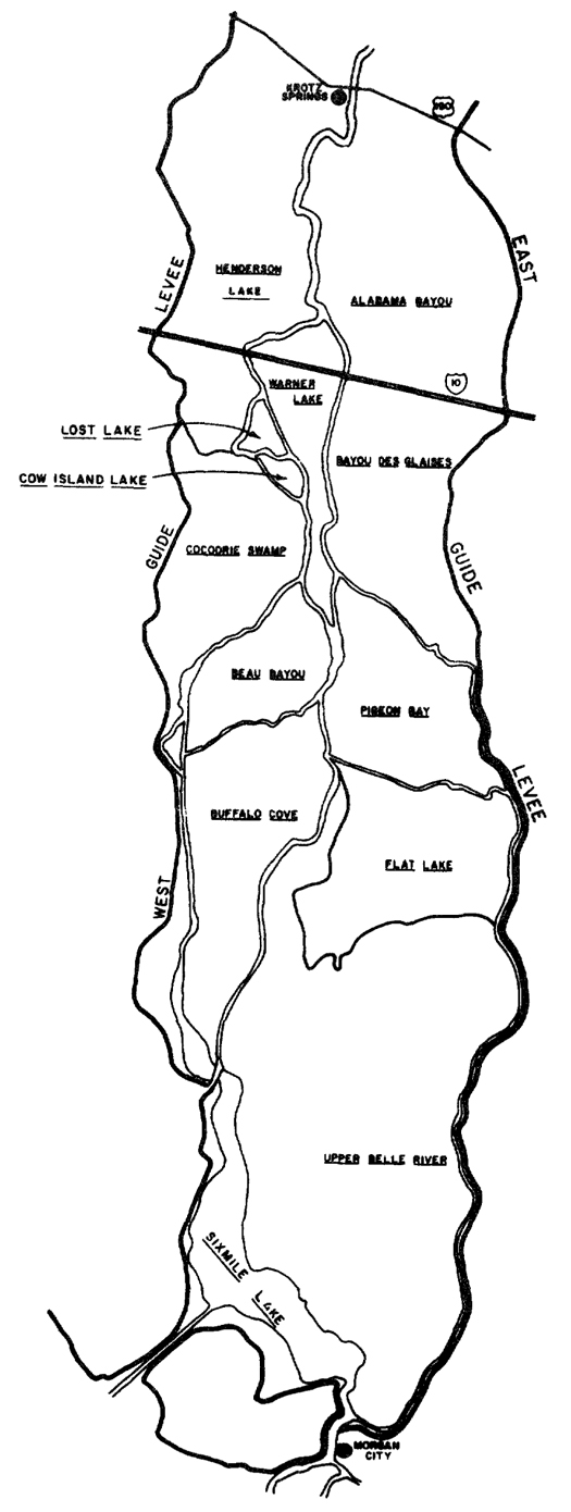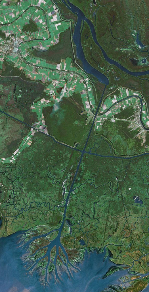
[A map of the administrative units of the Atchafalaya Basin Project in 1982, produced by the Army Corps of Engineers. The Atchafalaya Basin system is made up of three floodways: the Morganza Floodway (fed by the Morganza Spillway), the West Atchafalaya Floodway, and the Lower Atchafalaya Floodway; the latter is composed of the confluence of the two former floodways. The Basin is quite remarkable ecologically: the swampland of the Atchafalaya Basin is the largest swamp in the United States, and it is “unique among the basins [of South Louisiana] because it has a growing delta system with nearly stable wetlands”. Here, the land-making machine of the Mississippi River complex continues to function as it has since time immemorial, spraying sediment into shallow coastal waters to produce soggy new ground — particularly through the dredged Wax Lake Outlet (below), which lies to the west of Morgan City.]

[The Wax Lake Delta is entirely artificial, having been formed purely by sediments deposited through the diversion since its construction in 1942. It is apparently consequently often used in studies of deltaic formation.]


[…] you can see the map in more detail, including the rapidly accreting area of the Wax Lake Delta we previously mentioned.] 1 The Times-Picayune has a brief interactive map which provides an excellent overview of both the […]
After driving across Atchafalaya this summer, I realized I knew nothing of this vast area, and the first stop on my search was this interesting story: http://www.npr.org/templates/story/story.php?storyId=5367035 – still saw a few houseboats, even just driving through, but apparently not nearly as common as it used to be.
Nice. Thanks for the link, Mark. Will have to get your impressions of Atchafalaya next time we catch up…