One of the trends which most observers of global warming warn us could have particularly dire consequences is the rise of sea levels. And not without reason. The recent evacuation of the Cateret islands, chronicled by Dan Box as the tale of the world’s first climate refugees (though perhaps most recent would be more appropriate, given the historical record of places such as Greenland), provides ample evidence of the fragility of the human presence at the intersection of land and sea.

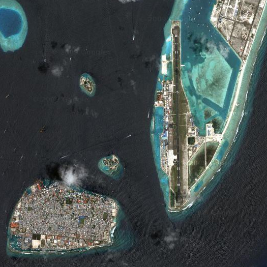
The New York Times Magazine recently profiled Mohamed Nasheed, President of the Maldives, who has made the search for a new home for the people of the Maldives — a low-lying set of islands south of India, so low that you could take a shovel out into your backyard and build the highest mountain range in the nation in a couple of hours (the current peak lies a mere 2.3 meters above sea level) — his presidential quest:
Last November, Nasheed … named India, Sri Lanka and Australia as possible destinations and described a plan that would use tourism revenues from the present to establish a sovereign wealth fund with which he could buy a new country — or at least part of one — in the future. “We can do nothing to stop climate change on our own, and so we have to buy land elsewhere,” Nasheed said.
Being so low, the Maldives are intensely vulnerable to fluctuations in sea level yet, even in the case of the Maldives, the issue is considerably more complicated than it may appear. It is not clear whether the ocean or the islands are rising faster, and much turns on whether the land can outgrow the sea:
“The question is whether coral growth can keep up with rising sea levels,” said the adviser. The Maldives consists of four reef platforms and 21 atolls, coral configurations that were produced over millenniums as dead volcanoes in the ocean receded, giving way to coral that grew vertically and formed ring-shaped reefs. The individual islands were formed as wave energy deposited shards of broken coral and shells.
“Really, the danger is an increase in temperature,” the minister countered, “because certain coral can only survive in certain temperatures.” In 1998, an El Niño influx of warm water “bleached” the coral in the Maldives, killing large portions of it. “Sea temperatures are the real culprit here.”
Though wonky, the conversation was hardly irrelevant: all islands and coastlines are formed differently, a fact sure to be explored more in years to come as planners develop more property in areas susceptible to rising sea levels. This is why Kench, the coastal geomorphologist, believes that the Maldives aren’t nearly as doomed as others think. He knew he was on to something big when he returned to the Maldives after the tsunami and found that the wave had actually raised the island surface as much as 30 centimeters, and did so as far as 60 meters inland. “This is actually building the islands vertically, building ridges that will buffer these islands from sea-level rises,” he says. “That sand is a permanent addition that is now draped among the coconut trees and is going to stay there.”
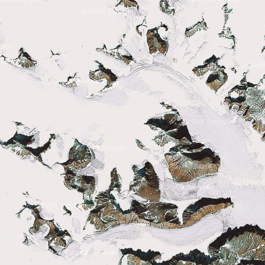
Another complication is that the vastness of the oceans makes the effect of adding water to them rather different than that of turning on the faucet in one’s bathtub: currents and distance intersect to spoil the even rise of the tides, so that melting ice in the Arctic could be mingling with the Hudson in months but melting ice in the Antarctic might not affect the Jersey Shore for years. The sheets of ice in question — the West Antarctic ice sheet, for instance — are also so vast that they exert a gravitational pull on the sea around them, such that, in the absence of that pull, the sea level in their immediate vicinity may actually fall as they melt, rather than rise.

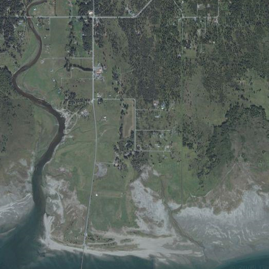
Meanwhile, in Alaska, as glaciers melt, such vast gravity is having another effect. The land — literally once pinned down by the glaciers — is rising in response to the weight being lifted off it, heaving itself out of the Pacific Ocean faster than the Ocean can swell. The sort of weight that it takes to push down a mountain is rather difficult to conceptualize (though, perhaps it would help to be reminded that it is similar to the sort of volume required to drown an island nation?), so perhaps it is helpful that the Times’ recent article on this geological shift (a geological shift happening on a human timescale is really a quite extraordinary thing, nearly as beautiful as the collision of timescales is potentially horrific) begins with the rather mundane consequences of this lifting, such as a man and his new golf course:
Morgan DeBoer, a property owner, opened a nine-hole golf course at the mouth of Glacier Bay in 1998, on land that was underwater when his family first settled here 50 years ago. “The highest tides of the year would come into what is now my driving range area,” Mr. DeBoer said. Now, with the high-tide line receding even farther, he is contemplating adding another nine holes. “It just keeps rising,” he said.

The effects, of course, are not all so positive:
Greenland and a few other places have experienced similar effects from widespread glacial melting that began more than 200 years ago, geologists say. But, they say, the effects are more noticeable in and near Juneau, where most glaciers are retreating 30 feet a year or more.
As a result, the region faces unusual environmental challenges. As the sea level falls relative to the land, water tables fall, too, and streams and wetlands dry out. Land is emerging from the water to replace the lost wetlands, shifting property boundaries and causing people to argue about who owns the acreage and how it should be used. And meltwater carries the sediment scoured long ago by the glaciers to the coast, where it clouds the water and silts up once-navigable channels.
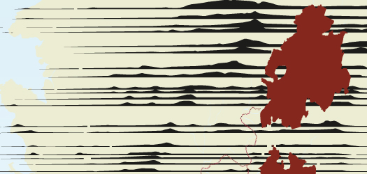
This ambiguity between land and sea reminds me of the recent project by Da Cunha and Mathur, “Soak: Mumbai in an Estuary”, which applies a deconstructive technique to landscape, “questioning the vocabulary imposed on terrains” — in particular, the line between land and sea, as drawn by the colonial surveyor and enforcing a conception of the sea as the other which threatens. The surveyor asks “Is this land or sea?”, and draws his map accordingly, but Da Cunha and Mathur convincingly demonstrate, through a series of stunning sectional drawings, the possibility of a mapping which accomodates the range of possibility created by the intersection of land and sea, rather than assigning a hard and fast line to that which is inherently maleable. Similarly, it is easy — and, on the fact of it, logical — to ask “Is the sea rising or sinking?”, yet the question embodies a hard dichotomy which is belied by the slurrying facts of individual situations.

All of which is not to say, as many do, that the presence of competing geological and meterological possibilities indicates the importance of inaction. Rather, recognizing the complexity of the situation ought to press us to consider carefully what line of action is most appropriate (and avoid facile and globalized solutions). Perhaps the Maldives should purchase a slice of Northwestern Australia, or perhaps they ought to begin, like Dutchmen of the Indian Ocean, to invent new land for themselves, confident in their ability to outmanuvere the rising tides, but they must choose — probably without certainty that the knowledge they base their choice upon is accurate. Certainly it is hard to condemn their effort to become the world’s first carbon neutral country (though perhaps some skepticism about the term ‘carbon neutral’ itself is justified, given the contortions, exceptions and distortions that are often applied to the plain meaning of the term in order to appropriate it). But it is important to recognize that debate about what to do is not the same as debate about whether to do.
(If you have an idea about what to make of this ambiguity, then perhaps you ought to enter the Rising Tides competition; or perhaps you prefer to construct memorials to geological history at implausibly small scales, and so you ought to enter the Gondwana Circle competition?)


[…] Previous discussion of water on mammoth: tracing the ambiguity of seamelt and landrise, on Alberto Kalach and the vanished lakes of Mexico City, wondering whether the Netherlands […]
[…] Any discussion of both Mathur + da Cunha’s work and unstable landscapes which failed to mention their work on the Mississippi River, Mississippi Floods, would be thoroughly incomplete; mammoth has also talked about Field Operations’ winning Fresh Kills proposal — which is also highly relevant to a discussion of the role of process in landscape design — in our post on the best architecture of the past decade, and briefly discussed another Mathur + da Cunha project, SOAK: Mumbai, in our post the ambiguity of seamelt and landrise. […]