mammoth // building nothing out of something

varnelis interview at triple canopy

Kazys Varnelis follows up his recent interview of Joseph Tainter (author of The Collapse of Complex Societies) by himself being interviewed, at Triple Canopy (whose last two issues on urbanism are indispensable):

Triple Canopy: You’ve argued that it’s no longer possible to rebuild existing infrastructures or, for that matter, to build better ones. And you’ve proposed “social engineering” and “human hacking” as keys to changing how we think of and how we use infrastructure. On the other hand, a quarter of the counties in Michigan are converting paved roads to gravel to save money. Do you still believe in the prospect of technology enabling us to salvage our increasingly chaotic, dilapidated built environment?

Kazys Varnelis: I’ve been thinking about this a lot lately. On the one hand, I still believe that a government initiative to bring infrastructure into the twenty-first century by opening data to everyone—not just leaving it in the hands of the technocratic elite—would make things better for everyone. We can see this in the ability to monitor traffic conditions in real time on Google Maps. If there is a jam in a certain area, our navigation system should route us around it.

But as I’ve been studying such possibilities over the past year, it’s become clear to me that there’s a danger to putting too much faith in the bottom-up model. During the past decade, there’s been a lot of fascination with bottom-up forms of organization. If these work at certain levels, they don’t work at others. In particular, they are unable to provide adequate structures of authority. This has been the typical lesson of revolutions: In the process of creating new governments, the revolutionaries fail or resort to authoritarianism…

I think we’re reaching that point [at which societal complexity becomes so “frustrating” and “unrewarding” that people walk away from it] rapidly. NIMBYism and legal constraints make much new hard infrastructure unlikely. One of the few projects that might get built, the high-speed rail line between LA and San Francisco, will take twenty years, assuming there are no delays. In contrast, the first transcontinental railroad took seven. We aren’t going to build our way out of this highly congested world. It’s going to choke us. This is a danger with any information-sharing mandate: It could build more complexity into the system! Does a light post need to share information? How about a traffic bollard? Probably not. But if you engineer them to do so, you add complexity and cost.

Read the whole interview for more on planning as megalomania, why architects ought to look to the Renaissance and postmodernism for clues on how to operate in the current economic climate, and the danger inherent in conceiving of architecture as an essentially technical discipline. I mentioned in the last post that a large box of reading material arrived last week, along with the Landscape Infrastructures DVD. I’m not certain what the appropriate balance is, but there’s something very interesting (and, I think, helpful) about reading the Varnelis-edited Infrastructural City (one of the items in that box and one which, to be simplistic and reductive, might be described as infrastructural pessimism) along with Landscape Infrastructures (which, to again be simplistic, might be described as infrastructural optimism).

landscape infrastructures: posthumous live blog

Been more or less out of it this week due to a little quarantine situation, but fortunately a lot of reading material has arrived on my doorstep and it’s been topped off with the arrival of the Landscape Infrastructures symposium DVD (available here). So Stephen’s joined me for a new (and entirely unannounced and therefore unnoticed) experiment: “live”-blogging a Canadian conference, months after the conference has ended (which provides a nice symmetry, because no one will read this until after the liveblog has ended). Join us below the jump.

update: We’re done for the night, but, if Pierre Belanger’s opening presentation is an accurate indicator, the conference is fascinating enough to be well worth the effort of tracking down the DVD and watching it — in about half an hour, he’s challenged the (singular) authority of engineering as a discipline, offered a quick but clearly well-researched look at the relationship between infrastructure and zoning in Rust Belt “economies of disassembly”, and posed a very interesting question that suggests something of how infrastructure might be understood differently in the coming century than it was in the previous.

Read More »

the cloud

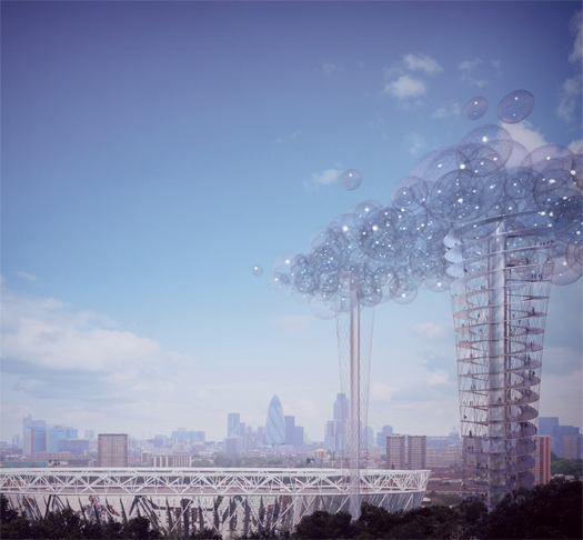
You’ll want to read all of Dan Hill’s post on his involvement in the design of The Cloud, a proposal for “a new form of observation deck” overlooking London and its new Olympic stadium.  The proposal draws upon a number of fascinating themes, including urban informatics, cloud computing, weather, crowd-sourcing, and “re-industrial” cities:

Data is to be drawn from the Olympic Games in real-time, telling particular stories — of industry, energy, innovation and connectivity — as well as of the basic facets of the Games themselves. This data could be visualised as ambiguous spectacle, using the effects most redolent with the landscape and locale (cloud, smoke, steam, fog, mist, water, wind, mechanical engineering, data). The Cloud physically twists and ripples in response to data patterns captured from environmental sensors placed around the grounds, data scraped from web activity, drawn from mobile carriers in real-time, interpreting audio to discern the different languages being spoken, acting as a giant scoreboard floating above the events, detects the viewing and listening figures around the games in real-time, explores the behaviour of localised weather systems, projects the global internet traffic to and from the Lea Valley, forms a gigantic smart meter for Stratford and surrounds at civic scale, and so on and so on.

The project is developed by a huge multi-disciplinary team including Hill and ARUP, Carlo Ratti and MIT’s Senseable City Lab, Umberto Eco, and Google; more information (including a full resolution version of the image above) can be found at the project website, and you can become a fan on Facebook here.  Whether the project will be built or not appears to depend on the decision of the Mayor of London, who is apparently considering a shortlist of other finalists.

beneath the antarctic ice

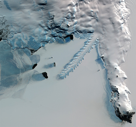
[Composite false color image of the Erebus Ice Tongue, a 7-mile-long, 33-foot-high sheet of ice projecting off the Erebus glacier in Antarctica, carved into unusual shapes by the summer waters of McMurdo Sound; via Wired Science: “During the summer, when the rest of the sea ice in McMurdo melts, the ice tongue floats on the water without thawing. As waves of sea water crash over the sides of the tongue, they carve elaborate shapes and sometimes create deep caves along the edges of the ice sheet. Occasionally, sections of the ice tongue calve off to form small icebergs.”]

As NASA’s “Ice, Cloud, and Land Elevation Satellite” (or ICESat) is nearing the end of its life span, and the next ICESat is not scheduled to begin orbiting the earth until 2014, the Cryosphere Program (the arm of NASA concerned with the study of ice and things encased in ice) is, among other things, flying a “DC-8 plane equipped with lasers, ice-penetrating radar, and a gravity meter” across Antarctica for six weeks. A report on NPR last week noted that while these flights are primarily intended to monitor the polar ice itself — the subject of ICESat’s study — they are also providing a “major scientific bonus”: because the plane flies so low across the ice, its radar penetrates through the ice and is mapping, in real time and three dimensions, the buried and previously invisible terrain of the Anarctic continent. Glaciers, so massive and seemingly uniform from above, are peeled back — “like an onion” — to reveal an unstable topography of entombed but liquid lakes which “form… pop and deflate… flow[ing] downstream” beneath the bulk of glaciers, rivers flowing between those lakes, valleys carved and concealed by the glaciers resting in them, and deep fjords akin to the familiar fjords of Norway, regarding which NPR’s reporter asks the obvious question: “Will there be a day when people can walk through the fjords of Antarctica too?”

readings: hydrologically situated infrastructures

Whether immense re-configurations of watersheds on a geological scale or fine and playful tunings of the interactions between city-dwellers and the infrastructures that deliver their water, those that transmit water or those that sit on and in it, the intersection of hydrology and infrastructure is a continual fascination for mammoth.

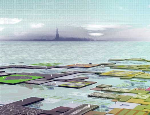
Image from Yue Yuan Zheng’s 2007 thesis project at Princeton, “The Water Edge”, which proposes a “pixelated urban edge” for the Jersey City waterfront, “inspired by the formal and organizational system of wetlands” and aiming to create “a vibrant, variable, and resilient waterfront system” accomodating “buildings, city, and park”, like some artificial Giant’s Causeway.

1. Nina-Marie Lister’s essay “Water/Front” at Places, discussing Field Operations’ Fresh Kills master plan; Mathur + da Cunha’s “speculative recalibration” of Mumbai, “Soak”; and “River+City+Life”, Stoss Landscape Urbanism’s entry to the Donlands redevelopment competition, which also produced the MVVA project previously endorsed.

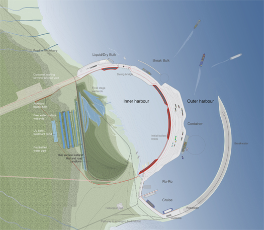
2. Courtney Likin’s “Wild North vs. Rational Port”, a thesis project at the University of Toronto and winner of an ASLA Student Award, envisions a new northern port in James Bay, Ontario — along shipping lines cleared of ice by climate change — and integrates both recreational and wildlife park program into the new port. It is, like Park Supermarket, a landscape of both production and recreation. Note that a project like this which overlays production and recreation is diametrically opposite in approach to many of the current projects so praised in contemporary landscape architecture, such as the High Line, which cannibalize the aesthetic experience of productive landscape, but exclude contemporary processes of productivity; while there may certainly be room for both kinds of project, the contrast is instructive.

Plan from “Wild North vs. Rational Port”; see 2.

3. Pruned on Waterpleinen, a hybrid stormwater infrastructure and public park system for Rotterdam, proposed and under construction; the hybridization of stormwater infrastructure and public parks being previously praised by mammoth in both Texas and the Netherlands. Waterpleinen is featured in the latest issue of Alphabet City, Water. Read Christie Pearson’s “The Public Bath and the City”, also in Water.

4. Delta National Park, a multi-format exploration of the content and potentials of the Sacramento-San Joaquin river delta, by John Bass; begin with the intro, continue with the map and the blog (via Mason White, a while ago). The Sacramento-San Joaquin delta is an inverted river delta, which are rather less common than the traditional delta.

5. Speaking of the American West, water is growing scarcer, as most of our readers are probably aware; this is producing difficult conflicts, such as the battle over the effect of activating a Yuma desalination plant on the Cienega de Santa Clara wetland, itself an accidental by-product of previous strategies for controlling the water supply, but now a vital habitat for migrating birds. What do we owe the healthy detritus of our industrial processes?

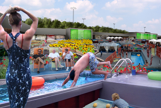
Image from Macro-Sea/VAMOS Architect’s “Latest Strip Mall Concepts”, which involve using their dumpster pools (better known for their Brooklyn implementation) as part of a scheme for community appropriation of an abandoned strip mall.

6. A (silly?) plan to build a floating airport off the coast of San Diego, at Infrastructurist.

7. Croton Water Filtration Plant at The Future Beneath Us; 290 million gallons a day beneath the streets of New York City, camoflauged by Ken Smith’s stormwater-infiltrating golf course.

park supermarket

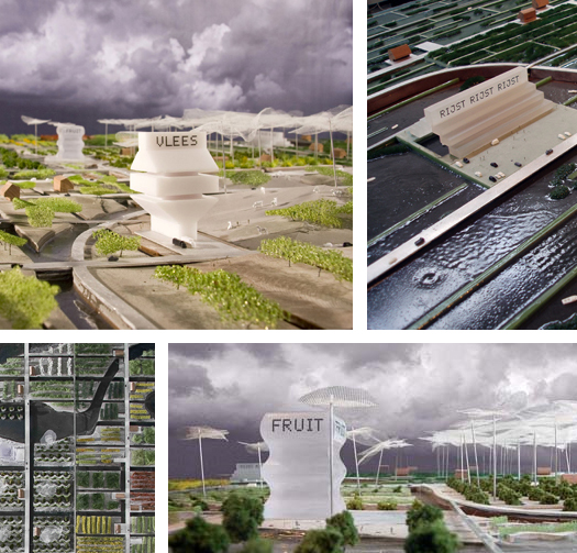
Dutch architects van Bergen Kolpa (with research ecologists Alterra) propose a “Park Supermarket” for the Randstad, transforming polders — historically landscapes of food production, now pressured by both development and rising waters — into a park subdivided into new climate zones (“moderate, Mediterranean, and tropical”) and constructed hydrological conditions (basins for the cultivation of tilapia, or terraces for Pandan-en Risotto), accomodating the program and contents of the contemporary supermarket within an agrarian park. And not only does the new park sell produce for the culinary traditions of the “170 different nationalities” who live in the Randstad, but it produces that produce. Literal landscape architecture, vertically integrated. One wonders what other building typologies might also become landscapes — power plants are one obvious example, whether primarily technological or biological, while the process and procedure of religious sites have long blurred the lines between landscape and architecture; however, what is particularly potent about van Bergen Kolpa’s proposal is the coexistence of an archetypal modern building program (the supermarket) with the production facilities that support that program (but are usually invisible) and the public and open access of a park. It’s as if you went to Wal-Mart, and found the jewelry sales counter was at the lip of the diamond mine’s pit, and in the background families were picnicking on the loitering excavators and skipping stones across pools of rainwater collecting in exhausted craters.

[via pop-up city, who explain how the project grows out of both the traditional Dutch relationship to productive landscapes and contemporary Dutch culture; speaking of diamond mines, see eatingbark on mirny and aikhal; “Park Supermarket” is part of the exhibition Foodprint]

re-inhabited circle-k’s


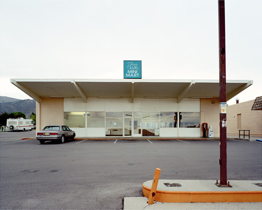
[“Mini-Mart, Albuquerque, NM”; photographer Paho Mann documents the diverse array of stores that re-inhabit the empty shells abandoned by the national corporation Circle-K; the current lives of Circle-K’s include “a dry cleaners, a couple of florist shops, a tattoo parlor, a tuxedo rental place, several mini-marts and dollar stores, and Bridgett’s Last Laugh Karaoke and Fish Fry.” More evidence of the suburb as a locus for informality in the American city. See the full slideshow at Places, and a map of the locations Mann is studying in Phoenix and Albuquerque on his website.]

the museum of innocence

Turkish novelist Orhan Pamuk’s new novel, “The Museum of Innocence”, tells the story of Kemal, the son of a wealthy Istanbul businessman, and the forbidden affair that derails his life, which is relatively standard stuff. What is fascinating, though, is that Kemal’s obsession with the affair leads him to collect an assembly of objects from around Istanbul which memorialize the affair, and that Kemal then houses those objects in the titular Museum of Innocence, a small and melancholy place which Pamuk describes in an interview as feeling as though “there was investment to preserve the past, but now no one is inside, except sleepy museum guards,” at once “timeless” and “ephemeral”. The twist is that Pamuk has been collecting the objects described in the novel for ten years — “I collected the objects first, then I described them in the novel” — and will open Kemal’s Museum of Innocence — a “melancholy place, but of course with some humor as well, just like the novel” — in July of 2010. What a wonderful commission for the architect: build this novel.

[via NPR]

claiming involuntary parks


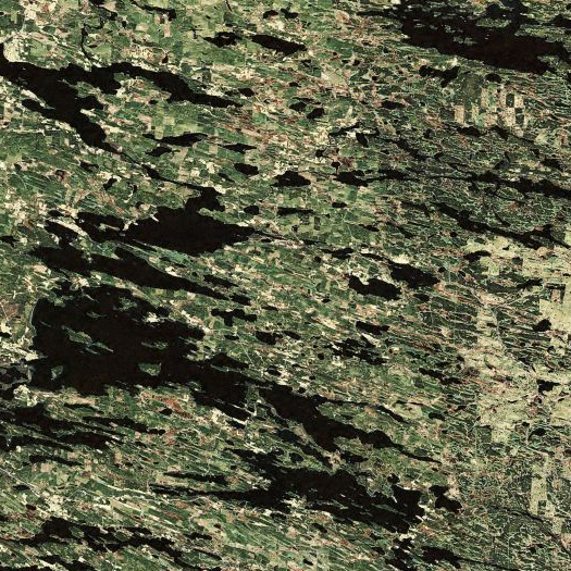
[Taiga at the glaciated and lake-spotted meeting of Finland and Russia]

The European Green Belt is an initiative to develop a pan-European conservation system as “an ecological network that runs from the Barents to the Black Sea”. Picking out the Cold War line of division between East and West, the initiative aims to thicken and de-civilize that political line, so that the ghostly trace of a militarized landscape becomes a feral and wild preserve, land sacrificed willingly not to Ares but to biodiversity. The line would crawl through “old-growth boreal forests” at the Finno-Russian border, across the western margin of the east Eurasian taiga, and past “airfields, missile bases, and [military] training sites” as it courses through climax Scots Pine stands, wetlands, and coast into the Baltic Sea.

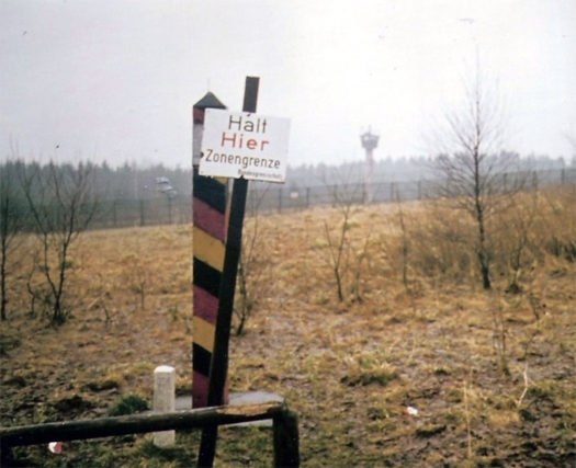
A marker at the East German border during the Cold War, via wikipedia

Emerging from the sea in Northern Germany, it would trace the Iron Curtain southward along the former border between East Germany and West Germany (that being the only place where the Green Belt crosses the interior of a country) and along the edges of various Central European states (the Czech Republic, Slovakia, Austria, and Hungary), joining together habitats involuntarily preserved by the geography of militarization (since the fortifications often were kilometers inside the actual borders, the territory between the border and the fortifications became a place where human trespassors risked death, but wildlife passed freely), enshrining accidental biodiversity in international law. Still further south, the Green Belt would splinter in several directions, turning to the Adriatic across Slovenia and around Albania as well as the Black Sea by Macedonia, Bulgaria, Greece, and Turkey, reflecting the confusing political geography of Cold War Europe, but also connecting diverse landscapes of rivers (the Danube, the Bojana), lakes (Prespa, Ohrid, Skutari), wetlands, mountains, and flood plains.

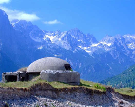
Cold War-era concrete bunkers in Albania; from an interesting thesis project, “Concrete Mushrooms”, forwarded to mammoth by two Albanian landscape architecture students (Elian Stefa & Gyler Mydyti), studying in Italy, who propose the adaptation of the bunkers into a network for economic development based on tourism; a Creative Commons license applies to their images. The full project can be read about here.

The idea is fascinating not only because of the temporal overlap between military/political landscapes and nature preserves, but also because land once involuntarily wild (as in Bruce Sterling’s notion of the involuntary park, which I’ve got a bit more to say about when I find the time to complete a post) is now being valued for its wildness and so becoming voluntarily wild — the claimed involuntary park.

[link via lewism]

metaphor and landscape

faslanyc has a good piece on the weakness of metaphor as a grounding literary device for landscape architecture.  The post is in reaction to Andrew Blum’s “Metaphor Remediation”, recently run in Places.

I approvingly cited Blum’s article a couple times, so I re-read Blum’s article with faslanyc‘s criticism in mind.  Having done so, I think maybe its not just that metaphor is the wrong literary device to cite (though faslanyc builds an interesting case for that, which you ought to read), but that, despite Blum’s own stated intentions, he isn’t really talking primarily about literary devices (MVVA’s work certainly isn’t overly preoccupied with them, as faslanyc notes), but about a “technical” shift (to use Blum’s term) in the relationship between ecology, cities, and landscape practice.  The primacy of ‘metaphor’ is shoehorned into the piece in various places, but it doesn’t really fit, and the piece would read fine without it.

For instance, how much is lost in this paragraph if one removes the reference to ‘metaphor’:

To do this — to define the poetics of a new kind of Eco-City Beautiful — landscape architects are tightening the links in their work between the scientific and the aesthetic and the ecological and the metaphorical. MVVA’s work in particular demonstrates a move beyond “postage-stamp” examples of urban nature that are easily contained, labeled and trumpeted. Beginning with the design of Mill Race Park, in Columbus, Ohio, and clearly evident now in the scheme for the Toronto Port Lands, the scale of MVVA’s interventions demonstrates a concern for ecological processes that is not merely illustrative, treating nature as if it were a museum exhibit, but rather that is necessarily rooted in a holistic understanding of site ecology. [6] More strikingly, it requires an agnostic approach toward nature’s coexistence with urban experience: accepting (indeed, insisting on) the presence of nature in the city, while being flexible as to the “truth” of that nature. The future landscapes described in their schemes suggest that there is no such thing as an orthodoxy of nature in an urban park, and that nature cannot be held at arm’s length.

Or this one:

In MVVA’s work of the last two decades, ecological thinking informs landscape making. Throughout, they have drawn on the help of professional consulting ecologists, including Stephen Handel, Steve Apfelbaum and Mark Laska, in search of a richer understanding of the possibilities for best incorporating natural processes into post-industrial urban landscapes. [8] This collaboration between landscape architects and ecologists is complex, and not without conflict. There is a basic difference in stance: landscape architects necessarily apply a design intention to a landscape, while ecologists observe and compare a landscape with an idealized theoretical framework of undisturbed nature. Landscape architects eager to respond to practical ecological concerns must reconcile these fundamentally different approaches to achieve substantial functional improvements — especially if those improvements are to operate both technically and metaphorically, for their own sake and as legible symbols of the Eco-City.

The problem isn’t that landscapes can’t operate as metaphors for a tightly integrated relationship between the city and nature (not that I think faslanyc is saying they can’t), but that they can’t operate successfully as metaphors without first operating successfully as landscapes that function in both ecological and urban systems (“technically”), and so it is backwards (of Blum) to emphasize the primacy of the metaphor when it is the literal reality which gives the symbol its power.

polis on suburban cairo

Polis on the suburbanization of Cairo; not surprising, I suppose, given that suburbanization (particularly the growth of the past decade, pre-recession) partly proceeded from the collusion of governmental and corporate interests in America’s relatively transparent political system, that suburbanization in a country with a more corrupt political system would proceed from even thicker, more direct collusion.

[via pruned]

the atlantic on new orleans

Wayne Curtis in The Atlantic on architecture and the reconstruction of New Orleans:

Four years after Katrina, the rebuilding of New Orleans is not proceeding the way anyone envisioned, nor with the expected cast of characters. (If I may emphasize: Brad Pitt is the city’s most innovative and ambitious housing developer.) But it’s hard to say what people were expecting, given the magnitude of the disaster and the hopes raised in the weeks immediately following. Seventeen days after the storm, President George W. Bush stood in Jackson Square and promised: “We will stay as long as it takes to help citizens rebuild their communities and their lives.”

The terms we, as long as it takes, and help turned out to be fairly elastic. The Federal Emergency Management Agency shuttered its long-term recovery office about six months later, after a squabble with the city over who would pay for the planning process. Since then, depending on whom you talk to, government at all levels has been passive and slow-moving at best, or belligerent and actively harmful at worst. Mayor Ray Nagin occasionally surfaces to advertise a big new scheme (a jazz park, a theater district), about which no one ever hears again. A new 20-year master plan and comprehensive zoning ordinance was being ironed out early this summer, but it remains subject to city-council approval. A post-Katrina master plan has been under discussion since before the floodwaters were pumped out.

In the absence of strong central leadership, the rebuilding has atomized into a series of independent neighborhood projects. And this has turned New Orleans—moist, hot, with a fecund substrate that seems to allow almost anything to propagate—into something of a petri dish for ideas about housing and urban life. An assortment of foundations, church groups, academics, corporate titans, Hollywood celebrities, young people with big ideas, and architects on a mission have been working independently to rebuild the city’s neighborhoods, all wholly unconcerned about the missing master plan. It’s at once exhilarating and frightening to behold.

Perhaps the most interesting section is the portion on 3428 Dauphine St and Andres Duany; I can’t decide if Duany is being incredibly condescending or accidentally brilliant.

vanished speedways


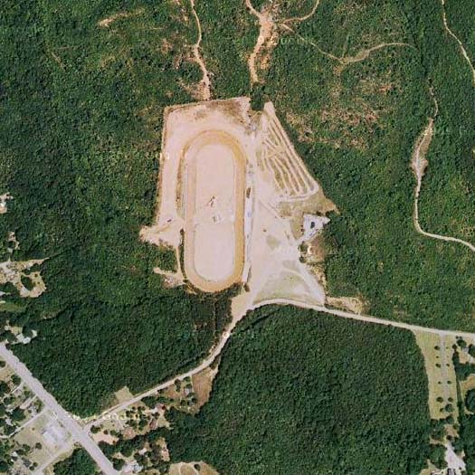
[Local speedway in Lancaster County, South Carolina; this is the speedway that sang me to sleep on Saturday nights for roughly twelve of the first fifteen years of my life]

In the comments on my post on soccer as a diagram traced on an exported landscape, Stephen notes that :

The landscape of [Formula One] racing is also an abstraction of urban space… [it] might be the only sport where temporary re-appropriation of an urban landscape by sport isn’t just an interesting OUA proposal, but commonplace. Where this field of play differs from those of soccer and American football, however, is in how the specificity of each landscape dictates very specific tactics for engaging it – basically, there are only one or two fastest lines around a racetrack. There is a fast space, surrounded by slow space… Because two cars can’t be in the same place at the same time, and unlike a field where there are many spaces with equal starting potential, timing your occupancy of the fast space becomes the critical tactical decision…

Which reminds Alexander Trevi of a CLUI exhibit on automotive test tracks, which he posted on a while ago, which in turn reminds me of this research project investigating the local speedways as social landscapes, by a landscape architect at Virginia Tech, Brian Katen:

“After my first race, I was intrigued by this other Virginia landscape that I had heard nothing about,” says Katen. “Virginia has well known places that present the commonwealth to visitors – Civil War battlefields, plantations, the Blue Ridge Parkway. “But there are other parts of Virginia that are important. Such as the crooked trail – a music trail from Ferrum to far Southwest Virginia, where bluegrass music comes from. And one-third of the local racetracks were in Southwest Virginia,” says Katen. “These are important places. The real power of racing – that ties the state together – emanates from Southwest Virginia. It is an important landscape that was unrecognized,” he says. “And it is an important social landscape that is not part of the Civil War battlefield and plantation way of understanding life in Virginia before television… “You are walking through the woods and you know the track is there somewhere. Then you realize that you are standing in it. The landform emerges out of the forest as your eye adjusts. Sometimes you feel yourself walking around a banked curve.”

Hillsville Speedway, photograph from the collection of Brian Katen

As a Washington Post article on the project notes, Katen grew up around DC, but only became interested in the racetrack landscape after moving to southwestern Virginia to take a position at Virginia Tech. A chance meeting with a former driver at the Motor Mile Speedway near Blacksburg led to a passion for locating and documenting the vanishing racetracks:

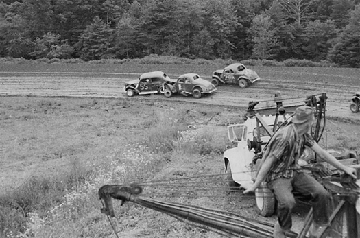
He happened to sit down next to Turman’s family and got to talking with them. Turman, now 66, had raced in the 1960s, gaining a local following and running moonshine to fund his obsession. He had photos of races from that same track, one with his navy-and-white 1937 Ford shooting past a turn right into a pond. By the time he got the car out, Turman said, “I bet there was five or six ton of mud in it.” Like most drivers back then, he built his car from junkyard scraps. He raced different tracks every few nights. Thousands of fans would watch from hillsides or pastures.

Katen was fascinated. All those places had vanished. So he started looking for tracks using clues from newspaper ads, aerial photos and people’s memories. He drove back roads to find them, especially in the summers when he had more time to wander. He has found more than 120 tracks in Virginia — although by his count, only about 18 remain. He is building an archive of stories, photos of drivers and speedways, tickets and posters, filling in a part of the everyday history of Virginia that might otherwise be lost.

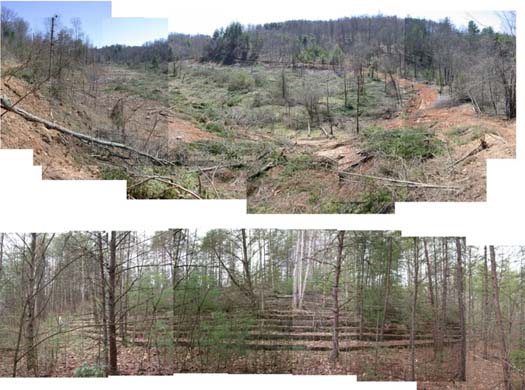
Some tracks closed because they didn’t make money, then were sold to developers or turned back into farmland. People became busy or lost interest, maybe staying home to watch NASCAR on TV instead. Some tracks are covered by lakes. One is underneath an Alexandria subdivision. Some are just ghosts, Katen said, a faint tracing in the grass where the dirt was compacted by all those spinning tires.

Floyd (top) and Ararat (bottom) speedways today; photographs by Brian Katen

This slideshow of oval tracks put together by Katen is a fascinating tour of automotive landscapes, both defunct and active. Like the test tracks Trevi refers to, the oval tracks are easily read as encapsulating something fundamental about American culture’s love for cars, tires, engines, and roads, spatializing American culture in the land itself (as every culture always has), but they differ sharply from the test tracks in being primarily social, or even nostalgic, landscapes, places where “generations of families and old friends” gather to celebrate or remember having gathered.

extraterrestial infrastructure

“A Space Program for the Rest of Us”, a brief history of the American space program to date and an interesting case for why the next step should be the development of an open and robust space refueling infrastructure, instead of recycling the technologies and methodologies of the Apollo program.

an assortment of links relevant to previous conversations

1. On the relationship between sports and urbanism, see Pruned on urban golf. Which led me to think that soccer might similarly be deployed with a similar future of appropriation, accomodation, commercialization, abandonment, and absorbtion, only to discover, via the Office for Unsolicited Architecture tumblr, that urban soccer has already been deployed as an architectural tactic.

2. Pruned’s post on urban golf was prompted by a great exhibit (partially available online) sponsored by the Canadian Center for Architecture on “action”, which aims to show the potential of “personal involvement” to trigger “radical change in today’s cities”.

3. Note (also via Pruned) that the Office for Unsolicted Architecture, who we’ve mentioned excitedly in the past, has a tumblr; posts on a map of spatial and infrastructural projects in Tbilisi, NL Architect’s Trial Factory, Paisajes Emergentes’ Quito airport competition entry and more (and that’s all just today, as today is its first day, I think).

4. A couple more links regarding the city/battlesuit/archigram conversation: millenium people’s “the data city + jules verne” and diffusive architecture’s “city as battlesuit/criticism and enthusiasm”, both of which are smart extensions of the discussion.

5. Mario Marchant on big boxes, little boxes, and urban diversity at Volume project, via Nam.

as diagram traced on exported landscape


[photograph by Maximilian Haidacher, via polar inertia]

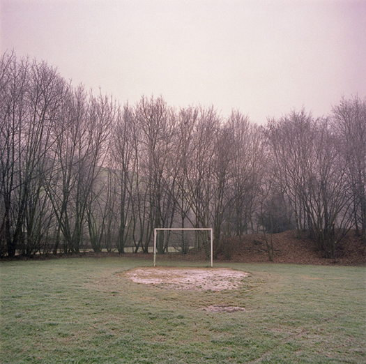
The few of you who may have followed my rather undirected ramblings at eatingbark before the launch of mammoth will be aware that I’ve long been rather fascinated by the notion that sport fields, in general, and soccer fields (football pitches for the non-North Americans), in particular, are canvases for the construction of diagrams of urban space — that the movements of the players and the ball, the rules of the game, the condition of the field (water-logged; frozen; pristine), and the formations proscribed by coaches and managers are mirrors of urban processes. Geoff Manaugh has described ‘football’ (I don’t know which football he had in mind, and I don’t think it really matters) as “a series of contradictory landscapes strategies… competing ways of using and filling space,” the truth of which is elegantly demonstrated in Jonathan Wilson’s definitive book on the development of soccer tactics, Inverting the Pyramid, which traces the history of the sport not as a list of winners and losers or a narrative of heroes and villains, but as the continual search for free space (“the question is always where is the space”), for seams in the “analytic geometry” created by dominant formations and patterns of play.

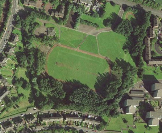
Old Cathkin Park in Glasgow, once the home of Queens Park (the oldest football club in Scotland), then of Third Lanark, and now melancholic fusion of pitch, terrace, and forest, via google maps

Relatedly, Sam Jacobs has described soccer as “a kind of essentialised urbanism”, tracing the lineage of the pitch from its “chaotic vernacular origins” in the football of the 14th and 15th centuries, when opposing groups battled across the whole landscape of a village — “houses, agriculture, sites of worship” — to place the ball into or onto a selected marker at the other end of the selected landscape. So not just the patterns of play, but also the white lines carefully chalked into grass or turf embody patterns of urbanization within the space of the game (which allows one to fairly easily read metaphors about conflicting rulesets for urbanism into North American fields with both American football and soccer markings).

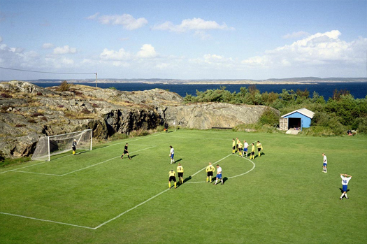
A field in Knippia, Sweden, photographed by Hans van der Meer.

The point of all this is to point you to this essay in The Norman Einsteins (a “Sports & Rocket Science Monthly”), by Sport is a TV Show’s Fredorrarci, which is fueled by the photography of Hans van der Meer, though it is about a good bit more than them:

What are the most impressive elements to me about the photographs of Hans van der Meer are the backdrops, or rather, the contrast they present. The background changes from picture to picture. First, a mountain, then some chimney stacks, then some scrubland or a housing estate or a harbour. The foreground, however, is the same each time. The marking is identical. The game is identical. It’s all the more remarkable when you remember how recent the idea of mass organised sport is. It’s impossible — try as some might — to imagine a world without it. Yet it took people not so many generations removed from our own to conceive of these games, or to take existing games and properly codify them and give them form. It took the endeavour and enthsiasm of people to spread the games. It’s easy to take sport for granted, like a river or a mountain, but it didn’t just happen. It wasn’t always there.

Van der Meer’s photographs demonstrate the persistence of abstraction, of the need to maintain the regularlized and minimalist interpretation that Jacobs identifies, even in the face of terrains which defy it. Thus the idealized form (or nearly the Platonic idea) of the English village is projected onto and carefully protected from the landscapes of every other continent, an exported landscape covered by a myriad of invisible diagrams.

[see also this old City of Sound post on design, architecture, and football]

ownership culture

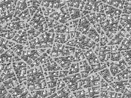
[“Subdivision: Sunshine Acres”, by Ross Racine.]

Thomas Sugrue, in a Wall Street Journal article on the American culture of home ownership from August:

Every generation has offered its own version of the claim that owner-occupied homes are the nation’s saving grace. During the Cold War, home ownership was moral armor, protecting America from dangerous outside influences. “No man who owns his own house and lot can be a Communist,” proclaimed builder William Levitt. With no more reds hiding under the beds, Bill Clinton launched National Homeownership Day in 1995, offering a new rationale about personal responsibility. “You want to reinforce family values in America, encourage two-parent households, get people to stay home?” he said. George W. Bush similarly pledged his commitment to “an ownership society in this country, where more Americans than ever will be able to open up their door where they live and say, ‘welcome to my house, welcome to my piece of property'”…

Some countries—such as Spain and Italy—have higher rates of home ownership than the U.S., but there, homes are often purchased with the support of extended families and are places to settle for the long term, not to flip to eager buyers or trade up for a McMansion. In France, Germany, and Switzerland, renting is more common than purchasing. There, most people invest their earnings in the stock market or squirrel it away in savings accounts. In those countries, whether you are a renter or an owner, houses have use value, not exchange value.

I tend to focus on technological (automobile), infrastructural (the interstate system, the regulatory dictatorship of the fire engine and its turning radii) and political (tax policies that favor home ownership, strict single-use zoning) reasons for the development of the form and ubiquity of the American suburb, but it is also very interesting to consider the suburb as the outgrowth of a cultural ideal, of a particular understanding of the relationship between person and home, or to consider the financial crisis as the (il)logical conclusion of that ideal, cultivated to absurd proportion and applied without regard to circumstance. That ideal is so deeply embedded in our culture that it is nearly invisible, seeming not a cultural construction but an essential and timeless rule, as deeply-embedded ideals often do.

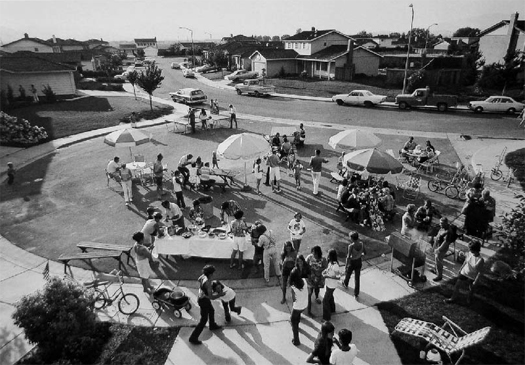
A block party in a young cul-de-sac in the seventies, from Bill Owen’s classic series “Suburbia”; an excellent illustration of the persistence of informality in the suburbs

The remainder of Sugrue’s piece develops a genealogy for this ideal of home ownership, leading to Sugrue’s conclusion, which is that the American ideal of home ownership is ultimately not founded on the rationales of personal responsbility, security, or stablity, but upon the notion of the home as an asset for the cultivation of personal wealth. At Front Porch Repulbic, James Matthew Wilson suggests that the lineage runs deeper than the 20th century political decisions Sugrue identifies, connecting the notion of the home-as-wealth-generator to Tocqueville’s observations:

This is not a new distinction, but it certainly is a vital one. Tocqueville observed in Democracy in America that the American restlessness, the constant pursuit of money because of the insecurity and evanescence of family fortunes in an intensely liquid capitalist, industrial society, saturated Americans’ practices of farming and property ownership. To a lesser extent — rather than a greater — than older and more traditional societies, Americans cherished the stability, autarky, and intergenerational continuity of property ownership. In an age when most agriculture was still subsistence agriculture, Tocqueville saw that Americans had managed to huckster farming into a short-term investment scheme; the American farmer might buy a patch of land, cultivate it for a few years, and, once the rocks had all been removed from the fields and the land turned to good account for a few seasons, that farmer was likely to sell it off and move away.

Architecturally, this is a strange notion — that the primary function of the home is to generate wealth, rather than to provide shelter, but it does, I think, go a long ways towards explaining the dominance of the primary architectural forms of contemporary America (the cheaply built urban condo and the even more cheaply built suburban home). How many school studios studying residential architecture begin by assuming that the primary purpose of the homes they design is to provide shelter and how many assume that it is to generate wealth (or, how many even raise the notion that a function of the home might be to generate wealth)? The obvious challenge for the architect, then, is whether to accept and work within the framework provided by that dominant understanding of the home (suburban Koolhaas), to do work which critiques or rejects the ideal of the home as a wealth-generating mechanism, or to look for a middle way (studying the framework in order to subvert it? homes which make explicit their duty as temporary profit generators by self-destructing after a certain period of time?).

[not unrelated: I won’t pretend that I know which (if any) of those options is best, but I will say that Stephen and I have been trying to develop a consistent argument that it is best to do architecture (even paper architecture) in a way that, at the very least, acknowledges the presence of the underlying motivations of the people we design for, even if it questions or subverts those motivations; links to the articles above via The League of Ordinary Gentlemen]

TED talks architecture

I’m loving the architecture series of TED talks – 20 minutes seems to be the perfect amount of time to get a handle on the key driving forces behind an architect’s practice. Also, the TED audience (which as far as I can tell is comprised mainly of brilliant non-architects) forces architects to talk about their work differently than is the norm. Even for someone who stays reasonably current on architectural theory through various books, journals, blogs, and school publications, high-level discussion about an architect or project can often feel like stepping into the middle of a conversation (because you are). Here, however, they don’t presume everyone in the audience is already familiar with their work and approach. Because of this, most attempt to paint in broad strokes their practice before delving into any particular instantiation. Even though we might not be surprised by what they say, listening to an architect talk for a few minutes in a very explicit way about the fundamentals of their approach to architecture is a wonderful check on the implicit understanding of ‘what they are doing’ developed piecemeal over time. Because of this, these talks are great way to look comparatively at several firms.

The following videos show wildly different approaches; particularly between the first two (REX and BIG) and the second two (Diller Scofidio + Renfro and Thom Mayne). I’ll say at the outset I’m a whole lot more convinced by the former, and thus found their talks a lot more compelling – though all four are undeniably interesting.  UPDATE:  I expanded on this a bit more in the comments.
Read More »

our collective spatial memory, modeled

From the description of the above video at PopSci:

Using nearly half a million Flickr photos of Rome, Venice, and the Croatian coastal city of Dubrovnik, a team of computer scientists at the University of Washington’s Graphics and Imaging Laboratory assembled digital models of the three cities in 3-D… Each video includes clusters of small diamond shapes, which represent each photographer and his or her vantage point.  The team built a new algorithm that proceeds in two steps — first, by matching the photos by what they had in common, puzzle-style, and then by determining the scene and each photographer’s pose.

I wonder if Regina Bittner has seen this. It immediately made me think of this article she wrote for Volume Magazine. This isn’t a model of Dubrovnik, it is a model of our collected visual record of that city – which is far more interesting, in my opinion.  Wouldn’t it be wonderful if this model was constantly accessible through an iphone app?  And constantly updated?  (Kind of like this). You’re walking around the city, and decide that one of your favorite nooks is lacking in detail, so you snap some extra pictures.  Upload them to flickr and tag them.  A few extra polygons further define the model, the crowd-sourced 3-dimensional map developing in real-time.  How many false images would it take to hack the model?  Citizen activists or a private developer pushing for a future project decide to show their vision to the world, and upload thousands of computer renderings photo-montaged into photographs of the existing site, the new geometry competing with the old, our memories mingling with our aspirations.

[via Gizmodo and Nam]

toxic waters

The New York Times is running a fantastic series on “worsening pollution in America’s waters and regulators’ response.”