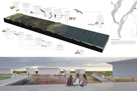
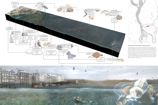
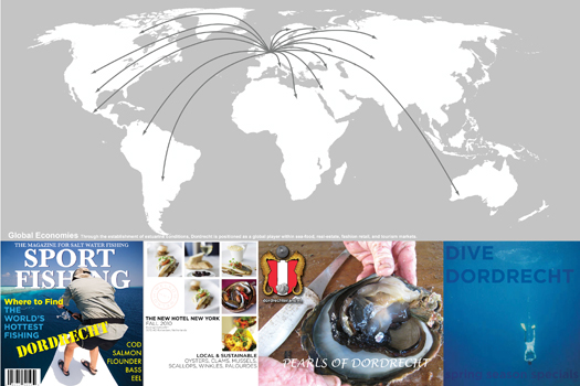
In recent years, as they seek to rethink the flood control infrastructures and climate defense systems of the Mississippi Delta, American politicians, engineers, planners, and designers have, with good reason, looked to the Netherlands for inspiration and expertise.
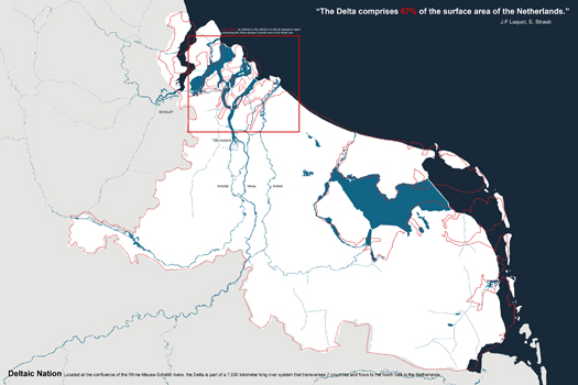
This is entirely natural, as the Netherlands has long been the world’s most sophisticated laboratory for deltaic infrastructural experimentation. In this vein, a recent studio at Harvard GSD, run by Nina-Marie Lister and Pierre Belanger, looked at potential futures for the region around the city of Dordrecht in the Rhine-Meuse Delta.
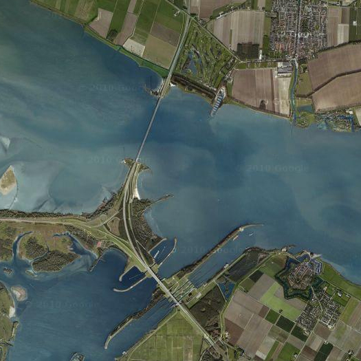
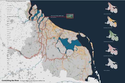
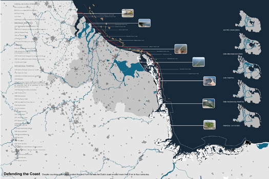
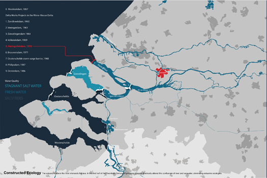
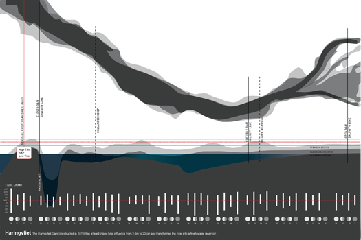
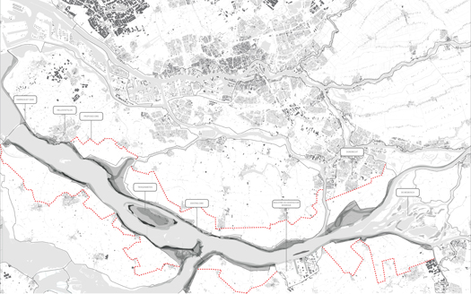
One of the projects that emerged from this studio, Kimberly Garza and Sarah Thomas’s “de-Damming the Dutch Delta”, makes a proposal that has a great deal of relevance for discussion of the future of the Mississippi Delta: open the massive (3-mile-long) Haringvliet Dam, permit salt and fresh water to mix freely again in the Haringvliet estuary, and make the resultant emerging aquatic ecology the central organizing infrastructure of an alternate urbanism.
There are a couple of things that make this project particularly compelling.
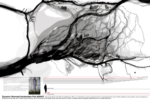
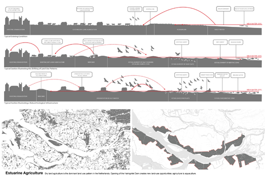
The first is the central role that Garza and Thomas give to re-thinking a key datum. Landscape architects have paid increasing attention in recent years to the ways that both standardized measurements and standardized measuring tools serve to not only measure landscapes, but also to shape them. (Gunter’s Chain and the Jeffersonian Federal Land Ordinance of 1785 being two connected examples that have received a fair bit of attention.) Garza and Thomas identify one such generative measurement, the Normaal Amsterdam Peil, or NAP. The NAP dates to 1675, when it was established Mayor Johannes Hudde to denote the average summer high flood elevation of the sea adjacent to Amsterdam. The use of the NAP spread widely through Europe, and is used to establish littoral policies, laws, and regulations. (The coastline drawn for the Netherlands on a normal map, for instance, is the coastline as set by the boundary between water and land at NAP.) The functional effect of the NAP, then, is to reify a “binary relationship”, as Garza and Thomas say, “between land and water”: on this side of the line drawn using the NAP, you have water; on the other side, you have land. This at once expresses and reinforces an attitude about the way that humans use and occupy littoral terrain, which privileges certain programs — such as the construction of dams that neatly separate salt and fresh waters — while excluding the possibility of other programs — such as an economy based on the biological productivity of the fluctuating gradient that typically occurs when salt and fresh waters mix.
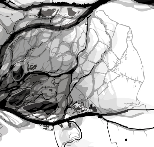
[Registering fluctuating deltaic conditions]
To re-open the possibilities that a more complex understanding of the relationship between land and water would permit, Garza and Thomas propose the replacement of the NAP with a dynamic Normaal Amsterdam Peil, or d(NAP), which would measure water level not as a single datum, but a gradient of possibilities, ranging from a summer low to a winter high and beyond to the highs produced by flood conditions. The incorporation of true flood conditions into the conception of normal is exceptionally important, as it produces an understanding under which flood conditions are not unexpected disasters, but anticipated and recurring conditions of the landscape — normal.
1 This capacity to generate massive change through comparatively small intervention is what we at mammoth have described as thegenerative capacity of infrastructures. Our friend Brian Davis, though, reminds us that it is not just a capacity of infrastructures; it is a fundamental capacity of landscape, essential to the landscape-ness of landscape. Put more simply, when you work with landscape, you get more out of it than you put into it. (And what you get will often surprise you — landscape transforms, alters, and weirds, which is why it always entropically resists attempts to polish and control it.)
This overlap between the capacity of landscape and the capacity of infrastructure is quite intriguing conceptually; it serves to explain why, for instance, an increased interest in infrastructures emerged within and fed the growth of the nascent discipline of landscape urbanism, as well as why the work of architects within that discipline tends to feel so much like landscape architecture.
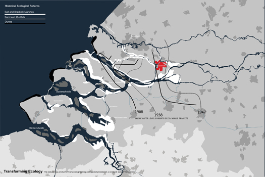
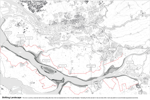
Having developed the conceptual grounds for their project, Garza and Thomas make two deceptively simple moves, which they suggest could have the effect of generating new economies, new patterns of land use, and ultimately new urbanization within the Dordrecht region1. The first, as mentioned above, is to open the Haringvliet Dam, permitting fresh water and salt water to mix again within the Haringvliet estuary, as well as restoring silt-depositing tidal dynamics.
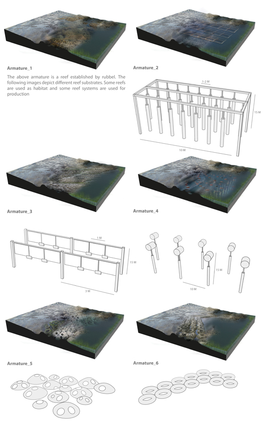
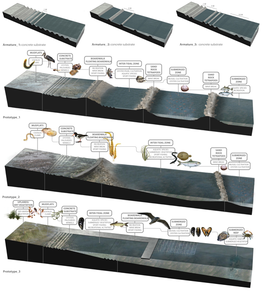
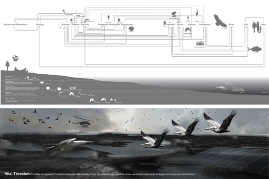
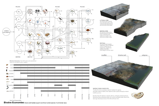
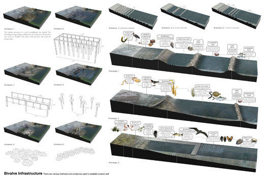
The second move is the provision of “bivalve infrastructures”, constructed armatures (above) which accelerate the development of bivalve reefs on new subaqueous ground produced by restored silt deposition. Garza and Thomas explain why they are so keen on the restoration of that process of silt deposition and the development of bivalve ecologies:
…the ground is transformed with the accretion of the estuary’s most vital resource: mud. Together with tidal dynamics, silt and sedimentation of the mudlfats enable reefs to build up and accumulate, hosting the colonization of thousands of bivalve species, one of the basic building blocks of intertidal ecologies. The benthic and pelagic foodshed begin to thrive: plankton and bacteria, clams and crabs, smelt and salmon, beavers and seals, reeds and cattails, willows and poplars.
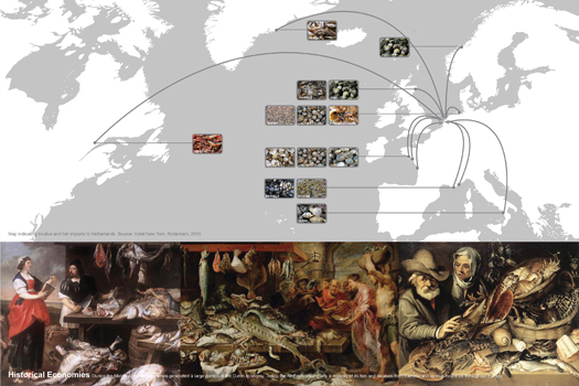
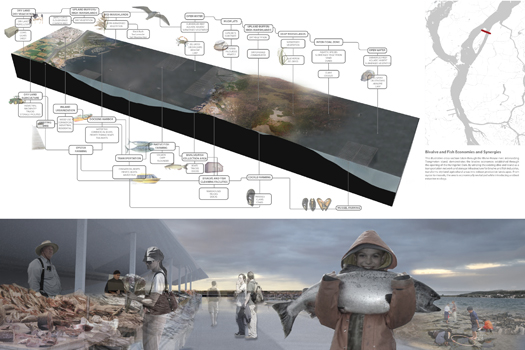
…bivalves have the ability to generate new economies… during the Middle Ages the Dutch economy once thrived on the delta. The establishment of bivalve reefs would enable the habitations of a larger bio-system, including salmon, flounder, oysters and mussels.
If we focus on the economic importance of the oyster, full economic value goes beyond dockside value. In addition to primary sales of raw, unshucked products, there are economic benefits from secondary services such as: shucking and packing houses, transport and manufacturing of prepared oyster products and retail sales. The shell itself is used in several different products, from ‘oyster shell calcium’ to ‘oyster shell concrete.’ More interestingly, the city of Dordrecht can utilize the oyster and the intertidal zone to generate a pearling industry. Mudflats will generate bivalve economies altering urbanization patterns inside and outside the dike and ultimately will position Dordrecht as a global player.
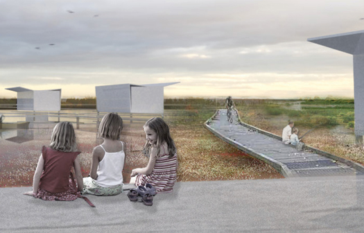
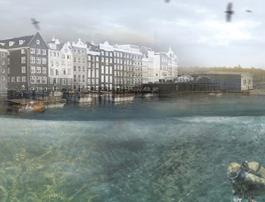
This vision of urbanization re-organized around the productive capacity of an ecologically healthier landscape2 is not only a vision of a new landscape for Dordrecht; it also represents (or, more accurately, exemplifies) the re-organization of landscape architecture into a discipline that is concerned not merely with “staging and decorating… destination environments”, but with the capacity of landscape to serve as infrastructure. It is not surprising that this work is coming out of the GSD — given the recent concentration of the academics and practicioners who have been arguing for such work there — but it is encouraging to see it emerge and give designed form to the possibilities that they have outlined.
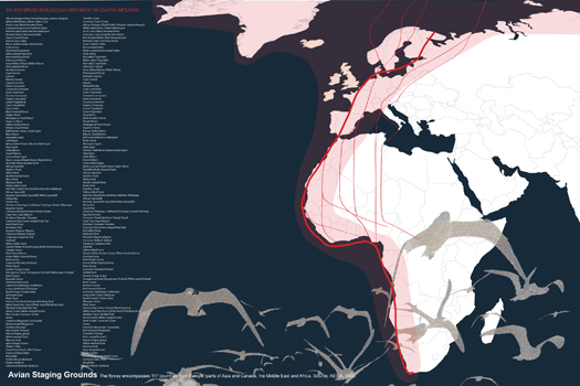
[Click below to see more images from Garza and Thomas’s project; click on the images to see them larger. The captions were written by Garza and Thomas.
Garza and Thomas’s project will be featured in the forthcoming issue of Bracket, [Goes Soft]. I haven’t talked much about the softness of Garza and Thomas’s proposal, but it is also notable for the way that it literally deconstructs a hard, engineered infrastructure in favor of the adaptive and flexible resilience of a new system dependent on biological infrastructures. No doubt readers of Bracket 2 will find worthwhile insights into the softness of their proposal there.
Two other notable projects to emerge from the studio: Laci Videmsky and Casey Elmer’s Continuous Region, and Gyoung Tak Park, Haein Lee, and Soomin Shin’s Ecology as Industry; both are fascinating, as projects, and as glimpses at what a program of urban design influenced by Belanger’s argument for the prominence of landscape infrastructures might look like.]

