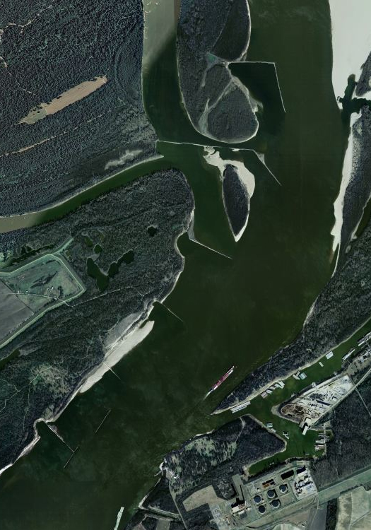
[A dike field in the Mississippi River near Greenfield, Mississippi; via bing maps.]
In the Mississippi River, dike fields are constructed in order to direct the river’s flow to a central channel, scouring it and reducing the need for dredging. Though their primary purpose is to thus maintain navigability for shipping, dike fields tend, as a side-effect, to produce useful habitat, through both the creation of low-velocity zones (‘dike field pools’) within the river (various fish and invertebrate species favor different river velocities at different points in their life cycles) and through sedimentation behind the dikes — the sandbars thus produced are often of great value for waterfowl.
Mississippi River blogger Quinta Scott describes one particularly fascinating dike field incident, an Army Corps re-design of a dike field near St. Louis, which had succeeded in producing a sand-bar, but a sand-bar which was dry and lacking the associated side-channels which birds and fish favor:
“Using an aerial photograph, the engineers built a scale model of the dike field and studied various alternatives for scouring new side channels along the east bankline and creating aquatic depth and diversity for fishes, creating an island between the side channel and the navigation channel, and creating a reliable navigation channel next to the island. They tried raising the dikes; widening and narrowing the notches dike; increasing and decreasing the number of notches in each dike; increasing and decreasing the height of the notches over the Low Water Reference Plane; subtracting and adding dikes to the field and adding dikes to the opposite bank.
They tested each new configuration. Would it create a self-sustaining side channel? Would it create a high elevation island within the dike field? Would it increase the depth of the navigation channel? Of the fourteen configurations they tested, three filled the bill. One created a good side channel, but a small dike in the field would interfere with barge fleeting. A second created a good navigation channel, but the side channel would be too shallow. The third worked. The small dike was removed and therefore did not interfere with barge fleeting, but the notches created a continuous side channel between five and ten feet deep at low water for fish and a nicely isolated, 190-acre island for the terns.”
This is experimental landscape architecture, testing various infrastructural hacks through the construction and modification of physical models. (Yet another example of why the Army Corps is — despite the bureaucratic language it cloaks its practice in — such a radical landscape organization.) A bit more of this sort of experimentation with fluid and granular dynamics — and a bit less second-rate aping of mediocre parametricism — might be quite good for the profession.


[…] which includes dredging (to improve navigability and maintain consistent channel depth), building dikes, providing cutoffs (artificially dug straight paths for the river which anthropogenically […]