mammoth // building nothing out of something

jam, hack

This is week five of our reading of The Infrastructural City; if you’re not familiar with the series, you can start here and catch up here.
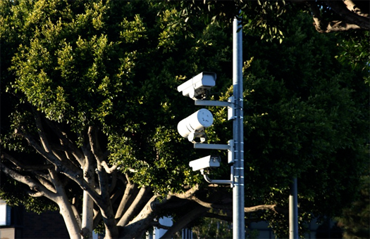

[Traffic cameras in Los Angeles, photographed by flickr user Puck90]

“Blocking All Lanes”, Sean Dockray, Fiona Whitton, and Steve Rowell’s contribution to The Infrastructral City, opens by questioning the various meanings of “traffic”:

“If Los Angeles evokes sunshine, flashy cars, and movie stars, it also instantly brings to mind traffic.  But the word “traffic” is always a little slippery, one of those words that escapes us when we try to pin it down.  For engineers and the dictionary alike, “traffic” refers to the movement of vehicles along a roadway.  For the rest of us, however, traffic has come to mean the exact opposite: that phenomenon of vehicles crowding a roadway until everything slows down to a frustrating crawl…

…We are traffic… Of course, we don’t talk that way: we say that we are “in traffic”, but we never admit to being traffic… our need to remove our own culpability from congestion, our need to speak of being “stuck in a jam”, is an expression of our profound ambivalence to driving.  The automobile, the capitalist vehicle par excellence, promises freedom while the often-frustrating experience of driving leaves us feeling quite out of control.  We hold onto the idea that although we might be stuck now, there is a way out.  But what if our agency were underpinned by an organizing, computational mechanism?  We stop.  We go.  We turn.  We yield.  What if these were not simply rules to follow (code as law), but instructions to follow (code as program)…”

After detouring through a (rather fascinating) history of the evolution of traffic control (a history which reminded me of a recent tweet from the excellent Lost Angeles: “at the turn of the century, speed limits for the new cars were 8 mph in residential districts and 6 mph in business districts”), the authors turn to a discussion of the contemporary means of traffic control in Los Angeles, which they split into two categories, physical systems and virtual data.  The former are described thusly:

“…over 50,000 buried loop detectors — the insulated wire loops that passively detect subtle magnetic field changes from vehicles — combine with over 700 weatherproofed video cameras, some of which are remotely controlled to pan and zoom, to monitor and control traffic flow.  Loops automatically trigger software in switching boxes linked to intersection signals, but also send data to TMCs that allow traffic engineers to monitor flow patterns and adjust timings remotely.  A simple click of  mouse button [in the control centers “ATSAC” (Automated Traffic Control and Surveillance) and “TMC” (CALTRANS’s Traffic Management Center)] can start or stop the flow of movement on the grid.”

Of course, as that description makes clear, the virtual and physical aspects of the modern traffic control apparatus are materially inseparable, as the data has neither host nor eyes without its physical appendages and the physical appendages are dead and useless unless the streams of information they host flows and is interpreted.  If there is a real distinction to be drawn between the physical and the virtual aspects of traffic control, it is, as the authors note, that the physical appendages are persistent and static, moving only when maintenance workers crack open their housings, while the data the system hosts is “ephemeral and dynamic”.
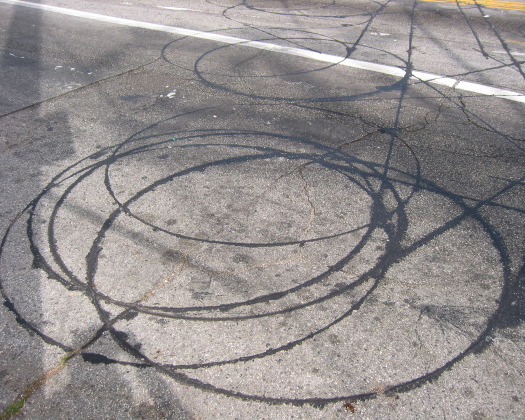

[Inductive loops in Los Angeles pavement; photograph via CLUI]

The final portion of the chapter discusses “incidents”, which are described as the re-introduction of the corporeal and embodied into the virtual system of traffic control – the smooth flow that the virtual seeks to enable is interrupted, human errors literally pile up on freeways and in the streets.  This feedback between traffic control system and human agents, though, is not at all one way.  Traffic (remember, “we are traffic”) and traffic control systems are functionally cybernetic: the driver’s foot on the gas pedal moves up and down in rhythm with the dictates of a city-spanning central nervous system, communicating as surely with the driver through the code of yellow, red, and green as the brain does with the arm.  The traffic control system is extraordinarily complex, existing as networked ecologies do, at a multiplicity of scales. At some scales, it is easily experienced directly — the traffic light — while others can only be experienced through mediating systems or summaries, such as the traffic diagrams the authors have drawn.  An inductive loop, for instance, can be understood both as a series of strangely beautiful markings in hot-poured asphalt (above) and as a single neuron in a massively complex system.  Stepping back further, that massively complex system only functions a part of the irreducibly complex urban whole: without pit mines to produce aggregate, there would be no roads for traffic to fill; or, without the individual people who commute on the roads, there would be no need to coordinate signal timings.

The interesting fact that arises from the complexity of these co-evolved systems (and, as noted in Varnelis’s introduction to The Infrastructural City, from the primacy of individual property rights in L.A.’s political culture) is that, “as the possibilities for adding new highways — or even lanes — dwindle in many cities, most new progress is made at the level of code”.  This shift which the authors identify is a part of a systemic shift in the methodology of urbanism, from plan to hack, that we’ve been fascinated with for some time now.  In a mature infrastructural ecology, like Los Angeles, the city has developed such a persistent and ossified physical form that, barring a radical shift in the city’s political culture, designing infrastructure becomes more a task of re-configuration and re-use than a task of construction.
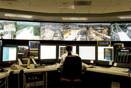

[The interior of ATSAC, via Swindle Magazine’s feature on ATSAC]

Initially, this may seem an extraordinarily frustrating condition for urbanists, who have of late been so interested in the possibility that the design of infrastructures might offer an alternative instrument for shaping cities, combining the intentionality and vision of the plan with the vibrancy and resilience characteristic of emergent growth.  Infrastructures, we’ve noticed, can be a stable element which mold and manipulate the various flowing processes of urbanization which produce cities: economic exchange, human migration, traffic patterns, informational flows, property values, hydrologies, waste streams, commutes, even wildlife ecologies.  Historically, governments and private developers have sought to harness this potential, whether by profiting from the sale of land along a new infrastructure or by supplementing existing infrastructure to reinforce growth and density in a locale (the initial growth of Los Angeles along privately-owned streetcar lines being one of the classic examples of the former sort of infrastructural generation).  But if, as the authors of “Blocking All Lanes” suggest (and, I think it is fair to say, The Infrastructural City suggests as a whole), opportunities to plan and design new infrastructural frameworks are likely to be extremely rare in mature infrastructural ecologies, should urbanists abandon their interest in infrastructure as an instrument for shaping the city?
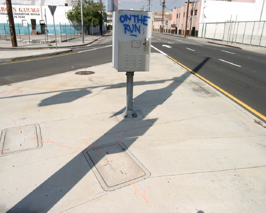

[Signal vaults in a traffic island, via CLUI]

1 I love, by the way, that the Beltline began a little over a decade ago as a student project — an excellent rebuttal to the trope occasionally trotted out that academic design is not real design.

I don’t think so, for two primary reasons.

First, the rarity and scarcity of those opportunities does not mean that they should not be seized when they are realistically presented.  And when opportunities for the construction of new infrastructures within a mature city do occur, they are likely to appear in hack-like guises: concretely, like Atlanta’s Beltline, which utilizes a defunct rail right-of-way as the foundation for a new commuter rail line1, or Orange County’s Groundwater Replenishment System, which redirects the flow of cleaned wastewater in Orange County from ocean to aquifer; speculatively, like Velo-City‘s Toronto bicycle metro (which, as it happens, has a less-speculative southern Californian counterpart, the Backbone Bikeway Network).  Go over, go under, re-deploy, tag along, piggyback.

Second, there are fantastic opportunities created by thinking about the architectural act as a hack rather than an object (whether or not the hack produces an object).  These opportunities were one of the primary themes of our post on “the best architecture of the decade”, which included both examples of hacks that lack a traditional architectural object — the iPhone, Kiva — and architectural projects executed as hacks — Quinta Monroy, Parque Biblioteca Espana.  Perhaps most relevant of the hacks cataloged there, given that the topic at hand is automobile traffic, is the MIT Smart Cities group’s CityCar, which utterly inverts the architectural methodology of the plan.  Instead of designing a new form for cities, and then producing buildings which fit that form, the Smart Cities group has designed both a technology — the CityCar — and a series of ways in which that technology would interact with the city (as a battery in a smart grid, as a part of an even more advanced traffic control system that would adjust congestion pricing in real time to efficiently distribute traffic over time and space), confident that doing so will enable ways of life that will generate positive changes in the city.  Notably, all these cases are new ways of utilizing existing infrastructures (the iPhone, Kiva, CityCar) or of thinking about architecture as an infrastructure (Quinta Monroy, Parque Biblioteca Espana).  Infrastructure is not made obsolete by avoiding object fixation.  Rather, it becomes increasingly important, as a material instantiation of non-corporeal forces and thus the potential physical locus of hacks.

In both cases — whether the hack is understood as a way of implementing a new infrastructure or as a new kind of architectural act — the key realization is that successful shifts in urban form will only happen when they are paired with successful alterations of the infrastructures, systems, and flows that generate those forms.  Attempts to construct a new vision for the city that fail to grapple with the underlying systems that, like traffic, constitute and produce the city will ultimately either be ineffective or collapse catastrophically.

For additional reading on the physical infrastructure of traffic control, I recommend CLUI’s online exhibition, Loop Feedback Loop.

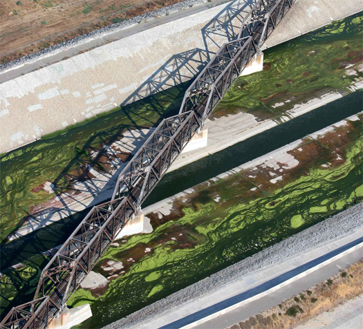
a tertiary river


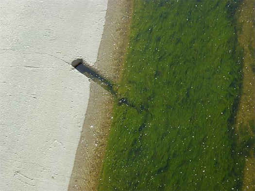
[Aerial photograph of sludge mats swirling in the Los Angeles River by flickr user Vision Aerie]

As we’re about to jump scales in our reading of The Infrastructural City — from the post-natural ecologies and mining operations of the first section of the book, “Landscape”, to the networks of cell towers and cable lines featured in the middle section, “Fabric” — I thought it would be worth excerpting a choice quotation from photographer Lane Barden’s essay “The River”, which closes that first section.  In this excerpt, Barden discusses how the reality of the hydrological condition of the Los Angeles River — its “dry season base flow… consists almost entirely of treated sewage water” — differs from the image of the river constructed by the movement to restore the river (“the public is not yet fully aware that the movement to restore the Los Angeles River is a movement to restore a river that will consist primarily of recycled sewage”):

“Today, the San Fernando aquifer and adjoining aquifers in the Southern California region are depleted sub-surface reservoirs controlled and administered by the city.  Because excessive storm water run-off from Los Angeles hardscape is swiftly funneled into the river, even heavy rains do little to recharge the aquifers, so ground water reserves are below capacity.  This groundwater is monetized and can only be pumped out with a license and a fee.  Pumping ground water into the river for restoration purposes is not an option and will not become an option.  The authentic conditions of an endless supply of groundwater feeding the Los Angeles River are lost and will not be reclaimed.

Prior to 1913, the Los Angeles River and its massive ground water supply was the sole source of water for the city.  After tapping the Owens Valley and the Colorado River with aqueducts hundreds of miles in length, Los Angeles was freed from its dependence on local aquifers.  Water from the aqueducts that once flowed in the Colorado and Owens Rivers now flows into our sinks and toilets, then into the sewers, and onto three treatment plants located next to the L.A. River.  There it gets scrubbed three times and is discharged into the river channel only to be polluted again with street runoff that includes various chemicals, oil products, hundreds of thousands of plastic bags, and coliform bacteria coming from kennels, stables, and the street.

That’s the contemporary Los Angeles River, a river that has been siphoned from outlying areas, has flowed through kitchens and bathrooms, treated before it goes into the riverbed as tertiary water, then polluted before going to the ocean.  Robust community movements are now underway to clean up runoff and storm water before it enters the river to protect the tertiary base flow.  Remarkably, this tertiary water, if it could remain unpolluted, is probably cleaner than the water in every urban river in the world.

Ideally, many years from now, the rain that falls in Los Angeles would be cleaned and diverted into the city’s aquifers for storage.  Then, tertiary water could become the primary source for the river year round.  With this in mind, a third, more adaptable image becomes possible, enabled by a constant, steady supply of clean tertiary water that could feed a linear public garden fifty miles long.  It would provide as yet unimagined cultural interpretations, natural habitat, recreation, and green infrastructure for a city that has become so dispersed, park-starved, and focused on short-term problem solving that its inhabitants are hard-pressed to imagine anything beyond what the river once was and what it has become.”

“a state of perpetual fracture”


[“The faults induced by military speleogenesis will lead to gradual yet certain failure of the jet noise barrier.”]

Nick Sowers (Soundscrapers) has recently posted a series at the Archinect school blog project exploring his recently-completed thesis project from a succession of disciplinary perspectives, which he titles the Archaeologist (who introduces the project), the Forensic Engineer, the Geologist, and the Landscape Preservationist.  Further posts — from a chiroptologist, a sonic archivalist, and an architect — are promised.

Sowers’s project (which is quite fascinating) investigates the future history of a jet noise barrier built (and then abandoned) by the American military on the Pacific island of Guam.  The posts so far are impressively diverse, skipping from the conception and definition of an “American military pastoral” (via the landscape history of Greco-Roman fortifications and the battle of Gettysburg); to well-drilling as political protest and the accidental military acceleration of processes of geological decay (“the National Park Service [for whom Sower’s fictional persona works] must consider that the military development has induced a state of perpetual fracture”); and a forensic analysis of the structural failure of that jet noise barrier which suggests that permitting entropic decay may be the only way to truly demilitarize a landscape.

reading the infrastructural city: chapter four index (updated may 31)


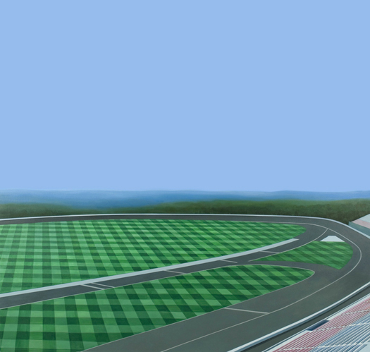
[Jake Longstreth’s “Skybox”; while the pit mines and flood-control apparatus found in Irwindale are one particularly spectacular kind of marginal landscape, there are many other kinds, exhibiting varying degrees of marginality, including speedways — such as the Irwindale Speedway — and the ubiquitous suburban strip.]

DPR-Barcelona returns to a familiar theme for that blog, the utopian and architectural appropriation of unusual terrains for dwelling, by way of proposals from Archigram, Robert Smithson, and Aristide Antonas, noting that the pit mines of Irwindale are already occupied by industrial structures reminiscent of Antonas’s Crane Rooms or Lebbeus Woods’s High Houses.

Similarly, FASLANYC ties “Margins in our Midst” to the science-fiction classic War with the Newts, orquidearamas, and a vision of cascading pit-mine apartment buildings.

Free Association Design looks at Portland’s Ross Island Sand and Gravel Pit as an analog to the pit mines of Irwindale, but an analog in which the “networked mobility of landscape has come full circle”, “processes of construction excavation, industrial material sourcing, global shipping, dredging, and wildlife habitat formation [becoming] bound together in a fortuitous network of mutual dependence”.

Nam Henderson looks at Berkeley Pit, a former open pit copper mine in Butte, Montana, and, noting that the pit is breeding extremeophile micro-organisms that researchers are studying in search of cancer-fighting compounds, wonders if pit mines might have a future as pharmacological farms.

Peter Nunns notes that Coolidge’s observations in Irwindale — and, indeed, The Infrastructural City in general — serve as a useful reminder of the inescapable materiality of the city, a reminder which is often needed as technologies and thinkers tempt us to believe that cities can elude the gravity of material production.

This, I think, is part of what is so useful about The Infrastructural City as a guidebook for the contemporary city: it reminds us that, despite vast scalar differences, the demolition of a backyard pool deck that Nunns describes and the excavation of vast aggregate pits on the margins of the city are inextricably linked activities, occurring in the same networked landscape.

3rd coast atlas

Readers of mammoth may be interested in contributing to the 3rd Coast Atlas, “a platform for research and design initiatives that explore the urbanization, landscape, infrastructure and ecology of the Great Lakes Basin and Great Lakes Megaregion.”  Submissions — which may take the form of written essay, design project, research, or visual essay — are due by August 30, and will apparently be reviewed by the editors, Claire Lyster, Charles Waldheim, and Mason White.

geology as infrastructure

Smudge Studio’s Geologic Time Viewer re-casts the “official Geologic Time Scale” as not only a way of looking back into the past, but also a window into the present: “the materialities of every previous geologic epoch flow into the present-as-middle and give form to our daily lives.” We learn, for instance, that iron infrastructures, like Manhattan Bridge, are built out of material laid down during the Precambrian; that it is Devonian oil which combusts in automobile engines; that East Coast brownstones are clad by Triassic stone; and that Cape Cod is an “ephemeral” Pleistocene landscape, “waiting for sea levels to rise and submerge it again”.

alternate los angeles no. 1


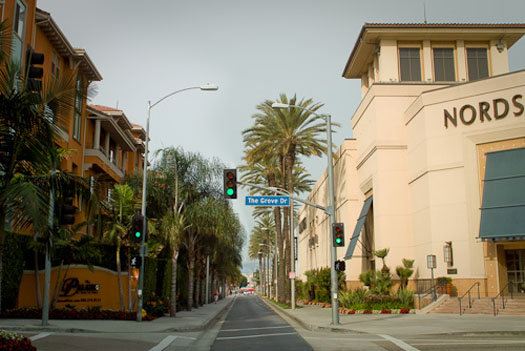
[Narrow Streets L.A. is a blog which posts photographs of greater Los Angeles streets, digitally manipulated in exactly the way you would expect from the title: made narrower.  While occasionally it may go a bit overboard and lurch towards self-parody, generally it is a fantastic experiment — postcards from an alternate Los Angeles — showing how much the perception of a street can be altered by manipulating a single, basic parameter.  The image above is N.S.L.A.’s re-imagined 3rd Street at the Grove; the link is via The League of Ordinary Gentlemen.]

“for every pile there is a pit”

We’re back from our week off with another installment of Reading the Infrastructural City; if you haven’t been following along, you can catch up on the series here and see the introductory post here.


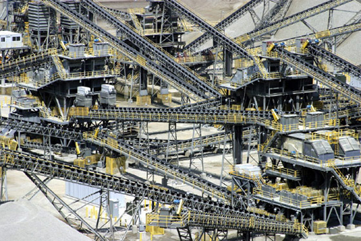
[Aggregate operation in the Reliance pit mine, Irwindale, California; photograph by Steve Rowell, via CLUI]

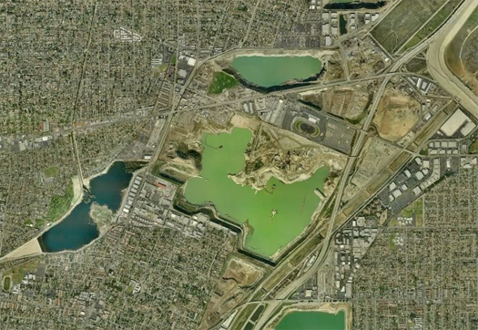
The fourth chapter of The Infrastructural City, “Margins in our Midst: Gravel”, is written by Matthew Coolidge, founder and director of mammoth‘s favorite Los Angeles-based landscape research organization, the Center for Land Use Interpretation.  In “Margins”, Coolidge describes the curious situation of Irwindale, a suburb of Los Angeles, playing on the use of the term “margin” to refer both to the edge condition of the city — Irwindale “lies at the base of the San Gabriel Mountains”, which delineate the northern limits of greater Los Angeles — and to the rock aggregate mined in Irwindale.


[Pit mines in southwest Irwindale, via Bing Maps]

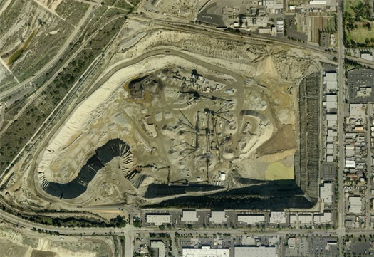
The rather wonderful reality, perhaps often obscured by the seeming banality of concrete and asphalt, is that both the buildings of Los Angeles and the spaces between them — streets, courtyards, sidewalks, driveways — are constructed from tiny shards of the surrounding mountain ranges, ossified with cement and petroleum.  Though concrete and asphalt often seem like infinitely available materials — only becoming visible once they are whole and ready for use in the beds of asphalt pavers and concrete mixers — they are, in fact, associated with specific landscapes of extraction, much like any other product of contemporary society.  For the greater Los Angeles region, Irwindale is the locus of that extraction, a small city pitted by seventeen major aggregate quarries, “so full of holes that more of the land in the city is a pit than not”:

“Of the seventeen major pits in the Irwindale area only four are being mined at the moment.  Many of the others are idle, having already been mined to their permitted depth of 200 feet, and having met their limitations in size by running up to the edges of adjacent properties and roadways.  In many cases the material extends to a thousand feet deep and the quarries are trying to get permits to go deeper.  [One of the main pit operators,] Vulcan, estimates that if they could go another 150 feet, their Irwindale pits would have another thirty years of life.  The city, on the other hand, having literally lost so much of its taxable surface area, is interested in bringing the inactive pits back up to grade, so they can develop the land in a more economically productive way.”

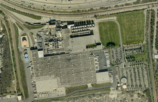
Perhaps not surprisingly, given the spatial dominance of these landscapes of extraction within Irwindale, the un-mined zones of the city are also dominated by “marginal” uses, as Coolidge relates: the Irwindale Speedway, constructed on a “giant slab of asphalt” capping a former pit mine, hosts races, notably including the “D1 Grand Prix”, the nation’s premier “drifting” race, and itself an activity that lies at the margins of automotive racing; landfills, primarily holding construction waste; the Miller brewery; and, of course, Irwindale Avenue, a typical southern Californian main drag, “lined with fast food restaurants”, “muffler shops and storefronts”.  The most fascinating of these additional margins is the network of dams that Coolidge describes, acting first as flood-and-aggregate control, but also as a sort of slow, passive mining system:

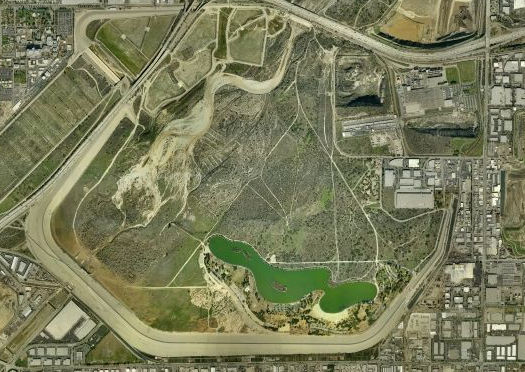
“Beyond the pits, one of the key landscape features in the region is the Santa Fe Dam, an arc of piled rock nearly five miles long.  Built by the Army Corps, it has never really had to be used for its designed purpose–yet.  It was made to defend the land downstream from catastrophic floods and debris flows.  These are occasional storm events, which have been very destructive to some parts of the city, where unconsolidated rock from the mountains is mobilized by prolonged rain, and tumbles down the canyons and river valleys like a slow motion avalanche of coarse rock, gravel, and mud, destroying everything in its path.  There are hundreds of check dams higher up in the mountains now, and these catch the majority of the flows before they reach the valley (the dam basins themselves are periodically emptied by the aggregate industry).

Structures like the Santa Fe Dam, the Sepulveda Dam, the Hansen Dam, and the Whittier Narrows Dam are last line of defense, built downslope to hold back a major flow that makes it out of the mountains, like a geologic shock absorber.  Behind these dams are undevelopable areas that need to stay empty to contain the material from this potential unscheduled aggregate delivery.  The permitted use of the land here is ephemeral: oddly disorganized wildlife areas and recreation zones.”


[The Santa Fe Dam, via Bing Maps]

It is important to note, at this point, that describing these landscapes and uses as “marginal” is not intended to be normative, but rather descriptive: while in this case the marginal landscapes of Irwindale do happen to sit at physical margin of Los Angeles, it is their position on the psychological margin of Los Angeles which we find more interesting, and more important to the study (and design) of the infrastructural city, generally.

Architects and landscape architects are, historically, most interested in — and most often employed to work on — the prominent, “significant”, symbolic cores of cities.  Think, for instance, of the disproportionate effort expended by the ASLA on advocating for the allocation of funds to renovation of the National Mall, and of the buildings on the AIA’s latest list of honor awards.  Or: how many architecture schools send students into historic cities to sketch monuments and courthouses, and how many send their students to the edge of suburbia to sketch muffler shops and fast food restaurants?


[Pit mine in Irwindale, via Bing Maps]

It is hard, of course, to blame a profession for wanting to highlight its most prominent products (and, correspondingly, entirely natural for societies to focus their creative energies on places of commonly-held symbolic worth), but the degree to which we exclusively define our professions in relationship to those prominent products has the effect of excluding us from conversations about the ordinary.  This becomes particularly problematic when we realize that — as studies such as Coolidge’s “Margins” indicate — ordinary and marginal places actually compose the bulk of the territory of the infrastructural city.


[The Miller Plant, via Bing Maps]

Perhaps this is part of the reason that utopian visions of the city — including, we think, even many visions which would not necessarily claim that descriptor for themselves, such as New Urbanism — tend not to have any place for marginal terrain.  That might even suggest an interesting way in which to arrive at a negative definition of a utopia: a harmfully-drawn utopia is a vision of the city which excludes marginal places.  That definition is obviously simplistic, if only because utopias are not easily or properly divided into “negative” (harmful) and “positive” (useful) categories, but it does serve to extend mammoth‘s consistent argument that it is vital to work with the city we have, to not make plans which wish away the parts of the city that we find undesirable or uninteresting, if only because, as Coolidge notes, the margins are literally the foundations of the city.

feedback: architecture’s new territories


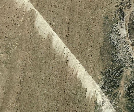
[The Bou Craa conveyor, which is similar to the Negev desert belt previously discussed on mammoth, carries phosphate across the desert in Western Sahara, leaving the wind-swept sediment shadow above, and is the longest conveyor belt in the world; seen at deconcrete, image via bing maps.]

It would befuddle me if there were anyone who reads mammoth and yet is not also a regular reader of InfraNet Lab, and so I rarely link to that excellent blog, but I feel obliged (because of the extreme convergence between the theoretical grounding of the series I’m about to link and mammoth‘s own infrastructural predilections) to mention the continuing series of posts there which are highlighting the work produced in a recent research seminar at the University of Toronto entitled “Feedback: Architecture’s New Territories”.  At InfraNet Lab, Mason White, who taught the seminar, explains the key presuppositions underlying the research:

++ The idea of architecture as a self-reflexive, isolated, and willful internal wrangling of formal preoccupations does not have the ability (alone) to address and re-dress the opportunities and challenges in our contemporary design climate.
++ Architecture operating as a singular act on a singular site overlooks its capacity as a large feedback machine extending increasingly beyond itself. Its footprint, always already, is wide and complex.
++ Architecture’s potential, today, lies as much in its functioning as a surface, conduit, and container for ephemeral flows of resources, cultures, and energy as it does in its symbolic cultural and formal capacities.

Mason develops from these suppositions a set of “new territories” in which architecture may begin to operate (“flows, velocities, ecologies, economies, and energies”), and it is those territories which are explored in the posts by the students from the seminar.  So far, the posts in the series have covered the convergence of the international flower trade market in a highly mechanized architecture in Holland (“Bloemenveiling Aalsmeer”), the “maquiladora” export production landscapes of northern Mexico (“Border Economies”), and the submarine structure of the internet (“Relink: The Physical Network of Data”), and we expect that there are more to follow.

teenagers and young people, in the city like locusts

With the publication of their latest issue, The Atlantic Monthly launched a month-long sub-site that they’re calling “The Future of the City”, which interests us for obvious reasons.   In particular, the articles on the potential of private transit and post-Jacobsian urbanists are worth reading (and if I get a chance I’ll pull excerpts from them later), but the purpose of this post is to point you to a rather revealing (though somewhat absurdly titled) interview the Atlantic has conducted with Andres Duany.  Within the a few short paragraphs, Duany manages to confirm some of my worst suspicions about New Urbanism (suspicions, which, I should note, by no means apply to all of the movement’s members or fans, plenty of whom are well-intentioned).

For instance, there’s the distaste for youth culture:

“There’s this generation who grew up in the suburbs, for whom the suburbs have no magic. The mall has no magic. They’re the ones that have discovered the city. Problem is, they’re also destroying the city. The teenagers and young people in Miami come in from the suburbs to the few town centers we have, and they come in like locusts. They make traffic congestion all night; they come in and take up the parking. They ruin the retail and they ruin the restaurants, because they have different habits then older folks. I have seen it. They’re basically eating up the first-rate urbanism. They have this techno music, and the food cheapens, and they run in packs, great social packs, and they take over a place and ruin it and go somewhere else.”

The clinging to the more destructive tenets of the magical thinking that characterized the real-estate-boom economy (renting is improper use of cities; buying is proper):

“…These people would normally be buying real estate by now. And we designed for them. We kept saying, “Aha, these kids, between 24 and 35, will be buying real estate.” Guess what? They aren’t. Because they can’t afford it. But they’re still using the cities–they’re renting and so forth. The Gen-Xers also discovered the cities; they’re buying in a proper way. The Millennials are the ones we’re talking about. And they love cities desperately. And they’re loving them to death.”

There’s also a Friedman-esque longing for an authoritarian government that would cut through all the democratic whinging and get things built the right way:

“But I think the most interesting experiment of all is Singapore. Singapore had nothing going for it. No raw materials. And you got a kind of top-down government that was almost completely enlightened, putting education first and so forth, and you have this city that is extremely livable.

While democracy does most things well, I think we need to confront the fact that it does not make the best cities. And that the cities that were great were rather top-down. You know–Paris and Rome, the grid of Manhattan. What would those have been like if there hadn’t been some top-down stuff? Every landowner would have done a separate little pod subdivision. That’s one of the things that’s naive about Americans–extremely naive, I find, as an outsider having lived in places that are possibly less democratic, like Spain. This idea that you have an individual right to do whatever you want with your land is very democratic, but the result is pretty questionable.”

And, perhaps most troubling, apparent approval indicated for an instance of literally keeping the rural poor out of cities (within the context of praise of the preservation of Havana):

I think it’s more than just capital. There are two kinds of destruction: there’s the loss of the city, the high rises, which is what happened in Mexico City and Buenos Aires and Bogota. But then there’s the other destruction, which is the migration of the rural people to the city. And that was controlled in Cuba. They just said, “You don’t have your card, you don’t have your permit, you are not coming in.”

Interestingly, it’s exactly this tendency — the desire to preserve the city as an aesthetic and social experience for the privileged (you’ll note that earlier in the interview Duany describes New Urbanism as originating in aesthetic concerns) by maintaining controls on the movements of the poor — which, in another of the Atlantic‘s articles in this special report, Benjamin Schwarz finds and criticizes in the writings of post-Jacobsian urbanists:

“Confronted with this unstoppable process [of globalization-induced gentrification], Zukin proposes waving a magic political wand by calling for an assortment of mandates and controls to ensure that certain ethnic groups and social classes and the practitioners of certain livelihoods that contribute to the “authenticity” of the city be able to live there. Surely this is taking the fetishization of vibrant Jacobsian urbanity too far. It’s entirely reasonable—in fact, humane—to argue that the state must ensure decent living conditions for its citizens (and God knows we are terribly far from that situation). But it’s a wholly different proposition to argue that, in the name of what Sorkin calls “the protection of … the local” and to forestall “a landscape of homogeneity,” the state should create the conditions necessary for favored groups—be they designers, craftspeople, small-batch distillers, researchers, the proprietors of mom-and-pop stores—to live in expensive and fashionable neighborhoods or boroughs. That effort would ultimately be an aesthetic endeavor to ensure that the affluent, well-educated denizens of said neighborhoods be provided with the stage props and scenery necessary for what Jacobs and her heirs define as an enriching urban experience.”

reading the infrastructural city: chapter three index (updated 17 may)


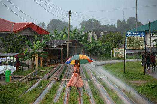
[Crude City today: a woman crosses oil pipelines in the Niger delta; photograph by Ed Kashi for National Geographic.]

Nam Henderson ponders the relationship between urban density and oil production in Los Angeles, and wonders if future landscapes might develop from the evolution of Leo Marx’s classic formulation, the machine in the garden, to the “machine as the garden”.  A bit of discussion related to that evolution appears in the comments of Stephen’s post “Oildorado”.

Free Association Design looks at the ephemeral infrastructures that sprout, like technological fungi blooms, when the useful lives of infrastructures of hydrocarbon extraction and distribution end, in “Remediating Crude City”.

DPR-Barcelona constructs a “speculative similarity between perpetual motion machines and oil pumps”, noting that, ironically, the seemingly perpetual motion of vanishing oil pumps mirrors the vanishing hope that oil could drive the perpetual motion of economies.


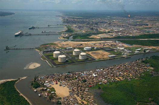
[“Uprooted to make room for a liquefied natural gas plant, people in the village of Finima on Bonny Island complain that the facility has damaged fishing grounds, with few jobs offered in return”; photograph by Ed Kashi for National Geographic.]

While Ruchala’s chapter concentrates on the disappearance of the infrastructure of oil extraction from Los Angeles, Peter Nunns makes note of an extremely important contradiction in that disappearance:

“…the other side of the story, perhaps the more important side, is that Los Angeles’ oil infrastructure has hardly contracted. Rather, it’s expanded to encompass most of the globe…  Most of the oil produced today comes from the third world, and what we used to call the second world (Russia, mainly). One of the many characteristics of places like Nigeria and Kazakhstan is their invisibility to American eyes…  The expansion of the Los Angeles oil infrastructure far beyond the region has occluded it more thoroughly than the derrick camouflage measures described by Ruchala.”

1 That quote is from the same New York Times op-ed Peter references; Margionelli is the author of Oil on the Brain, and also did a lengthy interview with NPR’s Talk of the Nation and with the Washington Post’s Ezra Klein, in both interviews arguing that “we might overreact to this spill, but underreact to the problem of oil dependency more generally.”

Because of this distancing, the infrastructures which sustain our industries only occasionally rise to the surface of our collective consciousness, usually prompted by local infrastructural disasters (such as the current Gulf oil spill) and, even then, as Peter notes, the degree of outrage Americans summon for those disasters is entirely disproportionate to their global frequency.  Writing about reactions to the Gulf oil spill at Clastic Detritus, Brian Romans notes that Lisa Margionelli has simply summed up the problem with our collective outrage: “effectively, we’ve been importing oil and exporting spills to villages and waterways all over the world”1.


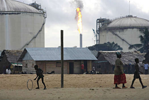
[“Villagers in Finima live within sight of giant fuel tanks and a polluting gas flare, part of the sprawling energy infrastructure on Bonny Island. Ships loaded with millions of dollars’ worth of crude oil and natural gas depart regularly from an island where most people subsist on a few dollars a day.” Photograph by Ed Kashi for National Geographic.]

Which, now that I think about it, is probably exactly the right way to understand what has happened to Crude City: we’ve exported it.  Implying that perhaps designing for Crude City now has less to do with problems generated by abandoned infrastructures than it does coping with how the current form and infrastructures of our cities affect our need to import hydrocarbons.

We’re taking a scheduled break from reading The Infrastructural City next week, but we’ll be back in two weeks, on May 24th, with the Center for Land Use Interpretation’s chapter on gravel.

oildorado

You’ve arrived at week three of our reading of The Infrastructural City; if you’re not familiar with the series, you can start here and catch up here.

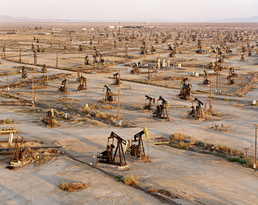
It’s cliche to reference dinosaurs when describing the oil well pumps which are ubiquitous throughout the LA basin, but as a 5 year old obsessed with those prehistoric creatures, there was simply no other way to think about them.  I grew up assuming that every place had oil, and along with it, herds of insouciant metal creatures slowly bobbing as they sucked it from the ground.  Beyond the mere fact of their presence, though, the wells, pumps and derricks scattered throughout the landscape were rarely a topic of conversation.  In this way, my youth mirrors the history of Los Angeles’s conflicted relationship with oil production described in Frank Ruchala’s “Crude City”, the third chapter in The Infrastructural City.

Oil Fields #19a, at Belridge, California, in 2003. An image by Edward Burtynsky from his fantastic series on oil.

The discovery of oil in Los Angeles — at one time, local production met 20 percent of nationwide demand — catalyzed development of the region by ensuring manufacturers had a supply of cheap energy, spurring the development of the ports, and pumping cash into the economy. Yet Los Angelenos have refused oil equal billing with the other infrastructural triumphs of their city:

… while the Los Angeles aqueduct and the freeways are well documented and have become part of the city’s history, the region’s oil story remains relatively unknown. Although Los Angeles named what is arguably its most famous road, Mulholland Drive, after its chief water engineer, almost none of the region’s hydrocarbon history has been commemorated, much less remembered, even though Los Angeles is so identified with its consumption of petroleum products

“Crude City” is a tour of this contested history, full of fascinating anecdotes.  Oil was not only a fuel powering production, but often the material of production.  It became the asphalt paving Los Angeles’s roads and freeways, and the plastic spun into hula-hoops.  But despite the prevalence of well pumps scattered about the landscape, the true scale of LA’s oil infrastructure was sequestered from public view.

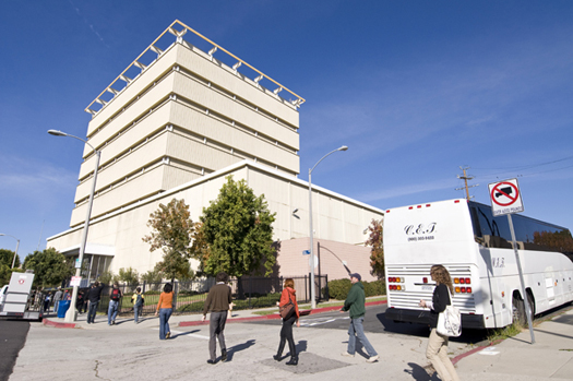
An image of the Packard drillsite from a write-up of a recent CLUI bus tour of Los Angeles’s ‘urban oilscape’, which you should absolutely click through and read.

Some facilities are designed to look like regular buildings, such as the thirteen-story Packard drillsite that completely overwhelms its surroundings on Pico Boulevard.  Designed in the 1960s to look like a modern office building, the drillsite has done a remarkable job of remaining hidden.  Supposedly, two vice presidents of a rival oil company once drove by the building three times before a police officer convinced them that it was really an oil site.  The entire structure is made up of steel sound-proof panels.  All drilling operations take place indoors, including truck loading and unloading.  The massive height of the complex is used to mask the height of the drilling rig which completes the individual wells.  The oil wells themselves are found in the basement level of the complex.

Consider the layers of subterfuge described by Ruchala above: this building is imitating other buildings, which are themselves imitating an architectural style; they are meant to conceal structures with incredible detail and character, by impersonating architecture which is meant to lend some measure of personality and character to spaces which would otherwise be devoid of it.  It is a strange inversion of the modernist cliche “form follows function” — although almost purely theatrical, this urban theater is a highly functional response to our society’s contentious mental relationship with oil extraction.

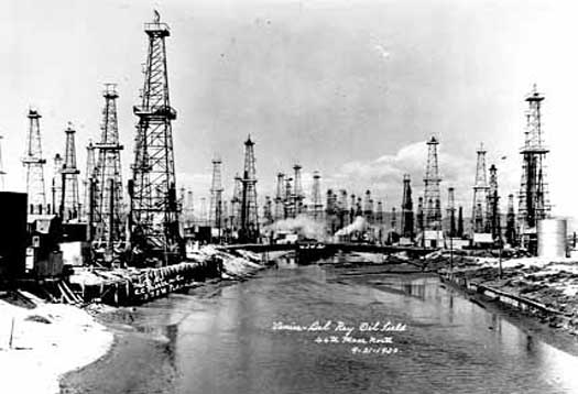
This attitude, combined with strong legal protection of landowners’ rights, has made it more profitable for major producers to ship oil in from the Middle East, leaving the bulk of oil production to smaller companies: “each homeowner could (and sometimes did) start their own company by simply drilling an oil well.  As a result over a hundred companies drain oil from underneath the city.”  This level of granularity, combined with fluctuating (but generally high) real estate values has caused oil drilling to be perhaps the most ephemeral of LA’s infrastructures, its prevalence totally determined by market forces.  Venice Beach might be the apotheosis of this trend.  Founded at the beginning of the 20th century as a tourist- and recreation-focused beach town, residents struck oil in 1929.  Within two years, the city was completely over-run with wells.

Image of Venice near peak oil production via The Discovery of Oil on Westland.net, which is a good history of oil at Venice Beach.

Current condition at the same location as the above image. The wells eventually retreated, but not before indelibly affecting the culture of Venice Beach. Instead of becaming a mini-Santa Monica or west-coast Coney Island, the gritty industrialism introduced during the oil fever has left it “something between a ghetto and a hippie haven,” in the words of Reyner Banham.

View Larger Map

The relationship Los Angeles has with its oil offers an opportunity to reconsider our attitude toward the physical and cultural presence of urban infrastructures — both during their useful life, and after.  Ruchala states that “oil is not only hidden in the city’s self-image, its full extent is hidden from sight.”  Strongly influenced by the tenets of landscape urbanism, I tend toward advocating for more integration of our infrastructures and public spaces, for more exposure — but this can be highly distasteful to the public.  So when does camouflage become the only appropriate tactic for operating in so highly a contested landscape as Los Angeles?  I’ll be the first to argue we should be able to come up with better strategies for embedding vital infrastructures within our cities than disguising them as poor approximations of poor architecture, but perhaps the strength of the familiar is a strategy too powerful to be ignored.

A bit earlier in the essay, Ruchala describes this tendency towards hiding infrastructures as not only characteristic of Los Angeles — the Infrastructural City — but of the infrastructural city in general:

If the history of oil — and its disapperance — is unique to Los Angeles, the history of infrastructures vanishing is not. Infrastructural systems once integral to their urban regions and celebrated as beacons of modernity are forgotten as they age and begin to symbolize outmoded economic orders. Los Angeles’s oil infrastructure fits into this historical arc, erased as the region reconfigures itself. But as this essay suggests, this erasure erases Los Angeles as well. Without oil, the region would have turned out to be a far different place.

But why shouldn’t we accept that infrastructures, like ecologies, will shift and vanish?  Many of us have a strong cultural (or perhaps philosophical) bias in favor of preservation — of ecosystems, of historic buildings, even, as Ruchala argues, of infrastructures.  We argue strenuously about which things are worth preserving, but we argue much less about whether preservation as a default strategy is appropriate.  Consequently, we default towards stasis and seek to avoid flux.  But just as we’re discovering that this isn’t appropriate ecologically, might it also be inappropriate infrastructurally? Do we need to see the infrastructures of the past in order to remember them? Or, put another way: isn’t discovering that a certain swimming pool was the first oil derrick in Los Angeles more wonderful than turning that derrick into a museum?

youth of today

One of the best of the print architectural critics, Christopher Hawthorne, writes about his recent visit to Medellin in the LA Times, and offers a well-rounded evaluation of the significance of the notable projects completed there in the past decade.  While the most important thing about Medellín’s new architecture is, as Hawthorne writes and mammoth noted previously, that it has been deployed as social infrastructure for the poorest areas of the city, I find particularly interesting Hawthorne’s insight about the relationship between Colombia’s legally-mandated competition-based selection process for publicly funded projects and the flowering of young, local firms that process has nurtured, which stands in stark contrast to the North American tendency to award public projects to a relatively small shortlist of the usual globe-trotting suspects.

[link via @javierest, @bldgblog]

lo-fi seed dispersal


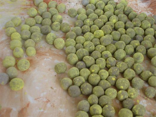
[Prepared Greenaid seedbombs, awaiting dispersal; photograph by Fletcher Studio via Sustainable Cities Collective]

Design Under Sky wrote about this a month or so ago, but given that we’re talking about the Los Angeles River, lo-fi landscape interventions, and that Brett Milligan brought it up again, it’s probably worth taking a moment to mention the Greenaid seedbomb dispensers.  Designers Kim Karlsrud and Daniel Phillips (Common Studio) partnered with David Fletcher (author of the chapter of The Infrastructural City that we’ve been discussing this week) to retrofit old gumball machines with a stock of indigenous seed mixes prepared by Fletcher for various urban Los Angeles habitats, letting inclined Angelenos engage in anthropogenic seed dispersal — perhaps, even, as Fletcher’s photomontages suggest, within the concrete confines of the River.

Perhaps somewhat predicatably, though, I wonder if seedbombs prepared for the harsh conditions of the River’s upper reaches should be limited to “indigenous” species?  What, after all, does “indigenous” mean in such a thoroughly transformed condition?  As Fletcher says in “Flood Control Freakology”:

“…the native versus exotic debate is oversimplified: the landscape assemblages should not be mistake as the cause of environmental degradation, when they are actually an ecologically appropriate result… Many of these infrastructural freakologies serve as green infrastructures, cleansing and processing excess nutrients, controlling erosion, and providing habitat which survives independent of human agency… Moreover, because soil and hydrologic conditions have so radically changed, native vegetation would require careful maintenance to survive.”

What if the seedbombs contained the seeds of the future forests of an infrastructural seaboard?

reading the infrastructural city: chapter two index (updated 6 may)


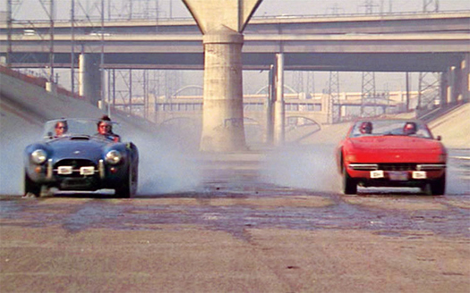
[A still from Gumball Rally, via motortrend.com. As high-speed races on the clogged freeways of Los Angeles have become increasingly implausible, the wide-open expanse of paved riverbed has proven irresistible to filmmakers.]

SUPRbrains’ “The Lowline” hypothesizes futures for the river as a series of Tschumi-esque event-spaces.

F.A.D.’s “Visual Histories of the Los Angeles River: Past and Envisioned Futures” curates images of the L.A. River’s history, and offers a critique of the official Los Angeles River Revitalization Master Plan.

Nam Henderson’s “A zone comprised of an invisible pattern of ownership and maintenance jurisdictions, railroadlands and easements” initiates discussion on several topics touched on by the discussion of ‘freakologies’ in the chapter and our earlier post.

Peter Nunns links the Los Angeles River to “Fire control freakology”, via Mike Davis’s Ecology of Fear, and then ponders the legal and lo-fi terrains of fire control.

FASLANYC provides a comparative survey of Latin American freakologies, in Mexico City, Sao Paulo, and Buenos Aires.

dpr-barcelona looks at the Los Angeles river as a Foucauldian heterotopia.

Next Monday, we’ll be discussing Frank Ruchala’s “Crude City”.  Ruchala traces the city’s complex cultural and economic relationship with oil, which has been both vital to its development and a bit of a black sheep in Los Angeles’s family of infrastructures.

We’ll try to update this post with additional links as more material is posted this week.  If you have responded to this week’s chapter and we haven’t added a link here, please let us know via email or in the comments.

“the parrot, the weed, and the sludge mat”

You’ve arrived at week two of our reading of The Infrastructural City; if you’re not familiar with the series, you can start here and catch up here — taking particular note of the index of contributing posts for the first chapter, which tracks the sprawl of the discussion across other blogs.


[The lower reaches of the Los Angeles River, via google maps]

Like Barry Lehrman’s chapter on Owens Lake, the second chapter of The Infrastructural City, “Flood Control Freakology” deals with a water-bearing infrastructure.  Unlike the aqueduct and the damaged playa the aqueduct produced, though, which exist to bring water to the city, this second hydrological infrastructure, the heavily-channelized Los Angeles River, has been re-constructed to remove water from the city.  The chapter’s author is David Fletcher, a Californian landscape architect and one of the contributors to the recent Los Angeles River Revitalization Master Plan.  Fletcher describes the Los Angeles River not just through the dominant “narrative of loss”, which focuses on the destructive qualities of its transformation from a perennial “meshwork of meandering rivers, streams, arroyos, and washes” to a “fully-engineered flood-control system”, but also as what Fletcher terms a “freakology”, or hybrid system composed of both infrastructural and natural parts, which supports “a vibrant mix of varied ecologies”:

“The present river ecology is a churning soup of exotic and native vegetative communities that have been introduced since the nineteenth century, some by design, others by accident.  Tourism, shipping, rail, industry, agriculture, and ornamental vegetation have brought humans, animals, insects, and seeds, from around the globe to colonize the river’s naturalized reaches.  These reaches have established a curious equilibrium with their ecologies, depending on nutrient-rich flows from sewage treatment and urban runoff…”

Fletcher’s description of “freakology” continues on for pages, reading like a whirlwind tour of ignored urban landscapes whose conductor is madly in love with what others would see as malignancies and degeneracies: “thousands of multicolored bags — known as ‘Los Angeles moss’ — hang from trees”; human encampments line the concrete channels, “smoke emanating from well-furnished stormdrain apartments”; “thriving parrot colonies” are composed of “ragtag teams of birds that escaped private homes as well as from the old Busch Gardens amusement park, closed in the early 1980s”; “bridges house bat colonies and swallow nests”, which are “critical to urban disease vector control”.


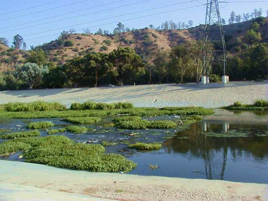
[A point of transition between concrete-bottom (at right) and dirt-bottom (at left), photographed by the awesome FOVICKS, or Friends of Vast Industrial Kafka-esque Sturctures, for a photoessay on the Los Angeles River]

The purpose of this cataloging, though, is not merely to assemble a wunderkammer of landscape curiosities, but also aimed at describing, through the creation of “new narratives and vocabularies”, a more realistic direction for the future of the river.  Recent efforts to transform the river are rooted in bucolic aesthetic expectations, demanding a return to — or at least a simulation of — the pre-urban condition of the river, typically understood to mean restored flood plains, daylighted streams, un-channelized river banks, and re-established populations of native flora and fauna.  Fletcher suggests, though, that these expectations are not grounded in an honest evaluation of the ecological potential of the system, constrained as it is by the limited quantities of water available to Los Angeles:

“The future of the river and its infrastructural ecologies depends on water availability and flood-control policy.  With prolonged drought conditions and growing pressure on water supplies in the American West, Los Angeles will have to become more self-reliant, turning to conservation and greywater reuse as major sources of water savings…  As the city grows rapidly over the next decades — primarily through sprawl and infill densification — and as wastewater is re-appropriated for that growth, the city forecasts that the amount of water reaching the river will drastically decrease.  Decreased water supplies due to climate change and increasing water demand for recycled water means that soon there will not be enough water to sustain the river’s ecologies and landscapes…”

This stance, and the provocative suggestion that “restoration” is, whether desirable or not, simply not an option, aggressively counters the received orthodoxy in landscape planning, which tends to see distinctions like “soft infrastructure” versus “hard infrastructure” as not only having functional distinctions, but also as existing in a Manichean moral environment: a river bed encased in concrete is always bad, and a naturalized flood plain is always good.


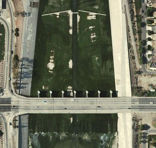
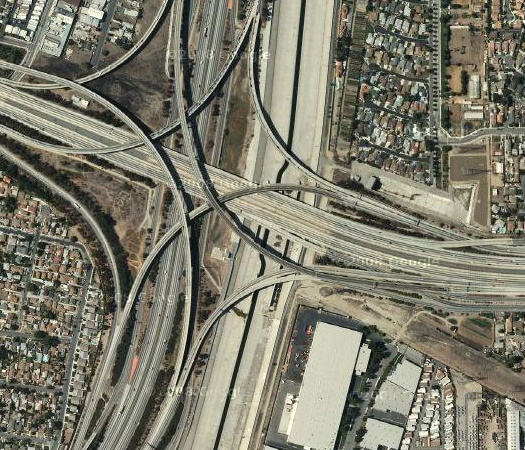
[The Los Angeles River slips under “the” 105, via google maps]

1 I’m not really convinced, by the way, that “freakology” is the most helpful term for an advocate to select, given both the naturally-negative connotations of the term and the degree to which hybridized natural-infrastructural ecologies have become the norm in urbanized areas.

If we can accept for the moment, as Fletcher asks us to, that “freakology” is, at least at times, the unavoidable result of the interaction of infrastructural and natural systems, then we are left with an important and fascinating question: what is a landscape architecture with freakish rather than bucolic characteristics like1?


[Life in the upper concrete reaches of the Los Angeles River, via FOVICKS]

It obviously involves an alteration of aesthetic priorities and models.  The bucolic traditions relies most deeply on Arcadian ideals handed down from the classical and Romantic landscapes of Western Europe, peripherally on the garden traditions of East Asia, and more recently upon the elaborate simulation or re-arrangement of previous local ecologies, a la Jens Jensen and Piet Oudolf.  A quick browse through the ASLA’s yearly residental award winners evidences the degree to which these traditions have been assimilated into a single bucolic vernacular favored by wealthy clients and their designers.  In comparison to these traditions, a gardened infrastructure may be jarring, prone to odd bursts of coloration and seemingly disorganized, but that does not mean that it will not have a beauty — and an organization — of its own.  That organization may be more emergent than it is planned, and that beauty as removed from the bucolic tradition as the favela is from Haussmann’s Paris, but that does not mean that we cannot train ourselves to see it.

Curating these ecologies may be accomplished less through the traditional tools of landscape design — the bulldozer, the front-end loader, the nursery-grown plant, the concrete pour — and more through the controlled alteration of and experimentation on the processes which input into infrastructural ecologies.  This is demonstrated particularly well by two qualities of the SCAPE Studio team’s contribution to the recently opened Rising Currents exhibition at MoMA, “Oyster-tecture”.  For that exhibition, each of the five invited teams was given a particular portion of the New York City regional waterfront to respond to.  SCAPE’s team was assigned a portion which includes Red Hook, the Buttermilk Channel, and the Gowanus Canal.  The Gowanus Canal, which has recently been designated an EPA Superfund site, is an obviously freakish landscape, containing waters so contaminated that their toxicity may actually be of use in researching cancer-resistant and naturally-antibiotic micro-organisms.


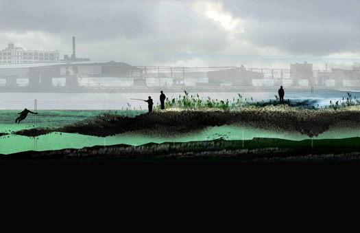
[Image from “Oyster-tecture, by SCAPE Studio; via Change Observer]

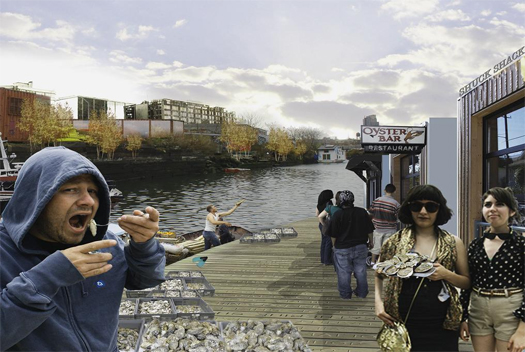
The first quality of “Oyster-tecture” which seems particularly applicable to designing for “freakologies” is its open-ended-ness.  Each of the other four exhibiting teams provides what amounts to a master plan, proscribing particular and desirable potential end states for their sites, though often quite clever in program and form.  The SCAPE team, however, proposes to insert a series of programmed architectural objects — an armature for the growth of an oyster-based ecology and economy, whose primary parts are the adoption of the Gowanus canal as an oyster nursery and the provision of a kit of parts on which young spats can grow into a harvest-ready mature reef — into interaction with the existing urban ecologies, both natural and human.  While the farming and cultivation of oysters would have a series of anticipated positive effects — biofiltration of contaminated waters, protection against storm surge through accumulation into reefs, cultural and economic revitalization prompted by biological revitalization — and so undoubtedly affect the evolution of both the city and its adjacent waters, the team does not seek to delineate or define exactly what form that evolution will take.  This humility (a quality not often ascribed to architectural designers, who have worshipped for decades the cult of the singularly brilliant ego) is entirely appropriate not only for working in the infrastructural city (which, as Varnelis is quick to point out in the introduction, has developed a systemic immune response to the construction of new infrastructures), but also for experimenting with the ecological balance of the “freakologies” our infrastructures have spawned.


[Image from “Oyster-tecture”, via Heroes and Charlatans]

The second quality is captured well by a comment left by Michael Horodniceanu on Mimi Zeiger’s review of Rising Currents for Places:

“SCAPE’s approach to the tide rising is grounded in a sustainable way of adressing environmental changes along New York’s shore line. It allows one to preserve our environment by instituting subtle physical changes along the shore line with the ultimate outcome of reducing the heavy reliance on mega infrastructure investments for protecting our waterfront. While the other solution are imaginative, they rely heavily in a massive infussion of money into infrastructre thus making them less likely to be implemented in the relatively near future. SCAPE provides contemporary, simple yet titilating solutions to protect our environment while pointing towards the implementation of inexpensive and sustainable ways.”

“Oyster-tecture” is, in other words, what FASLANYC has called a “lo-fi landscape”, quickly augmenting an existing ecology at minimal expense, but containing the potentially transformative seeds of a future harbor.  Unlike the “mega infrastructure investments” Horodniceanu refers to, which are typically constructed in an interdependent fashion, lo-fi interventions are relatively independent, even potentially experimental in a scientific sense.  If we accept that, as Fletcher suggests, the removal of the hard-engineered infrastructural components of “freakologies” is not a reasonable option, then we need effective but flexible ways to hack “freakologies”, and lo-fi interventions offer exactly that.

Finally, objective and scientific measurements, particularly those derived from the field of ecology, are of great utility in approaching “freakologies”, because those instruments can help us shed the cultural baggage which teaches us to consider bucolic qualities indicators of a landscape’s ‘health’ and “freakish” qualities indicators of a diseased state.  One useful alternative, drawn from ecology, is the measurement of productivity, which can often occur in surprising places — such as the sewage-rich Lower Los Angeles River.  Quoting Fletcher:

“…[running] six miles to the tidal estuary zone, [it] is perhaps one of the most interesting ecologies [along the river].  In this reach, the increased nutrient-rich waters spill out of the low-flow channel, a 1-foot-deep by 20-feet-wide channel running through most of the river.  This channel was originally designed to concentrate and conduct silt-laden water out to sea and to allow Steelhead Trout up the river to spawn.  But the original design  did not anticipate the increased flows from the sewage treatment plants.  This effluent-enriched water spreads out across the concrete sills, forming a thriving and vast algal zone, the “Sludge Mat”.  Invertebrates have extensively colonized this zone, creating the most biologically productive stopover for migrating shorebirds in Southern California.  It has the largest concentration of black-necked stilts in the United States.”

2 It is probably also the case that a similar bi-polarity between “freakish” and “bucolic” attitudes may be of use, particularly if it is understood that the introduction of new bucolic landscapes occurs in the context of “freakology”, rather than heralding a return to an obsolete landscape condition.

Such assessments, though, must occur at multiple scales simultaneously.  It is not enough to know that the “Sludge Mat” is productive and rich, without considering how it affects productivity (and, of course, a host of other measurements, such as diversity) upstream and downstream, and in other ecosystems touched upon by those migrating shorebirds, and so on.  This sort of massively interconnected, multi-scalar investigation requires the opposite approach from the lo-fi and experimental models, demanding instead the complex integration and processing of diverse knowledge and data-sets, suggesting that designing for “freakologies” may require a sort of disciplinary bi-polarity, accommodating both radically independent (open-ended, lo-fi) and radically interdependent (ecologically complex, scientifically-tested) working methodologies within the same physical and legal terrain2.

solar owens lake

In the comments at DPR-Barcelona, David Maisel points us to a pair of news articles on the Los Angeles Department of Water and Power’s latest plan for the Owens Lake playa:

The Department of Water and Power’s board of commissioners [in December] unanimously approved a renewable energy pilot project that would cover 616 acres of lake bed with solar arrays — a possible precursor to a mammoth solar farm that could cover thousands of acres.  City utility officials hope that, along with generating power for L.A., the solar panels would reduce the fierce dust storms that rise from the dry lake bed. To comply with federal clean air standards, the DWP must control the dust that has plagued the Owens Valley for decades. Its efforts are part of a $500-million dust mitigation plan…

To help win over environmentalists, Freeman promised that the DWP would continue its program to flood portions of the lake bed with water to help control dust; the project currently uses enough water to supply 60,000 families. That shallow, ankle-deep flooding has created critical habitat for tens of thousands of migrating waterfowl and shorebirds…

The pilot solar project would generate an estimated 50 megawatts by 2012, or about 0.5% of L.A.’s energy needs. Mayor Antonio Villaraigosa has vowed to halt the use of coal-burning power plants by 2020 and — that same year — generate at least 40% of its energy from renewable resources.  The DWP estimates that the solar pilot project also could save 2,460 acre-feet of water a year — worth $1.7 million — because the solar arrays could be used to control dust in that portion of Owens Lake instead of flooding.

Read the full article at the LA Times, and a second article from Reuters.  Interestingly, the interim chief of the DWP describes the array — which promises potential jobs and income for the Valley — as a way to “make peace” with the Valley, as he acknowledges that “eighty years ago, [Los Angeles] stole the [Valley’s] water”.

Update: It is worth reading both Barry Lehrman’s initial reaction to the solar farm proposal last December, and his more recent and more skeptical take, in the comments below.

“like a conveyor belt built to toss tea-drinking scientists into the icy sea”


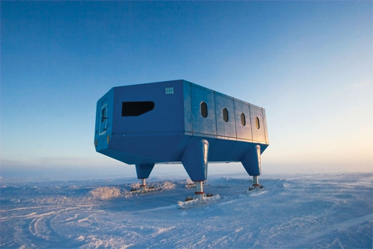
[Halley VI, a British research station on ski pods, via Wired.]

At Wired, Andrew Blum surveys the architecture of Antarctic research stations, which, as it includes buildings which have to be towed to remain at fixed geographic points, hydraulic lifts that raise buildings in reaction to snowfall, and architecturally-induced “subzero maelstroms”, reads like a photographic companion to the recently opened Archigram Archival Project.

reading the infrastructural city: chapter one index (updated 5 may)

Images by Robin Black Photography for the Owens Lake Project, an ongoing photo documentary chronicling the rejuvenation of Owens Lake. See the website for many more.  Black comments at DPR – Barcelona:

“No more is it a toxic wasteland, though it’s certainly odd, and occasionally ugly, and still troublesome along the portions deemed too disturbed to recover. Life is returning to the lake, and the future of the ecosystem looks more hopeful than it has in 100 years. It’s vital that people be made aware of the near-miraculous rebirth so that efforts are continued and made permanent. If people continue to believe that the lakebed is a toxic wasteland unworthy of restoration, that’s exactly what it will remain.”

We discovered the Owens Lake Project via Aquifornia.

Barry Lehrman, author of the first chapter of The Infrastructural City, discusses the genesis of the chapter and shares details from both earlier drafts of the chapter and his thesis project, which was to design “an alternate dust mitigation system to restore Owens Lake and create a hybrid landscape for tourism and habitat”, in Writing ‘Infrastructure of the Void’.  Lehrman will be posting additional material each day this week, including more details on that design project, “an Owens Lake/Los Angeles Aqueduct bibliography, the Owens Lake Dust Mitigation project team, and a podcast“.  As we’ve been discussing parallels between Owens Lake and the Everglades, both here and at F.A.D., Lehrman has also posted a project for the Miami Lakes Belt, “Emergent Urbanism”, which proposes a slightly tongue-in-cheek “Miami Archipelago”.

Free Association Design asks what Owens Lake tells us about the meaning of the term “urban”, and looks at Owens Lake as an example of how twentieth-century infrastructures were produced by a “viscous feedback loop” of “crisis-action-crisis”, in Problematic Surfaces and Collateral Urbanism: Reading into the Owens Lake Parable.  A follow-up post, Reconstructing the Void, compares Owens Lake to the Everglades, noting the impossibility of returning such heavily infrastructural landscapes to their pre-anthropogenic condition — which, of course, is not to say that there is no healthier or more ecologically productive future possible.

DPR-Barcelona curates a fantastic selection of photography of Owens Lake, while speculating about leaping From Dust Problems to Towing Icebergs.

FASLANYC lets William Vollmann guide us toward Owens Lake as mythology, concluding with an astonishingly appropriate quote from Italian poet Eugenio Montale: Bring me the sunflower so that I might transplant it into burning fields of alkali, which tells us just about everything we need to know about Owens Lake.

Peter Nunns discusses the strange ecologies of disrupted landscapes outside of LA and Seattle, linking the production of atomic bombs, glow-in-the-dark-feces, toxic dust storms, and the power infrastructure of Los Angeles.  In another post, the anti-infrastructural nation, he describes a handful of pieces of New Zealand’s infrastructural history, painting New Zealand’s tendency towards fragmentation and away from centralization as the polar opposite of the southern Californian tendency towards unification and mega-infrastructures.

Nam Henderson considers Owens Lake as a new nature and a frontier, in Preserving the integrity of the void.

Peter Sigrist emphasizes the ethical dimensions of Owens Lake at Polis.

Next Monday, we’ll be discussing David Fletcher’s “Flood Control Freakology”, which explores the ecologies of the highly modified Los Angeles River, as well as Lane Barden’s photo essay, “The River”.

We’ll try to update this post with additional links as more material is posted this week.  If you have responded to this week’s chapter and we haven’t added a link here, please let us know via email or in the comments.

wyoming is in los angeles

From now until the beginning of August, mammoth is hosting a chapter-by-chapter reading and discussion of The Infrastructural City: Networked Ecologies in Los Angeles.  This post is the first in that series, and discusses Owens Lake; for the full schedule of readings and an introduction to the series (and the book), click here.  In addition to the discussion hopefully generated in the comments here at mammoth, other bloggers will be contributing material for various chapters.  As that material is published elsewhere, mammoth will follow-up with another post indexing and linking to that related material.


[The pure geometry of desiccation, from David Maisel’s The Lake Project
]

1 Kazys Varnelis, in the introduction to The Infrastructural City: “If the West was dominated by the theology of infrastructure, Los Angeles was its Rome. Cobbled together out of swamp, floodplain, desert, and mountains, short of water and painfully dependent on far-away resources to survive, Los Angeles is sited on inhospitable terrain, located where the continent runs out of land. No city should be here. Its ecological footprint greater than the expansive state it resides in, Los Angeles exists by the grace of infrastructure, a life-support system that has transformed this wasteland into the second largest metropolis in the country. Nor was this lost on Angelenos. They understood that their city’s growth depended on infrastructure and celebrated that fact. After all, what other city would name its most romantic road after a water-services engineer?”

Of the myriad infrastructural life-supports which sustain (1) the city of Los Angeles, the most fundamental is surely the network of canals, tunnels, buried conduits, siphons, pumping stations, and reservoirs which exponentially magnifies the city’s watershed, along three major artificial tributaries.  Traced from Los Angeles, the California Aqueduct travels north and west (though the water obviously flows in the opposite direction) to its first pumping station on the San Joaquin-Sacramento River Delta.  The Colorado River Aqueduct shoots eastward from the city, to the California-Arizona border, where it meets Lake Havasu at Parker Dam, tapping, through the Colorado River, a vast watershed that extends into Wyoming, Utah, Colorado, New Mexico,  Arizona, and Nevada.  The third major aqueduct, which is the largest of the three and carries nearly half of the city’s water on its own, is the Los Angeles Aqueduct, which slips out of the Coast Range Province (where Los Angeles lies), through the Sierra Nevada and into the Basin and Range, where it rides north up Owens Valley, where it captures snow melt off the eastern Sierra Nevada and the flow of the Owens River.


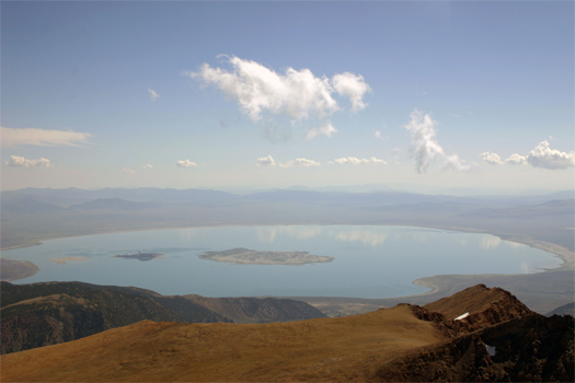
[Mono Lake, which lies just north of Owens Lake playa, and is a reasonable approximation of what undrained Owens Lake would have looked like, though it is only two-thirds the size; image via wikipedia.]

This anthropogenic watershed does not extend itself without cost, though.  One of those costs, the desiccated and drained Owens Lake playa, is the topic of the first chapter of The Infrastructural City, Barry Lehrman‘s “Reconstructing the Void”.  For somewhere around eight hundred thousand years, Owens Lake held salt water continuously, fed by the Owens River.  Though it had been slowly shrinking since its formation in the post-glacial period, in the late 19th century, the lake still covered over a hundred square miles, plied by a steamship which ferried goods and raw materials between the Cerro Gordo Mine and Cartago Landing.  Construction on the aqueduct began in 1905, was completed in 1913, and had essentially dessicated Owens Lake, through the indirect means of the diversion of the waters which sustained the lake, by 1924.


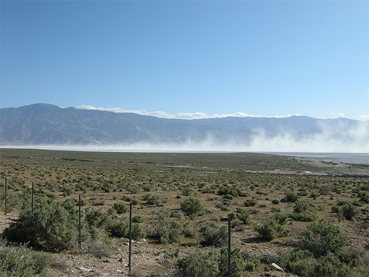
[A distant alkali dust storm on Owens Lake playa, via wikipedia]

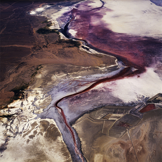
While the playa has never entirely dried out — even at its driest, a salty brine remains below the caked surface — and continues to sustain enormous populations of extremely hardy bacteria (salt-loving halobacteria which produce a striking red coloration) and algae (which produce green coloration), the lake and valley eco-systems were devastated: “lush meadows, sparkling lakes, and the rolling river were replace by the current basin-and-range landscape of sagebrush and sand dunes”.  The dried surface of the playa, meanwhile, became a massive ecological disaster, launching polluted dust storms which intensified throughout the twentieth century, as described by Lehrman, speaking here about the state of the playa in the mid-nineties, after environmentalists had pushed for reforms in water diversions upstream:

“Wind gusts above twenty miles an hour lifted over fifty tons per second of ‘Keeler Fog’ off the lakebed.  Often reaching over two miles high, these dust storms sent 130 times the United States Environmental Protection Agency’s limit for particulate matter into the atmosphere, blwoing the dust over 250 miles from the lake.  Such storms occurred two dozen or more times each year, generally in the spring and fall.  Composed of microscopic particles smaller than ten microns (PM10), the dust contains significant levels of toxic metals like selenium, arsenic, and lead along with efflorescent salts.  The largest single source of PM10 pollution in the country, these dust storms were a clear threat to the 40,000 people in the immediate region.  Even the feds suffered: the dust reduced visibility so badly that nearby China Lake Naval Air Station to the south had to stop flight operations five to ten days each year — costing the Navy over $5 million annually.  Physicians at China Lake linked the dust to significant health problems in the region, including higher rates of cancer, lung disease, and eye problems.”

2 According to Lehrman, “the scale of the dust control project on Owens Lake is roughly equivalent to that of a waterworks for a city of over 220,000 people”.

3 That strange apparatus, which Lehrman describes as “rising like alien plants on the terraformed lakebed”, is the subject of an excellent post at Pruned, from last January.

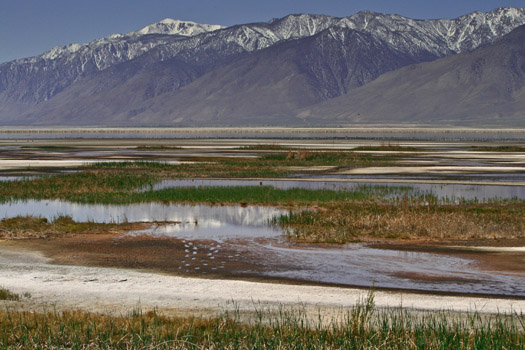
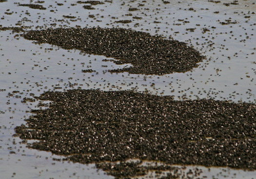
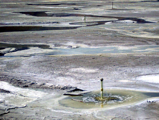
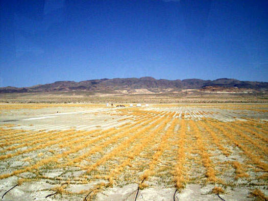
Finally, in 1998, Los Angeles installed a massive (2) irrigation prosthesis in the playa, composed of “over 300 miles of pipe… more than 5000 irrigation bubblers, and hundreds of miles of fiber optic control cables and valves”, periodically watering the thirty dustiest square miles of the playa (3).  Now existing in an artificially tensed state, neither truly playa nor fully lake, the lake bed has developed a strange new ecology: “brine flies and microbes” flourish in the “shallow pools” created by the irrigation works, producing a bounty which draws migratory shore birds from the Pacific Flyway.


[Bubblers on Owens Lake playa, via Metropolis]

This landscape is, of course, fascinating in-and-of itself.  Within the context of The Infrastructural City, though, it tells a specific story, both about the infrastructural city (in general) and the Infrastructural City (Los Angeles, in particular).

First, as Lehrman notes, the contentious diversion of the hydrological resources of the Owens Valley away from that valley is ironically responsible for the preservation of the rural qualities of the valley, even if those qualities have been radically transformed:

“Once natural, California is now thoroughly artificial.  Perversely, only in places as heavily regulated and mechanized as Owens Lake is there any semblance of what the territory might have been like before settlers arrived.  In a strange gift, Los Angeles has preserved the open rural landscape of Owens Valley, re-creating the void where by all rights we shouldn’t expect to find it.”

Similarly, adjacent Inyo National Forest — an apparently fully preserved natural landscape — is also a relic of the city’s thirst for water, having been created by the federal government at the behest of the city, which petitioned for its creation and expansion so as to preserve the watersheds which supply the Owens River.  While the creation of natural preserves is usually thought of as a mechanism by which to prevent the exploitation of an ecosystem, in this case the natural preserve is, functionally, as much a part of the hydrology and ecology of Los Angeles as the thoroughly channelized Los Angeles River or the LADWP aqueducts, illustrating a fascinating overlap between the economic incentives of development (which would not be possible in greater Los Angeles without water which is ultimately derived from Inyo) and the ecological imperatives of preservation.


[Rows of native salt grass, planted by the LADWP as part of remediation efforts at Owens Lake, via Metropolis.]

This functional integration between urban and rural systems indicates a second lesson, which is that it may well be worth re-learning the original definition of urbanism:

“…Whilst contemporary definitions focus heavily on the impact of built-form on cities, the original meaning [of ‘urbanism’] was coined by Ildefons Cerda to describe “the science of human settlements at various scales and times, including countryside networks”.  Although Cerda’s original definition referenced natural systems, the impact or understanding of these systems’ influence on built development (and vice versa) appears to have been lost in contemporary definitions.” (Christopher Gray, “Turning the field: contradictions in landscape urbanism“, in Kerb 15)

While the common tendency is to read “urban” as an adjective which is applied to territories in direct correlation to both density of settlement (thus downtown is very urban and suburbia is less urban and a farm is not urban at all) and the absence of natural ecological systems (though, of course, ‘natural’ is itself a cultural construct), the design of cities requires a continual awareness of the tentacular extension of the effects of urbanization into distant terrains.  After nearly 100 years of serendipity, greed, and lawsuits, the Los Angeles Aqueduct, Owens Lake playa and Inyo National Forest have evolved into a fascinating cross-section of anthropogenic landscapes, varying in degree of human influence, but all functioning in concert to support a heavily developed urban region.  Much as mammoth has recently argued that the iPhone cannot be understood without understanding its participation in a diverse series of physical terrains, the infrastructural city too begins with distant landscapes, and an understanding that Owens Lake playa, with its weird, manufactured ecosystem, is as much a part of Los Angeles as Mulholland Drive is.

Further reading:

David Maisel’s Lake Project uses Owens Lake as the site and subject of a series of stunning photo-essays.  Geoff Manaugh interviewed Maisel for Archinect, and there’s an extended interview in the BLDGBLOG Book.  DPR-Barcelona posted about the Lakes Project towards the end of last week.

Metropolis visits Owens Lake with CLUI, and CLUI provides an extended field report on that excursion, which includes travels up and down the Owens Valley.