mammoth // building nothing out of something

infrastructure without architects


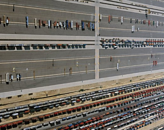
[Photo of Global III, by Alan Berger via NAi Publishers]

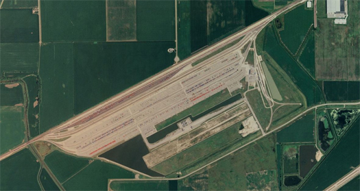
Approximately seventy-five miles due west of the gleaming towers of Chicago’s Loop, Union Pacific Railroad, the United States’ largest railroad company, operates the Rochelle Global III Intermodal Facility, twelve-hundred acres of switching yards, train tracks, loading facilities, and container-sized parking spaces.  Rochelle, a small Midwestern town with just under ten thousand inhabitants, has long been a significant crossroads for trans-continental infrastructures.  In 1854, the Air Line Railroad ran the first tracks through the town, tracks which are now owned by Union Pacific.  In the early 20th century, east and west bound automobiles passed through Rochelle, as the town lies on the route of the Lincoln Highway, the first coast-to-coast highway dedicated in the United States.  The town recently commemorated this history with the incorporation of Railroad Park, which it claims is the nation’s first park dedicated primarily to watching trains operate2.  Whatever the veracity of that claim, there is no doubt that there are many trains to watch in Rochelle, as every day over three thousand containers pass through the flat and linear landscape of Global III on an average of twenty-five trains.  Yet as impressive as the Global III’s scale and swiftness of operation is, it is only one of five Intermodal Facilities operated by Union Pacific in the Chicago area, and the Chicago area facilities are situated within Union Pacific’s much larger network of tracks, rail and hump yards, depots, terminals, and facilities which sprawls across mountains, deserts, plains, forests and coasts from New Orleans to Seattle to Los Angeles and back to Chicago.
Given the potent role logistical networks such as the one that Global III is a single node in play in shaping the form of cities, it is not surprising that contemporary architects, landscape architects, and urbanists of other varying stripes have developed a strong interest in the aesthetics and function of infrastructural landscapes like Global III.

It is also not surprising that the cover of a publication which aims to capitalize on and catalog architectural projects resulting from that interest, as Kelly Shannon and Marcel Smet’s The Landscape of Contemporary Infrastructure — the publication where I first encountered Global III — does, is adorned with the photograph of Global III from the top of this post, neatly rowed trains and splayed geometric parking spaces in the foreground, the facility’s stormwater detention ponds triangular in the background.  What is perhaps somewhat surprising, though, is that such a book features on the cover one of the few projects within its pages for which neither architect nor landscape architect is credited.  The authors have a rather full palette of projects to select from, including seventy-two “majors” – projects which receive detailed two-page spreads – and numerous “minors”.  Of the “majors”, only two – the Hangzhou Bay Bridge and the Qinghai-Tibet Railroad – lack a recognized architect or designer.  Global III is only mentioned briefly in the text, as a “minor”, included to serve, along with the Qinghai-Tibet Railroad, as an example of what the authors describe as infrastructures whose “mark of technological ability resides not so much in their expression of sophistication and stylishness, but in the raw force of technological advancement required to master the demanding objectives they were set to resolve”.  As the architectural professions are built upon the mastery of “sophistication”, “stylishness”, and “expression”, but not upon the ability to drive technological innovation, the selection of this rather unrepresentative infrastructure for this book’s cover perhaps unintentionally precisely locates one of the core dilemmas produced by the infrastructural turn in the architectural professions: while it is easy to understand why architects want to design infrastructures – as infrastructures are the bone and sinew of modern cities, those who design infrastructures design cities – it is much more difficult to explain why cities should want infrastructures designed by architects.

The reason this question is so difficult to answer is that the very form of these structures — the engineered purity that makes them so compelling aesthetically — arises directly from the spatial ramifications of raw numbers and patterns of logistics.  This is a particularly chilling point for architects interested in infrastructure, because, if form-giving is not to be our gift to infrastructure, what will?  The obvious response (which mammoth and others have discussed elsewhere) is that if architects want to be more than infrastructural decorators, we’ll need to learn to manipulate the performance-derived source-code that controls the spatial expression of infrastructures.  But that is much easier said than done.

So that wrapped up pretty neatly, and consequently I’m not sure how to fit this thought in, but I also suspect that the answer to this question — and other questions related to the involvement of the architectural professions in the future of cities — has a lot to do with the application of “spatial intelligence”, the strategic re-positioning of architecture as a discipline, and, perhaps a little bit less directly, our professions’ facility with what Bryan Boyer brilliantly calls “matter battles”.  (Boyer positions the matter battle roughly in opposition to the fluidity of digital design, but I think it could pretty easily be understood as a weakness in purely economic and political models of the city, as well.)

The middle link there, by the way, is to Rory Hyde’s piece from the end of last December on “Potential Futures for Design Practice”, which was not only a superb summary of some of those futures, but also sparked a discussion in its comments section which is not to be missed.  That discussion is really worth reading in its entirety, but if you’re looking for a one-sided (but excellent) set of Cliff Notes, Boyer compiled his contributions to the discussion on his own blog.

ecologies of gold


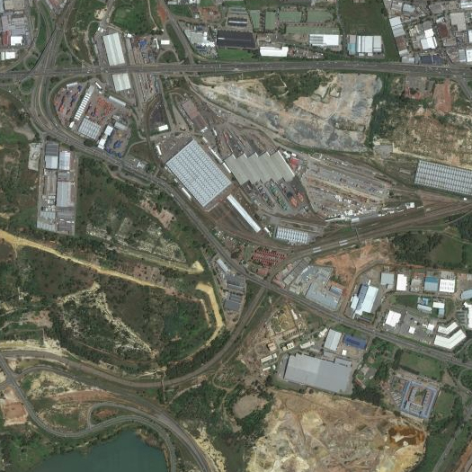
[Top: land-use patterns in Johannesburg, shaped by the trace of mines, mine dumps, and tailings ponds, via Bing maps; bottom: a drive-in movie theater, now closed, on top of the Top Star gold mine dump in Johannesburg, photographed by Dorothy Tang]

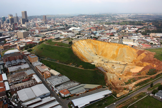
Last year, because reading thesis blogs is one of Stephen and I’s favorite (and nerdiest) pastimes, there were several student projects at Harvard that caught our eye — we published a piece on one of them, Andrew TenBrink’s Staging Ground, in the fall, and have a couple more that we still intend to write about.  One project that fell into the former group (projects that we thought were particularly interesting), but not the latter (projects we intend to write about) was Dorothy Tang’s “Cities of Gold”, a study of the complex interrelationship between the gold mining industry and contemporary land use in Johannesburg’s “gold belt”.  Together with architect Andrew Watkins, Tang has just published a large chunk of this research at Places, in a narrative slideshow which veers from on-the-ground exploration of the informal settlements that have been built on abandoned mining grounds throughout the gold belt, to diagrammatic explanation of the gold industry’s return to their abandoned grounds in search of further, to noting how the desire to ameliorate wind-blown dusts from mining operations led the city to plant what is effectively a new forest — an urban forest of imported and alien species — on land which had never before supported a forest.

It is well worth reading the full narrative.

“highway proposals never die, they just get more expensive”


[Library of Congress images of Robert Moses and Paul Rudolph’s Lower Manhattan Expressway, via Pruitt-Igoe‘s flickr set]

1. A couple months ago, Slate published a series of articles by Tom Vanderbilt (author of Traffic, which I hear is excellent) on “Unbuilt Highways”, which began with the installment “How a Road Can Change a City, Even if It Never Gets Built”.   I think the apparent appeal is obvious.

Unfortunately, the series is not quite what it seems.  Essentially, it builds towards a re-iteration of conventional appreciation for cities that didn’t building highways through their inner neighborhoods, captured by Vanderbilt’s quote of Sara Mirk’s nicely inverted formulation: “when current transit planners visit from exotic Houston and D.C. to admire Portland’s progress, what they are really admiring are the roads not built—freeways erased from the maps decades ago.” This is definitely not wrong, but rather than the consideration of the changes wrought by unbuilt infrastructures which the article’s title promises, it’s only a nice twist on the relatively obvious notion that an unbuilt infrastructure won’t have the same effect on the city it would have had if it were built.  (Of course, the title was probably not written by the author, so it’s hard to blame Vanderbilt for that disappointment.)

2. But we can talk about this idea anyways: that even when they aren’t built, the infrastructures that we propose still affect our cities.

This happens on two levels.

Once the Director of Planning has unveiled plans for an elevated expressway which will run right over your house, you can never look at those bricks and mortar the same way.  They’ve become fragile, almost ephemeral, subject to the whims of the planners and their bulldozers.  You and your neighbors can band together and put a halt to the project, but you can no longer pretend that your house is permanent, as the veil that hid its contingent nature has been ripped away, by something as thin and flimsy as a drawing, made by the right hands and invested with the right authority.

At the same time, the even more direct effect is that the city is physically marked by these plans.  One of the few moments in that Slate article which comes close to being what the title promised is a sentence about Toronto’s canceled Spadina Expressway: “Ghosts of the Spadina still haunt the city today—for example… the windowless Spadina facade of the New College of the University of Toronto, [whose architects reasoned] “Why look out onto an expressway”?”. You don’t have to build it; you just have to make other architects and planners think you might build it, and they’ll design as if that empty space were filled by the concrete and steel you’ve proposed.  Buildings and landscapes, permanently marked by the absence of a thing that never happened.


3.  Vanderbilt’s choice of the word “haunt” seems particularly appropriate, and suggests a question: what other unbuilt infrastructures haunt our cities?

What longings in the psyches of unheralded civil engineers and forgotten mid-century planners do the absurdly tall and over-engineered spans of an interchange like the intersection of Chippenham Parkway and I-95 signal?  How do their unbuilt counterparts relate?  Will we see in the coming decades histories of the Crosstown Expressway and Beverly Hills Freeway which (perhaps a bit like Pruitt-Igoe‘s defense of that much-maligned housing project) invert their contemporary place in history — reading them not as potential tragedies averted by noble citizen resistors, but as possible monuments or vital linkages lost to the first glimmerings of a disastorous NIMBYism?  (This is hard to imagine, given how much truth there is in both the initial resistance to ill-advised mega-projects and the contemporary valorization of that resistance, but still one wonders.)


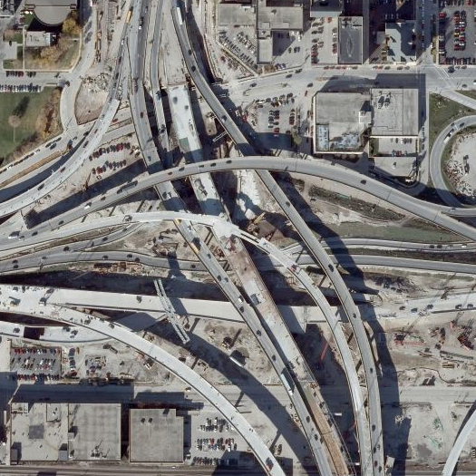
[The Marquette Interchange in Milwaukee, under construction; image via Bing Maps.]

It’s relatively easy to see how a highway does this, given the kind of cutting impact it has on a city’s physical fabric; but what of an unbuilt subway?  Do politically-connected developers buy up land around phantom subway stops, only to watch their real estate empires crumble when the will to fund the new lines evaporates?  What happens to the leftover land?  Or harder to see: unbuilt transmission lines, unfunded sewer tunnels, power plants that no one wanted to live near, public wi-fi networks never realized by contracted private service providers.  And not every unbuilt infrastructure is produced in a city planning office: the internet is nothing if not an archive that permits us to browse and share one another’s unrealized fantasies, and so it is awash in pet projects which explain how infrastructures should be expanded and contracted.

4. Someone please hire me to teach a seminar on unbuilt mega-infrastructures.

We’d study opening and re-appropriating the abandoned metro lines of Antwerp as everything from linear apartment complexes to subterranean public spaces.

We’d pour over archival plans for the full build-out of the interstate highway system, juxtaposing the plans with contemporary aerials, looking (like urban geologists tracing the forms of ancient oxbows) for the signatures of unbuilt infrastructures in sprawled land-use patterns.

We’d examine the the Great Recycling and Northern Development Canal, debating whether capturing the outflow of numerous Canadian rivers at their intersection with James Bay and diverting it south and west would be the economic and environmental boon proposal engineer Thomas Kierans claims it would be.  We’d design that Canal’s vast system of “outflow-only, sea-level dikes”, carefully studying dike and sluice typologies, and staring at our proposals traced like “archaic glyphs” onto satellite photography of that bay in both verdant summer and ice-locked winter.

We’d compare and contrast the Canal with it’s slightly-better-known-yet-still-quite-obscure-and-entirely-unbuilt cousin, the North American Water and Power Authority, dividing ourselves into two factions, each equally determined to prove the superiority of our continent-wide river diversion scheme.


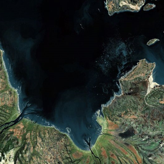
[Top: a portion of the south end of James Bay; bottom: the Ob River.]

And, of course, we’d have to devote a significant portion of our study to the equally outrageous unbuilt mega-infrastructures of Soviet Russia — like the Siberian River Reversal, a plan which dated back to the dreams of a 19th century surveyor in the employ of the tsar, Alexander Shrenk, and was seriously considered by Soviet leadership throughout the 20th century.  By the mid-sixties, the plan called for reversing the flow of the Pechora, Kama, Tobol, Ishim, Irtysh, and Ob rivers.  By the seventies, the Soviets had begun excavation around the Pechora and Kama — using, of course, 15-kiloton nuclear charges.  (Opinions on whether the use of nuclear charges was environmentally sound were “divided”.)  Progress was slow, though, and in the eighties, as the plan grew in scope and the Soviet government appeared increasingly serious about implementing it (Brezhnev officially sanctioned the scheme in a speech on agricultural policy), both internal and international opposition mounted, as this fascinating Time article from 1982 explains:

Now the old fantasy has taken on a staggering new reality. Under pressure from its water-needy Central Asian republics, and shaken by repeated agricultural failures, the Soviet leadership seems on the verge of sanctioning a water-diversion scheme that would be the grandest engineering project of all time. At least a dozen northerly-bound rivers would be reversed. By channeling 37.8 billion extra cubic kilometers of water a year to the south in European Russia and 60 billion cubic kilometers in Siberia, the project would greatly increase farm output in such arid regions as Uzbekistan and Kazakhstan, where the high birth rate of the largely Muslim population could overtake food production…

On the European side of the Urals, the volume of the Volga would be increased by funneling into it the flow of three major northern rivers, the Onega, the Northern Dvina and the Pechora. Officially sanctioned by President Leonid Brezhnev in his speech on agricultural goals two weeks ago, the European grand scheme is scheduled to be launched next year. The rerouting would require the building of 25 dams and numerous pumping stations. As the barriers go up, they would raise river levels a section at a time, until the water no longer reached the Barents Sea and the Arctic Ocean. The builders would also erect colossal dikes across the mouths of the rivers, creating great fresh-water bays. The first northern water should begin flowing southward into the Volga through a network of canals and reservoirs by the late 1980s.The Asian portion is no less ambitious, involving the rechanneling of Siberia’s mighty Ob River and its major tributary, the Irtysh. The original idea was to carry the water south by building a canal some 1,500 miles long, perhaps by nuclear blasting. But that proposal drew so many objections in the West that Soviet planners are now talking of rerouting the water along old riverbeds revealed by satellite photographs…

[But] the diversion, which would take 50 years to complete, would exact an enormous toll. In an area larger than Western Europe, tens of thousands of people would be displaced from their homes. Millions of acres of northern land would be flooded, including great tracts of game forest. Towns and villages would disappear, some of them with onion-domed churches dating back to the Middle Ages. No less disturbing, the diversion could drastically alter climate not only in the Soviet Union but throughout the Northern Hemisphere, even as far off as the U.S. and Canada.

So high and unpredictable are the social and ecological costs that an environmental debate has broken out in the Soviet Union. Ignoring the strictures against public dissent, an increasingly vocal group of Soviet climatologists, historians and distinguished citizens have joined local protesters—to say nothing of worried scientists abroad—in strong criticism of the scheme.

And so, having had our fill of grand and unrealized schemes — and having satisfied ourselves that, in many cases, both we and our planet are better off for their absences — we’ll then talk about how the cities they were never built in and never connected to have been changed by their absence.

And, of course, we’ll draw up the new mega-infrastructures of the 21st century — user-owned fog-farming networks and hovering re-purposed military drones broadcasting pirate wi-fi over financial districts and miles of coastal climate defense systems — never having any intention of building them, but carefully planning the effects that their proposal will have on our cities.

We will have a whole lot of fun.

400 years of 124 Green Street

Go read this micro history of a block in New York City:

We usually analyze Development at the national level. Why not other levels? At the other extreme, here is a short and surprising illustrated history of one city block […]

Its history had been a series of unexpected events involving many actors, from Nicholas Bayard to the yellow fever mosquito to Anthony Arnoux to James Bogardus to Jane Jacobs to George Maciunas, few or none of whom could have anticipated the outcomes of their actions. Like many other examples, Soho illustrates that a lot of economic development is a surprise.

tahrir square

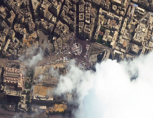
Apparently anticipating our post yesterday on revolutionary space, Dwell‘s Aaron Britt interviews Nezar AlSayyad, author of the forthcoming Cairo: Histories of a City, about the design of Tahrir Square:

Why from a design angle was it so successful as a point of protest?
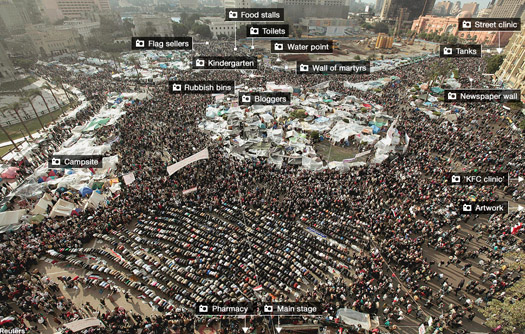
Twenty-three streets lead to different parts of it, which is why it was so successful with the demonstrators. There isn’t one big boulevard that you can block off, and there are two bridges that lead to it as well. One of them saw a clash between the regime and the demonstrators. It’s also the case that all of downtown Cairo, which isn’t that big, has a street that leads to side or another of Tahrir Square.

Read the full interview at Dwell; link via Nam Henderson.

the largest vessel of any type known to be in operation

Bridging the gap between mammoth’s interest in infrastructure, global logistics, economies, and really, really big things is this announcement from Moller-Maersk:

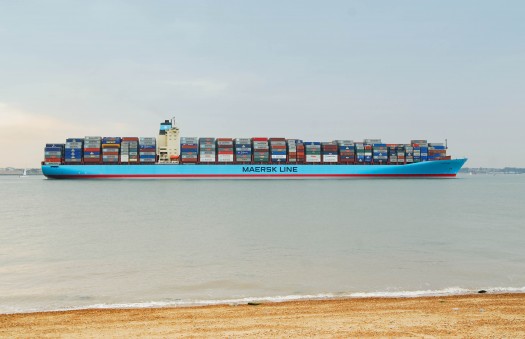
Danish shipper Moller-Maersk, the biggest container carrier, confirmed Monday it has signed a contract for a South Korean shipyard to build it 10 giant container ships over the next three years… The new container vessels, at 400 metres long, 59 metres wide and 73 metres tall, will be “the largest vessel of any type known to be in operation,” but emit half as much carbon dioxide as the industry average for Asia/Europe trade, the statement added.

Purchasing your own fleet of carriers will set you back $2bn.


[The Georg Maersk – 9074 TEU (twenty-foot equivalent units – typical shipping containers are forty feet long, meaning each count for 2 TEU). The new ships will be approximately 18,000 TEU.]

[Photos via Maersk, h/t to Telstar Logistic]

revolutionary space

In saying anything about the past couple weeks’ events in Egypt, we have to begin by saying that we know little about Egypt.  (What we do know — that it is absolutely appropriate to celebrate the downfall of a tyrant, however limited our understanding of Egypt may be and however complicit America has been in sustaining that tyrant — is well said here by Will Wilkinson.)

1 Of course, mapping the intersection of social media and public space could also be very interesting.  When I saw this visualization of #Jan25 tweets, I thought at first that it was going to be a heat-map of revolutionary Cairo like the ones that Urban Tick has produced for various Western cities, but it is only a map of connections between tweets, not of their geo-references.

With that caveat in place, there is one specific aspect of these events (or, really, the analysis of these events) that we find curious.  It has been hard to escape the flood of commentary (for example) that attributes the catalysis and successful organization of the revolution to Twitter and Facebook.  But despite the key role that Tahrir Square played and how closely it became associated with the revolution itself, there has been little analysis of the role of public space — which we find just as interesting as the role of social media — in a successful revolution [1].  (One notable exception to this that we are aware of is the New York Times‘ day-by-day mapping of the protests here and here.)

Questions come easily to mind.  How would the revolution have been different if the public spaces of Cairo were different?  What if the protestors had been forced to carry out their protests on narrow streets, where the sheer magnitude of the crowd could never be captured in a single gaze, as it could in Tahrir?  Both the pitched din of outrage carried across social media and the pitched battles between protestors and pro-Mubarak forces occurred in kinds of space (albeit very different kinds of space), but can a revolution sustain itself in space without becoming physically instantiated?  How does this relationship change when physical space can be hacked from virtual space?  What conclusions about the role of public space in peaceful revolution could be drawn from a comparative study of how revolutionaries used the public spaces of Tunis, Cairo, and Alexandria?


[via The Big Picture]

This story in the Wall Street Journal (not behind a paywall at the time of this post, but that may change) paints a fascinating picture of the ways in which the planners of the Egyptian protests considered specific spatial characteristics of their city in tandem with the logistics of communication, the willingness of potential participants to join, and the expected resistance from establishment organizations:

They chose 20 protest sites, usually connected to mosques, in densely populated working-class neighborhoods around Cairo. They hoped that such a large number of scattered rallies would strain security forces, draw larger numbers and increase the likelihood that some protesters would be able to break out and link up in Tahrir Square.

The group publicly called for protests at those sites for Jan. 25, a national holiday celebrating the country’s widely reviled police force. They announced the sites of the demonstrations on the Internet and called for protests to begin at each one after prayers at about 2 p.m.

But that wasn’t all.

“The 21st site, no one knew about,” Mr. Kamel said.

[…]
They sent small teams to do reconnaissance on the secret 21st site. It was the Bulaq al-Dakrour neighborhood’s Hayiss Sweet Shop, whose storefront and tiled sidewalk plaza—meant to accommodate outdoor tables in warmer months—would make an easy-to-find rallying point in an otherwise tangled neighborhood no different from countless others around the city.

The plotters say they knew that the demonstrations’ success would depend on the participation of ordinary Egyptians in working-class districts like this one, where the Internet and Facebook aren’t as widely used. They distributed fliers around the city in the days leading up to the demonstration, concentrating efforts on Bulaq al-Dakrour.

[…]
In the days leading up to the demonstration, organizers sent small teams of plotters to walk the protest routes at various speeds, to synchronize how separate protests would link up.

On Jan. 25, security forces predictably deployed by the thousands at each of the announced demonstration sites. Meanwhile, four field commanders chosen from the organizers’ committee began dispatching activists in cells of 10. To boost secrecy, only one person per cell knew their destination.

[…]
The other marches organized at mosques around the city failed to reach Tahrir Square, their efforts foiled by riot-police cordons. The Bulaq al-Dakrour marchers, the only group to reach their objective, occupied Tahrir Square for several hours until after midnight, when police attacked demonstrators with tear gas and rubber bullets.

It was the first time Egyptians had seen such a demonstration in their streets, and it provided a spark credited with emboldening tens of thousands of people to come out to protest the following Friday. On Jan. 28, they seized Tahrir Square again. They have stayed there since.


[via The Atlantic]

But why was Tahrir Square so important to the success of the protest?

A reading of the urban space of Cairo informed by both the revolution and Canetti’s Crowds and Power might go a long ways towards answering this. After opening the book with an argument that “there is nothing that man fears more than the touch of the unknown”, Canetti continues:

It is only in a crowd that man can become free of this fear of being touched… the crowd he needs is the dense crowd, in which body is pressed to body; a crowd, too, whose physical constitution is also dense or compact, so that he no longer notices who it is that presses against him… the more fiercely people press together, the more certain they feel that they do not fear each other. This reversal of the fear of being touched belongs to the nature of crowds. The feeling of relief is most striking where the density of the crowd is the greatest.

The open and closed crowd
As soon as [the crowd] exists at all, it wants to consist of more people: the urge to grow is the first and supreme attribute of the crowd. It wants to seize everyone within reach; anything shaped like a human being can join it. The natural crowd is the open crowd; there are no limits whatever to its growth; it does not recognize houses, doors or locks and those who shut themselves in are suspect. “Open is to be understood here in the fullest sense of the word; it means open everywhere and in any direction. The open crowd exists so long as it grows; it disintegrates as soon as it stops growing.

For just as suddenly as it originates, the crowd disintegrates. In its spontaneous form it is a sensitive thing. The openness which enables it to grow is, at the same time, its danger. A foreboding of threatening disintegration is always alive in the crowd. It seeks, through rapid increase, to avoid this for as long as it can; it absorbs everyone, and, because it does, must ultimately fall to pieces.

In contrast to the open crowd which can grow indefinitely and which is of universal interest because it may spring up anywhere, there is the closed crowd.

The closed crowd renounces growth and puts the stress on permanence. The first thing to be noticed about it is that it has a boundary. It establishes itself by accepting its limitation. It creates a space for itself which it will fill. This space can be compared to a vessel into which liquid is being poured and whose capacity is known. The entrances to this space are limited in number, and only these entrances can be used; the boundary is respected whether it consists of stone, of solid wall, or of some special act of acceptance, or entrance fee. Once the space is completely filled, no one else is allowed in. Even if there is an overflow, the important thing is always the dense crowd in the closed room; those standing outside do not really belong.

The boundary prevents disorderly increase, but it also makes it more difficult for the crowd to disperse and so postpones its dissolution. In this way the crowd sacrifices its chance of growth, but in staying power. It is protected from outside influences which could become hostile and dangerous and it sets its hope on repetition. It is the expectation of reassembly which enables its members to accept each dispersal. The building is waiting for them; it exists for their sake and, so long as it is there, they will be able to meet in the same manner. The space is theirs, even during the ebb, and in its emptiness it reminds them of the flood.


[from open protest to closed camp – click through to BBC for interactive version]

What’s instructive about Canetti’s crowd theory is the importance it places on a crowd’s self-perception, particularly how it perceives its own density, which in turn affects its ability to either grow forcefully or remain resilient. Social media clearly can augment these perceptions, especially during the nascent stages of a protest (and, of course, provides space for lines of communication that are not available in physical space). But when a revolution like Egypt’s calls for bodies in the streets, the space of those streets deserves detailed consideration as well.

It’s easy to imagine this becoming a terrific urban design studio — streets for people extended to streets for permanent revolution, re-working the fabric of cities to better accommodate the ability of the seemingly-powerless masses to exert their mass against ruling elites — thick with both exciting spatial possibilities and thorny ethical problems.

[Thanks to Nam Henderson for some of the above links. Also check out the website for the Urban Design and Civil Protest exhibit (h/t Kush Patel), particularly Max Page’s essay, for more on this topic.]

kongjian yu and the conscientizacao of the landscape

FASLANYC posts an interview with pioneering Chinese landscape architect Kongjian Yu, who I’ve heard speak a couple times and always been impressed by.  They talk about the origins of Yu’s firm’s name (Turenscape), how Yu worked to convince Chinese officials that landscape architecture was a useful discipline, what defines a productive landscape, and the relationship between labor and landscape.

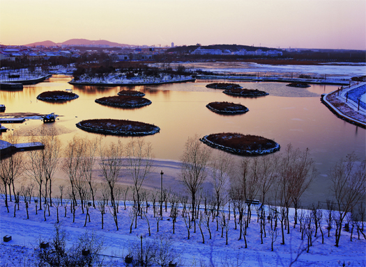
[Image: artifical islets from Turenscape’s Qinhuangdao Beach project.]

switches and access points


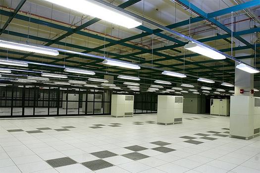
[Inside Terremark’s “NCR NAP” facility in Northern Virginia, a key data center; photographed by flickr user nlaudermilch.]

Alexis Madrigal points out an article in the New York Times this morning which starts to uncover some of the specifics of how the Egyptian government unplugged the internet.  Quoting from that article:

Because the Internet’s legendary robustness and ability to route around blockages are part of its basic design, even the world’s most renowned network and telecommunications engineers have been perplexed that the Mubarak government succeeded in pulling the maneuver off.

But now, as Egyptian engineers begin to assess fragmentary evidence and their own knowledge of the Egyptian Internet’s construction, they are beginning to understand what, in effect, hit them. Interviews with many of those engineers, as well as an examination of data collected around the world during the blackout, indicate that the government exploited a devastating combination of vulnerabilities in the national infrastructure.

For all the Internet’s vaunted connectivity, the Egyptian government commanded powerful instruments of control: it owns the pipelines that carry information across the country and out into the world.

As we’ve been continually interested at mammoth in how the digital ephemera of the internet is materially instantiated — both in the infrastructures that it depends on and the global landscapes that it produces — this is a fascinating story, though it is obviously also a sinister story.

Relatedly, if we hadn’t been at the tail end of our winter hiatus when it first ran, I would have definitely linked to Andrew Blum’s brief article from the morning after Egypt turned off the internet, also at the Atlantic Technology channel, in which Blum rightly notes that the efficacy of the Egyptian government’s actions should make us more aware of the importance of who controls the physical infrastructure of the internet.  (Of course, Blum would say that! — he’s writing a book on that infrastructure.)

markets, constituencies, and infrastructure

I’ve been reading the blog Market Urbanism quite a lot recently. Writing recently about “the problem with “public” transportation” (and after noting the frequent use of ‘public transit’ where the broader ‘mass transit’ would be more appropriate), they argue:

…although the [New York] Subway was heavily subsidized by the government, the truth is that it was a very expensive and ineffective replacement for elevated trains, which are just as fast as subways, and far cheaper to build. The els were quite profitable and transit companies were eager to build them, but the NIMBY interests didn’t like the noise they made and the city resented the limited role that it had in the lines. In fact, it was the city holding out for a subway and the massive spending binge it took to finally build it that contributed to mass transit’s insolvency – a trend which continues unabated today. If the city hadn’t insisted on the unsustainable luxury of forcing all rapid transit underground (a theme I hope to explore more deeply in the future), then Second Avenue, and a whole bunch of other streets, would have gotten rapid transit a century ago. (And I won’t even get into the fact that much of the NYC “Subway” is actually repurposed old private elevated lines.)

There is a lot to agree with in that graf, but the conclusion of the post, which is literally “public transportation sucks”, lacks nuance (hah) — as does the implied conclusion that private development will always lead to a better solution than public. For example, it would be interesting to see property values plotted along aboveground and underground train lines in NYC and Chicago. It’s easy to call underground mass transit an unsustainable luxury, but would that assessment be altered by an offset resulting from increased property tax income derived from higher property values along underground lines? More generally, I’m not convinced that the formulation ‘cheaper and easier equals more attractive to private companies equals better solution’ is universally true, though this will probably be the case in many scenarios, due to the high opportunity cost of not building additional lines paid when cities choose to focus limited funds on less noxious but more expensive underground lines. In an excellent later post, Market Urbanism makes a case that the opportunity cost of not embracing private elevated lines was actually tremendous for America:

Though everyone loved the subway (well, sort of), burying rapid transit is much more expensive than building it above streets and alleyways, so few cities ever mustered up the funds to build subways. (This cannot be emphasized enough: Elevated lines were(/are?) cheap and profitable enough to be built by relatively apolitical private enterprise, whereas subways were not.) From this lack of els came horrible street crowding and congestion as people piled into overburdened at-grade streetcar lines. From this congestion came height limits, and from these height limits came sprawl, and from sprawl came the automobile and parking lots, and by the Great Depression, development pretty much ended.

The complicated nature of this set of cost/benefit trade-offs between public and private infrastructures is why we’ve argued in the past that, when discussing the creation and operation of infrastructure, using ‘development for constituents’ vs ‘development for markets’ is a better way to frame this debate.  This framing provides a window into some of the key results of the two methodologies, such as (respectively) geographically comprehensive coverage vs redundancy at high-impact nodes, or pricing to increase use vs pricing to increase profitability and financial sustainability. Infrastructural development is always in response to some sort of demand, and the type of demand (or mix of demands) has a significant impact on the nature of that development.

I would love to study the differing characteristics of constituent-driven and market-driven infrastructural development, as I suspect that the resulting infrastructures lead to dramatically different generative effects on the development of urban systems. How do patterns of infrastructural development differ depending on the type of demand which instigated their creation – and how do these effects remain embedded in the city as it develops among its infrastructures?

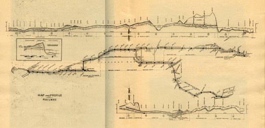
[For more beautiful early maps of NYC transit, like the combination plan / section drawing of the Interborough Rapid Transit lane from 1904 above, visit this incredible online archive: http://www.nycsubway.org/maps/historical.html]

spillway on simcity

At Spillway, Will Wiles writes about a series of contradictory tensions at the heart of SimCity:

“…there’s a sheer atavistic thrill that comes from playing the game fast and loose, with all sorts of destruction and little thought of consequences. Your urgently needed relief road happens to pass straight through a small, comfortable middleclass neighbourhood? Pah, build it anyway. Sure, you could spend the money on a neat little bus system, but isn’t a glistening motorway just a bit more swanky? Similarly, a vast stadium complex is always going to be more appealing to the ambitious mayor in a hurry, even though a well-funded local library network could yield better results for a fraction of the cost. Huge engineering projects will always be more fun to put together, and more impressive onscreen, than microscopic local initiatives. A mayor should be building suspension bridges and airports – leave the rest to Extreme Makeover: Home Edition.”

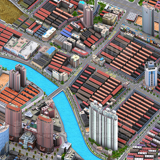
[If you are looking for more evidence that SimCity has permanently altered the way we look at cities, then the above view of Shanghai from Chinese search engine Baidu’s “dimensional map” is probably a pretty good place to start; seen via @doingitwrong.]

“will we all one day be eating away the evidence of government corruption?”

At Domus, Subtopia’s Bryan Finoki relates the troubling story of a secret government cyberwar organization’s efforts to co-opt a current architectural design competition.  Brilliant reportage.

geologic city


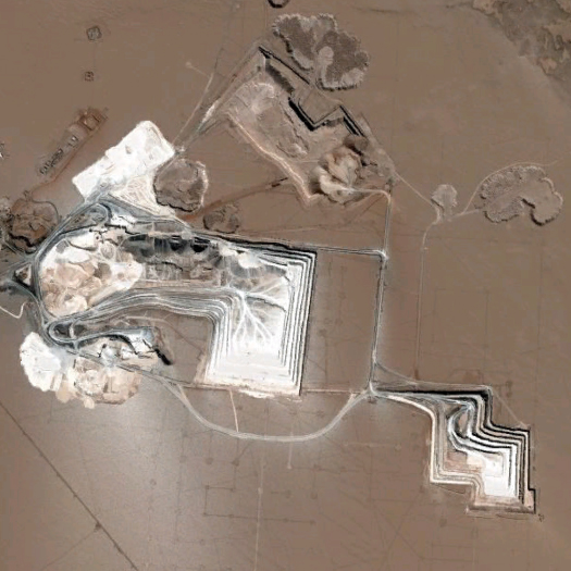
[SPL’s open-pit salt mine in the Tarapacá salt flats, via Google Maps.]

In December, after we began our winter hiatus, Urban Omnibus posted ran a fantastic post by Elizabeth Ellsworth and Jamie Kruse, “Geologic City”, which briefly summarized several of the much longer “Geologic City Field Reports” which have run on the Friends of the Pleistocene‘s blog since last August.  If you haven’t checked out those longer field reports — and you should — you ought to at least read the post at Urban Omnibus, as it traces a few of the many strands of interaction between one city (New York) and the geology that permeates it, such as the Department of Sanitation’s stockpiles of Chilean rock salt:

The salt travels here via International Salt, the City’s supplier, from the Tarapacá Salt Flats in Chile, vast deposits inside ancient sea beds that now lie in the driest desert in the world (50 times drier than Death Valley). Despite having materialized 8-10 million years ago during the Miocene epoch, the tons of solidified geologic time piled beneath the bridge will dissolve away in a matter of weeks as they are spread atop hundreds of miles of wintry city streets. Before washing away with spring rains, this thin coating of ancient salt will first encrust nearly every exterior surface of the city — roads, sidewalks, bikes, cars, and shoes — with traces of deep time.

Friends of the Pleistocene/Smudge Studio have also announced a call for submissions for an “edited collection of brief writings and visual essays”, which they have tentatively titled “Making a Geologic Turn”.  The book will map and explore rising interest in the geologic (their quick list of geologic forces reads: “deep time, slow accumulations and metamorphoses of the world’s materiality, tectonic plate movements, erosion and displacement of landforms, dramatic earth reshaping events, geo-bio interactions“) as a condition of contemporary daily life, particularly as that interest is expressed in art and design.  Abstracts are due on 1 March; you can read the full call at Friends of the Pleistocene.

[Previously on mammoth: the salt mines of Detroit.]

infrastructural opportunism

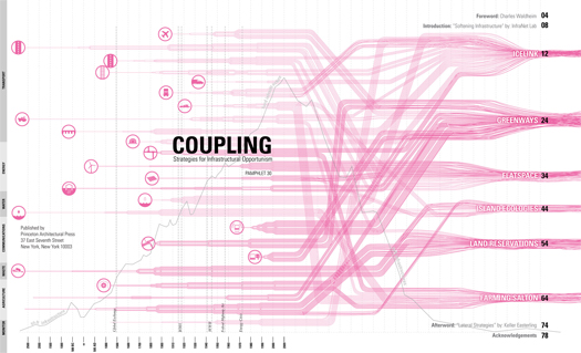
Mammoth will be in New York tomorrow night — January 28th — presenting at the Storefront for Art and Architecture in an event tied to the recent release of Lateral Office/Infranetlab’s Pamphlet Architecture 30:

MANIFESTO SERIES 02
INFRASTRUCTURAL OPPORTUNISM
PAMPHLET ARCHITECTURE 30 +

Storefront for Art and Architecture presents Manifesto Series 02: Infrastructural Opportunism showcasing 100 points [10 speakers] towards a new methodology of action for the 21st century.

While contemporary politics is navigating towards a better understanding of the geopolitical consequences of an increasingly globalized territory through a publicly acknowledged Infrastructural Investment, architects, simultaneously, have shifted their attention from the object to the territory. Coupling: Infrastructural Opportunism , the last issue of Pamphlet Architecture, is a collection of projects, strategies and methodologies that show us how to learn to see our build environment anew and find new opportunities for action. This event will bring together a series of this issue’s contributors and other architects and writers to deliver a series of fresh thoughts towards an Infrastructural Opportunism.

Presented by INFRANET LAB + LATERAL OFFICE

The infrastructural opportunism begins at 7 pm; see the Storefront’s website for more details.  We’d love to meet any readers who can make it.

fourth natures

“Fourth Natures” is an upcoming conference at the University of Waterloo School of Architecture, which sounds like it will be quite interesting:

…landscape theorist John Dixon Hunt elucidate[d] three categories of landscape first defined during the Renaissance: ‘first nature’ being wilderness, ‘second nature’ being the cultivated landscape, and ‘third nature’ being the garden, a combination of nature and culture.

One might argue that over the course of the twentieth century, a ‘fourth nature’ has been evolving which expands both the scale and complexity of our landscapes. From the territorial to the nano-scale, mutant environments which fuse natural and artificial, technologic and infrastructural have been proliferating. Natures are monitored and controlled, ecologies are amplified or manufactured and interior landscapes are conditioned, with the intent of augmenting performance and responsiveness, controlling the flow of resources, monitoring data or redressing environmental imbalances. In the current scenario, the dialectic is no longer nature versus city, or natural versus artificial, but positions within a spectrum of mediation and manipulation of nature, landscape and built environment.

The built and natural environments are increasingly defined by the infrastructures that sustain or monitor them, and more often than not these systems are seen as being ‘unnatural’ and imposed upon the built landscapes. Yet, it can be argued, that it is necessary to view augmenting our environment as a merging of artificial efficiency and natural logic. With that, there has been a rise in architects, landscape architects, urbanists and ecologists offering infrastructures as catalysts for organizing and defining the constructed environments, proposing scenarios in which the boundaries of built and unbuilt, mediated and natural are growing ever more complex and ambiguous.

A solid and diverse list of speakers includes Sean Lally (WEATHERS) on “The Air on Other Planets”, Janette Kim (Urban Landscape Lab/All of the Above), Ila Berman on “Synthetic Natures and Living Machines”, Martin Felsen (Urban Lab) on “Growing Water”, Liat Margolis, Lola Sheppard (Lateral Office/Infranet Lab), and more.

The conference, which is on February 4th and 5th, is free and open to the public.

winter hiatus (polar night)

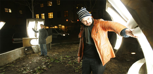
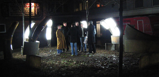
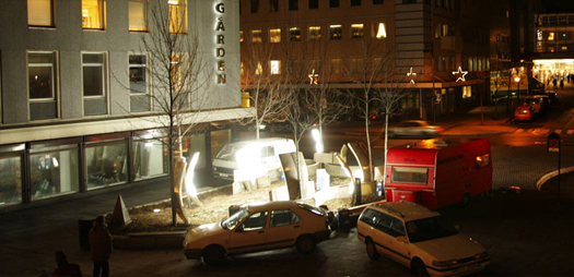
[Fantastic Norway‘s 2005 installation “Polar Night”, built in the Arctic town of Bodø.  A total of 40 daylight lamps — bulbs of the sort which are designed to simulate natural sunlight and used in therapy — were attached to fiberglass panels, lighting a public square during the polar night, and producing an event which attracted citizens into public spaces which are usually abandoned during the lengthy darkness of the polar night.]

[Fantastic Norway’s signature caravan is visible in the bottom right corner of the final image; for years, architecture school dropouts Håkon Matre Aasarød and Erlend Blakstad Haffner traveled Norway in their caravan, moving from town to town reading the power structures of municipalities, meeting with both key individuals they identified as well as interested members of the public, writing local newspaper columns to describe their intentions and utility to the community, and developing clients willing to finance their projects.  Though their practice has evolved away from its early itinerant character, their combination of public interface and the curation of clients remains, in the very best sense, unsolicited architecture.]

watch patiently, with sound

winter hiatus (basilica snowbirth)

I hope everyone has watched the video of the Metrodome collapse.

The moment when the fabric tears and a inverted volcano of snow pours onto the field is incredible, like a roof giving birth.  (I tried to capture a still, but the wonder is all in the fluid motion.)

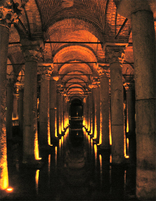
Parametrics should be the study of how to make more incredible roof collapse videos through incredibly complicated fabric roof designs. Imagine a series of collapses carefully cascading through some cavernous structure — a textile-roofed Boeing Everett Factory cross-bred with the Istanbul Basilica Cistern — with the whole roof having been structurally timed to produce this singular and ephemeral moment of destructive choreography.

The roof re-imagined as time-delayed fireworks by way of harnessed snowloads.

winter hiatus


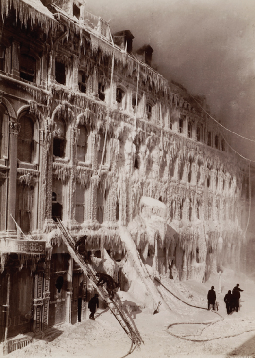
[Photograph by William Notman & Son, photographers, of a building encased in ice after a fire, 65–83 Little St. James Street, Montréal, Québec, 1888.  From the collection of the Canadian Centre for Architecture in Montréal, via Sense of the City.]

We’re taking the remainder of the dimly-lit month of December to rest, eat, read, and think; we’ll be back sometime in the new year — most likely January, perhaps the beginning of February.  (I’m not saying we won’t post anything until then; I am saying that you shouldn’t expect it.)

glass house conversations

This week’s Glass House Conversation may be of particular interest to mammoth readers.  Deborah Marton, of the Design Trust for Public Space, asks:

Everyone agrees that public space is important, but why? We know that quality public space is the bellwether of a healthy society. Strong communities supported by well-conceived public spaces are better positioned to defend against a range of social ills including physical deterioration of the environment and crime, particularly in times of economic hardship. The best public spaces foster a sense of civic optimism that is critical to building the social cohesion necessary for a vibrant culture and democracy. Obviously public space should be beautiful and well designed for circulation, but what else should it do?

How can public spaces be designed to help individuals become more active participants – socially, economically, intellectually, physically – in the life of their communities?

You can join the conversation here.  If we weren’t so buried in work this week, we would be.

(If you’re not familiar with Glass House Conversations, the basic idea is that each week, a guest “host” is invited to contribute a question, which registered commentators — anyone can register — then discuss for the remainder of the week.  Recent hosts include Geoff Manaugh, Alissa Walker, and Alexandra Lange.  There’s something a bit odd about the format — is a cleanly-designed and time-limited bulletin board the internet mode most conducive to thoughtful discussion? — but the content can be quite good at times.  And it’s certainly more accessible and democratic than the original “invitational dialogues” that inspired it.)