mammoth // building nothing out of something

withdrawal and rise


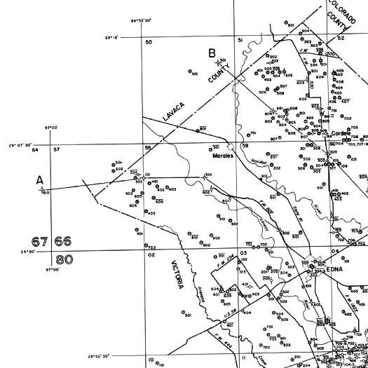
[Detail from a map of groundwater wells in Jackson County, Texas, drawn by the U.S.G.S. in cooperation with the Texas Water Development Board and Jackson County; satellite studies of groundwater levels — which use small changes in the Earth’s gravitational field to detect fluctuations in groundwater reserves — have indicated extreme depletion in Texas as a result of that state’s current drought.]

The Guardian reports on new research that quantifies the contribution of aquifer depletion (primarily through the artificial conveyance of water to the surface via deep wells) to sea level rise — “five times bigger in scale than the melting of the planet’s two great ice caps, in Greenland and Antarctica”:

“Trillions of tonnes of water have been pumped up from deep underground reservoirs in every part of the world and then channelled into fields and pipes to keep communities fed and watered. The water then flows into the oceans, but far more quickly than the ancient aquifers are replenished by rains. The global tide would be rising even more quickly but for the fact that man-made reservoirs have, until now, held back the flow by storing huge amounts of water on land.

The new research was led by Yadu Pokhrel, at the University of Tokyo, and published in Nature Geoscience. “Our study is based on a state-of-the-art model which we have extensively validated in our previous works,” he said. “It suggests groundwater is a major contributor to the observed sea level rise.” The team’s results also neatly fill a gap scientists had identified between the rise in sea level observed by tide gauges and the contribution calculated to come from melting ice.

The drawing of water from deep wells has caused the sea to rise by an average of a millimetre every year since 1961, the researchers concluded. The storing of freshwater in reservoirs has offset about 40% of that, but the scientists warn that this effect is diminishing.”

It is worth noting, as one of the scientists consulted by the Guardian does, that where many of the defining trends of the Anthropocene are accelerating (so commonly that one might be tempted to say that acceleration is the defining characteristic of the Anthropocene itself), the contribution of groundwater withdrawal to sea level rise appears to have held steady over the past fifty years or so, suggesting that the relative contribution of groundwater withdrawal will decline as other contributors accelerate.  Despite that, the picture the study and article paint remains utterly fascinating to me: a world where the aggregate suction of a global economy’s worth of groundwater wells is contributing meaningfully to a massive phenomenon like sea level rise.

[Link via Anson Mackay and Erle Ellis on twitter; risings seas and gravitational flux on mammoth, previously: “the ambiguity of seamelt and landrise”.]

shiptracks


[Ship tracks — “narrow clouds… form[ed] when water vapor condenses around tiny particles of pollution that ships either emit directly as exhaust or that form as a result of gases within the exhaust” — in the Pacific Ocean off the coast of California, captured photographically by a NASA satellite; the atmospheric trace of the seaborne transfer of goods and materials between East and West.]

comments

In an attempt to stem the flow of comment spam, we’ve adjusted the comment policy to increase the scenarios under which comments are held for moderation and we’ve turned off comments on old posts.  If you’d like to contact us about an older post or you’ve posted a comment and it seems to be stuck in moderation, we’re always available by email.

voices going viral


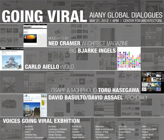
[mammoth is among the blogs included in the “Voices Going Viral” exhibition accompanying “Going Viral”, an event tonight at the New York Center for Architecture:

Going Viral explores the impact that social media, technology and device culture are having on ourdesign process, and ultimately the way we practice. How do we shape a global conversation? How are we changing the relationships between academia and the profession? What is the impact of hyper-information sharing and critique? Throughout the evening, the topics of communication, research, collaboration, and data distribution will be addressed and debated. Bjarke Ingels of BIG, Toru Hasegawa of Morpholio and Columbia University, Carlo Aiello of eVolo, and David Basulto with David Assael of ArchDaily will come together for a lecture and panel discussion moderated by Ned Cramer, editor-in-chief of Architect.

Further details can be found at the AIANY Global Dialogues website.]

“brute force architecture”

We highly recommend checking out Bryan Boyer’s latest post, “Brute Force Architecture and its Discontents”, which is a fascinating take on OMA and its uinque impact on the operational models of other architecture firms around the globe:

OMA is famous for two things: its astounding output, and the extent to which its operations chew through the majority of the human capital that walks through its doors. As an office that had already made a name for itself and was lucky to enjoy a steady flow of applications from aspiring young interns, OMA could organize around a workflow that depended on the maximum variety and quantity of design explorations before electing one to carry forward. Like Turing 60 years prior, OMA’s operations are based on brute forcing through the search space. Whereas Turing relied on something that would later come to be known as computing power, OMA relies on employees who willfully work long hours to be part of the magical machine.

This maximum variety is the direct output of the bloodshot eyes and over-caffeinated bodies of the legion workforce pushing themselves to create just a few more iterations before calling it quits…

The sum of this way of working is one where the search space of ideas is exhausted seconds before the individuals doing the searching. If so, success has been achieved. If not, the office collapses under its own entropy. So far OMA has been able to keep the lights on, but at significant cost. Particularly to the lower ranks who put the “brute” in “brute force”.

OMA has been singled out because their contribution has been so definitive to the last couple generations of professional practice. Although the offices of Renzo Piano, Zaha Hadid, and others are on similar or perhaps even higher levels of success in terms of productive output, none have had as large an impact on the practice of architecture as OMA.

The pervasiveness of OMA’s habits in other offices are so extreme that one is tempted to ask whether this way of working is a logical outcome of globalized practice, but the dearth of competing operational models hints that perhaps this is not the case. At a moment when formal, tectonic, and material diversity are at the extreme, we as a community of architects lack a healthy discussion of operational models. OMA’s model trundled into a second generation with firms such as MVRDVBIG, and REX but who else has proposed a coherent idea about how to operate an architecture firm?

Part of what makes the piece so excellent is that, like much of Boyer’s writing, it refuses to needlessly distinguish between design and business operations within the architecture firm, preferring instead to treat all (or at least most) operations as components of a whole with both architectural and economic ramifications. As Boyer says, the piece is “a mythology of the habits of organization, production, and decision making that one office has pursued”, which demonstrates in fascinating fashion how Koohhaas’s theoretical work provided the framework for a configuration of roles and responsibilities among project team members that had key differences from the standard atelier design studio model. This altered the process for initiating, iterating, and editing design options, as things like specific prototyping methodologies (think blue foam) and work attitudes (think bleary-eyed interns) aggregated into the OMA methodology.

Thus Boyer shows how, at OMA, theory, design methodology, and business practice interact as a unified whole, in which theory determines the possibility space for design and design methodology determines the possibility space for business practices and business practices determine the possibility space for design (and so on, in repetitive feedback), instead of (falsely) bifurcating business decisions from design decisions. This integration, of course, is in fact present in every firm, but the cliche understanding of the atelier studio model, which characterizes business decisions as a distraction from the real work of the architect, obfuscates that integration. The implication of Boyer’s argument is that the operations of a firm (any firm) can and should themselves be designed, and in fact are — whether consciously or unconsciously.

[Coincidentally (or not), you can catch Bryan in conversation with Rory Hyde, Martti Kalliala, and Jenna Sutela at Studio-X NYC this Friday at 1 pm, talking about alternative design practices; details here.]

dredge research collaborative: live interview @ studio-x


[The Dredge Research Collaborative — Stephen, Tim Maly, and myself, with fourth member Brett Milligan present in spirit but not body — in live conversation back in January at Studio-X NYC about the dredge cycle, artificial islands, geotubes, sensate geotextiles coating aqueous terrain, the scale of human influence over sediment, the New York Bight’s “Mud Dump Site”, other landscapes of dredge, and the potential involvement of the design disciplines in the territories affected by anthropogenic sediment handling practices. As we mentioned then, we’re planning to be back in New York, again with Studio-X, for a longer event this fall, where we’ll talk to organizations operating on and designers designing for the landscapes of dredge, as well as getting out into and exploring those landscapes (by boat!). Further details will be forthcoming.]

“google/arctic/mars” at studio-x nyc

If I were in New York City tomorrow night, I’d be at Studio-X for what sounds like a really great evening: first, a live interview with Michael Gerrard on “drowning nations” and climate change law, and, second, a roundtable on “sovereignty, governance, and the nation-state itself in a range of geographic and spatial scenarios, from the Arctic to the Internet”. Quoting the event announcement on that roundtable:

Joining us will be architect Ed Keller; Benjamin Bratton, from the aforementioned Center for Design and Geopolitics; Tom Cohen, co-editor with Claire Colebrook of the Critical Climate Change series from Open Humanities Press; novelist Peter Watts; architect and urbanist Adrian Lahoud, author of Post-Traumatic Urbanism; and Dylan Trigg, author of, among other things, The Aesthetics of Decay.

This moderated round-table discussion will also explore a joint research project underway this spring for which Ed Keller, Benjamin Bratton, and Geoff Manaugh have been looking at what they call Google/Arctic/Mars, analyzing the emergence of a new geography—from the virtual to the off-world—and speculating as to its future political organization.

It sounds like things get started around 6 pm; full details at the Studio-X facebook page (or at BLDGBLOG). (Word is that there may even be a live stream; if there is, I would imagine you could find a link at that page.)

glitch jam


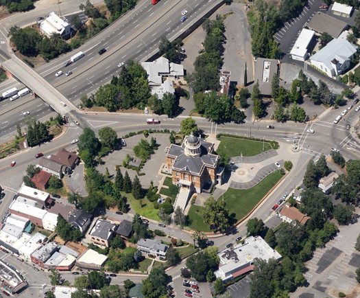
[The Placer County Courthouse, in Auburn, California — imagine it swarmed by a glitch jam.]

NPR reported this morning on a traffic jam in California caused by an algorithmic glitch “accidentally summon[ing] 1,200 people to jury duty on the same morning”. An excellent reminder of the tendency of algorithmic dysfunction to manifest as physical dysfunction, and (at a relatively small scale) of the potentially disproportionate impact of glitches when they are translated from dataspace into an infrastructural system. The glitch may be as simple as having accidentally swapped the 0 indicating “do not come in” for the 1 indicating “come in”, but the resulting jam is rendered in aluminum autobodies and on asphalt corridors where it is much more difficult to clear than it was to create.

empire negative


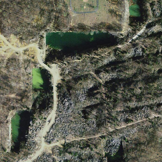
[The negative image of the Empire State Building, carved out of oolithic Indiana limestone, and aged into an enormous swimming pool; via Atlas Obscura, which writes:

[Indiana limestone] was in such demand that a massive industry cropped up around it, and hundreds of thousands of tons of mammoth stone slabs were carved out of the ground and shipped around the country. A shocking number of iconic American structures are made out of Indiana limestone, including the Empire State Building, the Washington National Cathedral, the Pentagon, and 35 of the 50 current state capitol buildings.

Unfortunately, in the second half of the 20th century, stone masonry fell out of favor as preferences shifted to glass-and-metal skyscrapers that were cheaper to build and maintain. This dissolution of the limestone industry left many southern Indiana towns impoverished, as they are to this day. Their plight was fictionalized in the 1979 Dennis Quaid film “Breaking Away.” Now all that remains of many of the limestone quarries are massive, eery rectangles etched out of the earth and speckling the otherwise pastoral countryside.

The most famous of these quarries is the Empire Quarry, which provided the 18,630 tons of stone needed to construct the Empire State Building. The quarry is so long and so deep, one can imagine the entire Empire State Building lying within it, refilling the 207,000 cubic feet of empty space now left vacant.

Read the full entry at Atlas Obscura.]

minus extraction


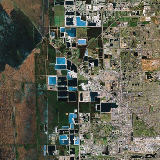
[Miami’s Lake Belt, the zone in which the city of Miami becomes a mirror image of itself — reflected in blue polygons induced by the mining of the limestone rock literally used to construct the city — before it disintegrates into the Everglades.]

I’ve gotten part way through listening to the portions of last weekend’s Landscape Infrastructures symposium that have been posted online, and was particularly struck by comments that Charles Waldheim made in the closing roundtable:

“I was struck by Neil Brenner moderating the second panel [as he] brought it to a close by saying something to the effect of “the idea, the model, that somehow our action around urbanism should concentrate in the cities, is an outdated notion”.

That struck me as correct, and, at the same moment, if that’s true, it has enormous implications for those of us in [the GSD] and in these disciplines. If in fact we should focus on urbanism and urbanization and its infrastructure, not necessarily focused on the city and an opposition between the city and the externality of biological process, it strikes me that there’s an equally profound paradigm shift potentially for us in landscape architecture. I think, you know, for the better part of the last half-century, in our field, we’ve been operating under a paradigm in which nature exists outside of human agency, the kind of classical if not modernist defintion of ecology, in which urbanization was the problem. And having said that, what I’ve heard over the course of the last twenty-four hours, is that we need to fundamentally re-think that paradigm. [In terms of] the practices that we engage in, the models and habits of thought, the tools, the representational tools that we have available, to be able to think through our commitments, both to social and cultural production, but equally to environment and ecology, absent the idea of our extraction from those natural systems.”

This seems a profoundly important point for landscape architecture, in particular: that urban and natural systems are inextricable, not opposed. Indeed, that they have always been, though the scale of that intertwinment is rapidly accelerating. (If that inextricability seems obvious, it is also important to recognize that an understanding in which natural and urban systems are not just in conflict but fundamentally exclusive has been, as Waldheim notes, the primary paradigm within environmental land planning for at least a half-century.)

One consequence of this is that density and urbanism should not be conflated as if they were always one and the same thing. Density, rather than being the primary characteristic that determines whether a place counts as urban or not (a definition which produces endless pointless arguments about exactly how dense a place must be to be urban), is merely one of the important effects of processes of urbanization. It is a peculiarly important effect in any number of ways — economically, ecologically, phenomenologically —  but it should not be mistaken for an essential characteristic of urban terrain.

This is supported (as we’ve noted before, after Christopher Grey) by the definition that Ildefons Cerdà provided for urbanism when he coined the term: “the science of human settlements at various scales and times, including countryside networks”. It’s not terribly far from “countryside networks” to “landscape infrastructures”, is it?

Another really interesting thing, related to both Waldheim’s point and the de-conflation of density and urbanism, is what this indicates about where opportunity lies for landscape architecture as a discipline. While much progress has been made by firms like MVVA and Field Operations in finding roles (leading roles, even) for landscape architects on projects within the envelope of density, it seems to me that the more stretched the scale of an urban network becomes, the more it becomes uniquely suited to design by landscape architects. Put concretely, there are vastly more square miles of land in, say, the artificial watershed of Los Angeles than there is spare open land in Boston’s city limits; and what other design discipline is used to working with so much land? An expanded definition of urbanism quite literally has more room for landscape architecture.

unknown unknowns

0. Everyone’s favorite Donald Rumsfeld quotation: “[T]here are known knowns; there are things we know we know. We also know there are known unknowns; that is to say we know there are some things we do not know. But there are also unknown unknowns – there are things we do not know we don’t know.” (As evidence that this is everyone’s favorite Donald Rumsfeld quotation, I submit that (a) it has its own Wikipedia page, the wonderfully-titled “There are known knowns”, where debate over its profundity or lack of profundity is documented, and (b) that Rumsfeld himself titled his autobiography Known and Unknown.)

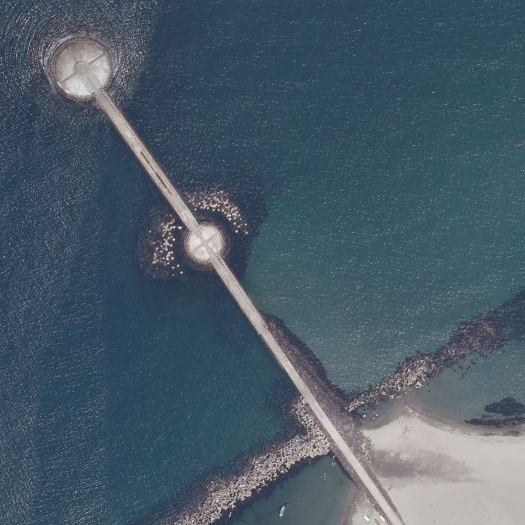
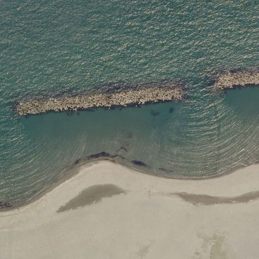
Tetrapods deployed off the Japanese coast near Toyama (top) and Niigata (bottom). An old article in the New York Times reports:

“‘The [Japanese] construction state is in some respects akin to the military-industrial complex in cold-war America (or the Soviet Union), sucking in the country’s wealth, consuming it inefficiently, growing like a cancer and bequeathing both fiscal crisis and environmental devastation,” Gavan McCormack, a professor of Japanese history at Australia National University, wrote…

In the [1990s], public works spending has been stepped up even more to stimulate a languid economy…

…Japan uses as much cement each year as the United States, despite having only half the population and only 4 percent of the land area.”

The tetrapod — a concrete coastal armament used to solidify coastlines and arrest erosion — is symbolic of this metastasized public works state, as there is little constituency opposing their placement and thus tetrapodding typically proceeds more quickly than other projects, so that roughly half of the Japanese coastline has been so armored.

1. GAMES
Last December, I had the pleasure of sitting on the jury for the final reviews of Jorg Sieweke’s landscape studio at UVa, which was exploring various design scenarios for a hypothetical shift of the Mississippi River from its current course to the course it “naturally” desires to take through the Atchafalaya Basin. (This was particularly enjoyable given that I’d accidentally spent the summer blogging about flooding in general and flooding on the Mississippi River in particular.)

[0] I think this set of problems is occurring concurrently in the broader/parallel world of architectural design, so, throughout this post, I’ll shift between talking about architectural design and talking about landscape design, without being particularly clear about boundaries between those two things. Of course, that’s what we usually do here.

One of the student projects proposed a kind of abstracted board game which attempted to codify the interactions between the insurance industry, various economic activities in the Atachafalaya Basin (such as gambling), floods, disaster management systems, public space, and citizens of the flood-prone Basin. This project intrigued me greatly — but it did so less because of its resonance with the recent vogue for “gamification” (where I am inclined to agree, for the most part, with Ian Bogost), and more because it helped me articulate a set of problems related to aggregation, complexity, perversity, and misalignment in the design of landscapes0.

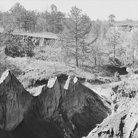
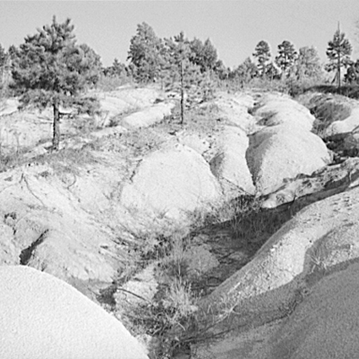
The soils of the Southeastern Piedmont — from Alabama to Virginia — suffered terrible erosion as a result of short-sighted agricultural practices in the 18th, 19th, and early 20th centuries. The prevailing agricultural economic systems of that region during those times — slavery and share-cropping — both encouraged short-sighted practices, as the men and women working farms and fields did not own the land, and so had little incentive to care for its long-term health, even as farming techniques that would have arrested or prevented erosion were well-known.

David Montgomery’s fascinating Dirt: The Erosion of Civilizations recounts the travels of the British geologist Charles Lyell through the antebellum South:

“[Lyell] stopped to investigate deep gullies gouged into the recently cleared fields of Alabama and Georgia. Primarily interested in gullies as a way to peer down into the deeply weathered rocks beneath the soil, Lyell noted the rapidity with which the overlying soil eroded after forest clearing. Across the region, the consistent lack of evidence for prior episodes of gully formation implied a fundamental change in the landscape. “I infer, from the rapidity of the denudation caused here by running water after the clearing or removal of wood, that this country has always been covered with a dense forest, from the remote time when it first emerged from the sea.” Lyell saw that clearing the rolling hills for agriculture had altered an age-old balance. The land was literally falling apart.

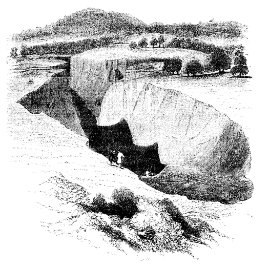
One gully in particular attracted Lyell’s attention. Three and a half miles west of Milledgeville on the road to Macon, it began forming in the 1820s, when forest clearing exposed the ground to direct assault by the elements. Monstrous three-foot-deep cracks opened up in the clay-rich soil during the summer. The cracks gathered rainwater and concentrated erosive runoff, incising a deep canyon. By Lyell’s visit in 1846, the gully had grown into a chasm more than fifty feet deep, almost two hundred feet wide, and three hundred yards long. Similar gullies up to eighty feet deep had consumed recently cleared fields in Alabama. Lyell considered the rash of gullies a serious threat to southern agriculture. The soil was washing away much faster than it could possibly be produced.”

The top image is soil erosion in Mississippi (not, of course, in the Atlantic Piedmont — but sharing the same economic systems), photographed by Evans Walker in 1936 and via the Library of Congress; the bottom image is soil erosion on a farm in Caswell County, North Carolina, photographed by Marion Post Walcott in 1940 and also via the Library of Congress. The image at the top of this post is, of course, Charles Lyell’s illustration of the gully described above, reproduced in Dirt.
2. CRASHES
A series of talks that I’ve listened to in the past year also helped frame these problems for me. The first is an interview on Terragrams with Case Brown, currently of P-REX; the second, Kazys Varnelis’s “A Manifesto for Looseness”; and the third, Kevin Slavin’s “Those algorithms that govern our lives” (or, the somewhat shorter TED version, “How algorithms shape our world”). To explain how they’re relevant to the set of problems within landscape design I’m after, I think it’s best to take them in reverse order.

[1] The last time I mentioned Slavin’s talk, it was with an interest in both of these effects, or maybe the point at which these two effects intersect, as I described my interest in the physical geography of global financialization.

The central thesis of Slavin’s talk is roughly that programmed algorithms — embedded in and running financial systems faster than humans can react, controlling Roombas, determining price points on Amazon — are participating in the construction of a world that is increasingly designed to suit them and encoded with their logic. This has a pair of weird effects: first, algorithms begin to manifest physically (James Gaddy, describing Slavin’s talk, writes “he describes a fiber optic canal that was dug between New York and Chicago to deliver stock market information microseconds faster, and the way buildings are being carved out from the inside to house trading servers”) and second — and of more interest to me here — algorithmic systems have the tendency to exhibit suddenly bizarre behaviour, like an algorithm on Amazon.com pricing an unremarkable used book at $23 million1. Algorithmic systems are thus prone to the kind of sudden and unpredictable bifurcations that Manuel DeLanda describes in the introduction to A Thousand Years of Nonlinear History, switching with little apparent warning from a seemingly stable state to something considerably more extreme or erratic:

“Ilya Prigogine revolutionized thermodynamics in the 19060s by showing that the classical results were valid only for closed systems, where the overall quantities of energy are always conserved. If one allows an intense flow of energy in and out of a system (that is, if one pushes it far from equilibrium), the number and type of possible historical outcomes greatly increases. Instead of a unique and simple form of stability, we now have multiple coexisting forms of varying complexity (stable, periodic, and chaotic attractors). Moreover, when a system switches from one stable state to another (at a critical point called a bifurcation), minor fluctuations may play a crucial role in deciding the outcome.”

We might say that algorithmic systems, because of they follow programmed rules strictly, are prone to rapidly becoming far from equilibrium.

Kazys Varnelis’s “A Manifesto for Looseness”, meanwhile, addresses the way that complex systems are, despite — or maybe really because of — their sophistication, vulnerable to crashes. Talking about the research of sociologist Charles Perrow, Varnelis says:

“…creating tightly coupled systems, very complex, finely tuned, highly efficient systems, in which one part’s operation is closely dependent on another’s, and when we add all these together, we can achieve remarkable levels of efficiency. The result is that these systems, because they are so integrated, can fail in unpredicatable ways. One part fails — a sensor — this has a cascading effect on another part, which exceeds its tolerances. This makes another part fail; and so on, and so on. This leads to anomalous readings on a number of sensors. Operators can’t figure out what’s going on; personnel become overwhelmed. They don’t understand what’s happened; they make the wrong decisions. Things get worse. Nobody knows what to do… Three Mile Island, Chernobyl, Fukushima, the Challenger disaster, the Columbia disaster… Don’t blame the operator — blame the complexity designed into the system itself.”

The algorithmic systems that Slavin describes are, obviously, a subset of complex systems generally and, insofar as they occasionally have something like an operator (though an important part of Slavin’s thesis is the argument that algorithms are increasingly defined by our general inability to comprehend or ‘read’ the ones that shape our world), the operator clearly cannot be faulted for failing to react with algorithmic speed to the actions of the algorithmic system. The kind of cascading failure that Varnelis describes by way of Perrow is, it seems to me, a perfect example of what a rapid bifurcation where “minor fluctuations… play a crucial role in deciding the outcome” looks like, played out in real time. And that minorness — the smallness of the critical fluctuations within the overall scale of the system — is precisely what makes them difficult for the operator to predict, anticipate, or even observe. (Replace “operator” with “designer” in that last sentence, and you’ll have a hint of where I am going with this.)

Third, I mentioned Case Brown’s interview on Terragrams: Brown is principal researcher for P-REX and, most relevantly here, recent recipient of the Rome Prize in landscape architecture, where he studied the Roman villa system, “the ancient… agricultural complex that spread the empire, fed the armies and grew the surpluses to make senators rich” as an early example of a real estate bubble:

“The rise and crash of the Roman villa system reads eerily like the modern story of American foreclosures — profit schemes of land speculation, securitized and excessively mortgaged properties, rapid expansion and even more rapid decline.  … As a system, they provide a marvelous example of combining a food economy infrastructure and an elite leisure system, all the while staking claim to an enormous empire. How did this economy operate and did the Romans overextend their land ventures as many have in the modern United States?” Brown asks.

He said it is the nature of these markets to bloat beyond their own means, and the tendency continues today with such examples as oversized American vacation homes, elaborate golf course communities in China or ambitious skyscrapers in Dubai.

“We tend to overextend markets with gluttonous consistency. All these forms of extra-urban development, ancient and modern, draw on a common set of market-exploitation tendencies. Fertile land, urban respite and profit have provided the skeleton for centuries of speculation. To be able to document the birth of this trifecta could reformat our current landscape speculative practices,” Brown said.

Here, in a speculative system, the collapse is perhaps a bit more predictable than within the algorithmic or complex system — with every bubble, there are those who recognize the bubble before it collapses — but the result is the same: a disastrous and typically sudden crash. In all three kinds of systems, I think, crashes can be said to originate with the actions of individually rational parts acting, in aggregate, in accordance with perversely misaligned incentives. The algorithm, for instance, is based on a model of the “real” world (“real” being in quotation marks because the algorithm is, of course, as real as anything else), and when that model is even just slightly misaligned with the world it models, the aggregate nature of algorithms — algorithms always flock — produces outcomes that are rapidly perverse: $23 million used books, “flash crashes”.

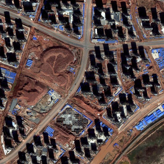
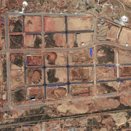
An empty street grid (top) and unfinished residential towers (bottom) in Ordos, the coal boomtown in Inner Mongolia made famous by a 2009 Al Jazeera report describing it as “China’s empty city”, its growth propelled by a heady mixture of new wealth generated by the coal boom, local state policies responsible for planning and providing infrastructure for a huge new city in the desert, and national state policies that opened up real estate speculation as one of the few investments available to private individuals; images via google maps.
3. DISTRIBUTION, AGGREGATION, AND DISAGGREGATION
Returning to the studio I reviewed at UVa: there were several other projects, in addition to the one explicitly referencing game design, that struck me as broadly representative of a trend in architectural design (and particularly landscape architecture) towards proposals that rely on aggregation and distributed components to drive beneficial change. For instance, one proposed distributing the functions of rainwater control and freshwater supply to individual units located on each city block and shared by the inhabitants of that block; another set up a system for collecting fecal matter and turning it into productive soil, again on a small scale, and with collection incentivized by small scale economic rewards (“bring your morning shit, get a morning cup of coffee”). Typically, I think, what such proposals have in common is that they design distributed systems that rely on incentive structures to guide individual actors towards making individually rational decisions with collectively beneficial consequences. (In that, these proposals might be understood as something like neoliberal architectural design, with neoliberal intended here to be simply descriptive, neither derogatory nor laudatory.)

These kinds of proposals are increasingly common: witness the proliferation of projects hoping to find some alternate use for vacant lots at a city-wide scale or the vogue (particularly in student work, which I take as an indicator of future disciplinary trends) for “tactics” (the (genuinely excellent) GSD student publication “Tactical Operations in the Informal City” is typical of this vogue: “the students were asked not to develop a master plan for the whole city, but rather to propose one or two interventions that could initiate a chain reaction of improvement”). A reliance on distributed components and aggregated effects is even making in-roads into surprising places, as in the case of the New Urbanism’s enthusiastic embrace of “Tactical Urbanism” (though, if there is anything consistent about the New Urbanism, it is that it has remained enduringly flexible as an ideology, seeking to co-opt and absorb counter-movements, as Duany wrote in a fascinating article for Metropolis last April that I’ve always intended to write at more length about), an embrace which has been well-received in and amplified by the broader urbanist community on the internet (see, for instance, the chord that the Atlantic Cities‘ coverage of a so-called “guerilla wayfinding” project in Raleigh struck).

And mammoth has both often praised projects in this vein — such as Visual Logic’s excellent Backyard Farm Service or, in our “Best Architecture of the Decade”, where we claimed Kiva as an architectural actor — and proposed them ourselves. (For that matter, the projects I’ve referred to from the studio at UVa were — in no small part due to their participation in the project of distributed design — among the stronger projects in that studio.) Rhetoric surrounding the incorporation of resilience as a primary goal into design — rhetoric which we have encouraged — also typically promotes the dissolution of centralized structures into networks of smaller components which will function in aggregate towards some goal. (I also think this interest extends beyond human actors, towards harnessing the aggregate behaviors of variegated non-human actors like tides, clasts, markets, microbesbrick-laying drone helicopters, and alligators.)

[2] I also find it intriguing that both studio work and the practice of architectural design have a certain meta-resonance with games. That is, studio and practice could both be understood as games — structured sets of rules that aim to map reality that nonetheless exhibit disconnects with the reality they map at various points — even if both studio work and practice tend to have more sophisticated rule systems than the vast majority of games, which makes it harder to notice those disconnects. In both cases, it is interesting to note what is included and what is excluded from the game.

So I intend to phrase my concern here within the context of a deep appreciation for the merits of the general project of distributed design which, at its best, offers a more democratic, more organic, and more resilient alternative to heavily centralized, fracture-prone strategies. But I am wondering: when designers set up complex systems reliant upon the alignment of incentives to channel the swarming and flocking behavior of aggregate wholes towards beneficial ends, is there any thought going into the potential of that very same kind of behavior to magnify small mis-alignments into major crises — mis-alignments that may have been so small as to be invisible to the original designer or which (worse) the original designer may have had her own incentives to ignore? What would be the landscape effect equivalent to the weird behavior that happens at the margins of a video game — or a financial crisis? Where does aggregated behavior cascade through glitches into perverse results2? Where do individually rational behaviours become collectively irrational? What are the dangers in assuming that everything goes according to plan?

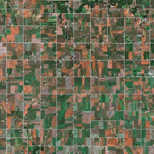
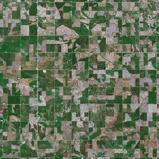
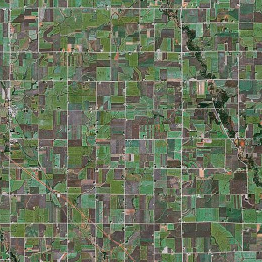
Cropland in Iowa, whose land use is thoroughly dominated by agriculture — roughly ninety percent of the state’s land is in use for agricultural production, and more of that land is cropland than in any other state (well, at least by this source; I’ve also seen indications that it might be Nebraska). While Iowa’s land was originally converted into cropland by settlers attracted by a fertile combination of climate, soils, and topography, the current dominance of that land use can at least partially be attributed to federal subsidies, particularly for corn and soybean production, which tilt market dynamics in favor of farming cash crops. Thus Iowa might be said to be an agricultural freakology (the ecoregion it is in is named not for a defining natural feature — like the “Northern Glaciated Plains” or “Mississippi Valley Loess Plains” — but for the crop that dominates it: “Western Corn Belt Plains“), sustained in part by the perverse misalignment of incentives.
4. SAFEGUARDS
If the misalignment of incentives is an obvious potential problem with design that relies on directing aggregate behavior through incentives, then there is an obvious need for safeguards — for structures within a design proposal that will contain the risk of cascading failures.

Thus I suggest that these projects should anticipate failure, which (ironically? I guess?) indicates that they should be particularly concerned with systemic resilience. That is, they should be designed not to finely-tuned limits of tolerance, but with enough give that they can withstand the accidents, perversions, and even crashes that will inevitably result from the misalignment of incentives in unpredicatable ways. Furthermore, they should explicitly acknowledge the presence of “unknown unknowns”. While it is logically impossible to anticipate specific unknown unknowns, it is quite possible to anticipate misalignment and perversity generally. The tendency, I think, in making these kinds of proposals — and this is very much what Stephen and I did in our proposal for Luanda, for instance — is to construct proposals on the basis of best-case scenarios, considering only first-order failures, where first-order failure is defined as the problems that the project responds to and second-order failure is defined as the problems that are potentially generated by the proposed response. In a way, this suggests that designers need to become better futurists, though that may often mean being a futurist at relatively small temporal and spatial scales.

If architects and landscape architects accept that it is probably impossible to set up perfectly aligned incentive structures, but still want to take advantage of their potential, then we’ll need to have mechanisms in place to protect against misalignments that we know are both unpredictable and inevitable. There’s a lot of talk about what those mechanisms look like in the financial world, for example; what would they look like as a component of the design proposal or design initiative?

[Parts of this post emerged out of conversations with Stephen, Brian Davis, and Brett Milligan; in particular, Brett suggested the example of Iowa as an unnatural ecology produced by misaligned incentives. As noted in one of the footnotes, this is all closely related to my interest in the landscapes of global financialization — which are typically spectacular case-studies in the landscapes thrown off by the misalignment of incentives — and so, if you enjoyed this piece, you might want to also check out Metro International Trade Services.]
expiration dates


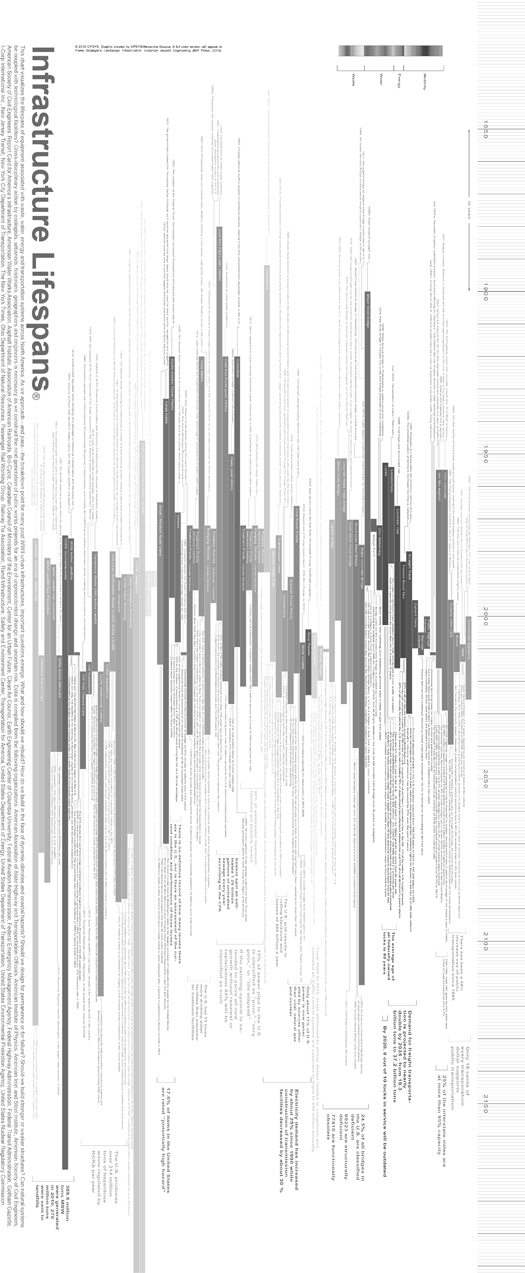
[Chart showing the typical lifespans of a wide variety of infrastructures (and components of infrastructures), from treated wood ties to deep geological repositories for high-level radioactive waste. The descriptive text reads:

“This chart visualizes the lifespans of equipment associated with waste, water, energy, and transportation systems across North America. As we approach — and pass — the breakdown point for many post-WWII urban infrastructures, important questions emerge. What and how should we rebuild? How do we build in the face of dynamic climates and coastal hazards? Should we design for permanence or for failure? Should we build stronger or weaker structures? Can natural systems be coupled with technological facilities? Cross-disciplinary action by ecologists, urbanists, historians, geographers, and engineers is necessary as we construct the next generation of public works projects for an era of unprecedented change and uncertain risk.”

The chart is on the flipside of the poster advertising this weekend’s “Landscape Infrastructure” symposium at Harvard GSD; poster design is by OPSYS/Alexandra Gauzza. For more detail on the symposium, which is this Friday and Saturday in Cambridge, see mammoth’s earlier post. Click here for a larger (and properly-oriented) image.]

stable borders

My wife pointed me to a short but very interesting piece on NPR last night, about the re-surveying of the line between North Carolina and South Carolina:

JULIE ROSE: Way before there was GPS, years even before the Revolutionary War, surveyors on horseback drew the line between the colonies of North and South Carolina. Every mile or so, they made a slash on a tree and took notes – hickory here, chestnut there – standard practice for the time, but not so helpful in 2012.

ALEX RANKIN: We’ve worked the whole length of the survey, and to our knowledge, none of those trees exist 200 and almost 50 years later.

ROSE: Alex Rankin owns the Charlotte area engineering firm hired to help retrace the steps of those original boundary markers. The effort spans 334 miles from the Atlantic to the Appalachians and has cost the states nearly a million dollars. Without those original trees for guidance, Rankin’s team turned to matching up the edges of historic property deeds.

RANKIN: What we’re doing is simply discovering where the state line is. It is where it is.

ROSE: But that’s certainly not how it feels to Karen Byrnes. Just look at the document she signed when she closed on her home and 5 acres in 2006.

KAREN BYRNES: You know, it clearly shows that our home is in York County. And so now, they’re saying that the line has moved and now our house is in Mecklenburg County.

ROSE: York County is South Carolina. Mecklenburg is North Carolina.

BYRNES: We would not have purchased the home if it had been zoned Mecklenburg County or North Carolina.

ROSE: Byrnes prefers South Carolina’s lower taxes and schools for her 9-year-old son. Rather than switch residency, she’s listed her house for sale, even though she worries it will be worth less now that it’s in North Carolina. State officials working to retrace the boundary say about 93 properties appear to have discrepancies, concentrated in the highly developed Charlotte region. Some, like the Byrnes family, suddenly find themselves in a different state, but most are like Natalie Everett.

NATALIE EVERETT: I have a South Carolina neighbor and a North Carolina neighbor.

ROSE: And she just found out the state line splits her house.

What’s so fascinating here is that the act of surveying is actually producing increased uncertainty.

This is because the conflict here isn’t between a set of actors who want the border to remain where it is and a set of actors who want to adjust the border, but between two different understandings of what it would mean for the border to remain in place.  For the people living along the border, the border is (quite reasonably) defined by habit and custom: it is where they’ve always thought and acted like it is, which means that ultimately they understand the border to be constructed by the accumulated opinion of property owners.  For the states, though, the border is a legal entity, defined by the recording of its position in legal documents, and consequently a thing out there in the world, waiting to be excavated and clarified.

And with that in mind, you can see that the sentence I wrote above — “the act of surveying is actually producing increased uncertainty” — is only accurate if you accept the border residents’ point of view (which, again, is quite reasonable); from the states’ point of view, the survey is not producing anything, only revealing an existing conflict between practice and reality, because, for the state, the description of the border in a set of historical property deeds is more real than any other description of the border.

nambe falls dam


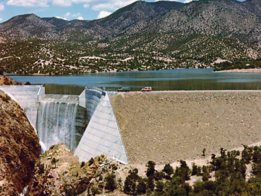
[The strangely geometric edge of Nambe Falls Dam in New Mexico; Nambe Falls Dam is a component of the San Juan-Chama Project, which delivers water from the San Juan River Basin through 26 miles of tunnels under the Continental Divide into the basins of the Rio Grande and Rio Chama, providing drinking water for Albuquerque; image source.]

“the last remaining organic components of a city-wide cybernetic system”

Writing at Fast Company, Tim Maly ties recent interest in autonomous cars and related intersection-managing algorithms back to the guest post he wrote for mammoth during our reading of The Infrastructural City:

What’s interesting about the skepticism towards automated driving is that it reveals how invisible the current systems of automation already are. Traffic control in most cities is already monitored and controlled by wired up intersections laced with a complex network of sensors and lights, designed to cause traffic to flow smoothly around town. In many ways, the fallible fleshy pilots of vehicles are the last remaining organic components of a city-wide cybernetic system.

Read Tim’s whole post at Fast Company.

center pivot pixelation


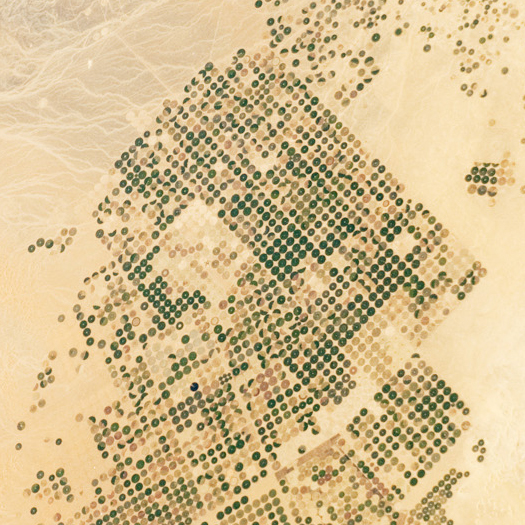
[A particularly stark example of the pixelated patterns produced by pivot irrigation, in northern Saudi Arabia. The patterns produced by irrigation in Saudi Arabia are so stark because what water is available in the Arabian penisula is buried as fossil waters at such great depths that wells may reach as much as three thousand feet below the surface, so that what water (and water-dependent vegetation) is present on land seems to have magically appeared in precise patterns (unlike, say, the great American pivot-fields over the Ogallala Aquifer, where irrigation is merely an overlay onto existing hydrology).

I’m reminded of a Der Spiegel article from a couple years ago, which told the story of a team of German geologists hired by the Saudi king to hunt ancient waters in the desert:

Fossil groundwater is the only natural water source in a region without rivers and lakes, where every raindrop is an event. After the last ice age, when the climate on the Arabian Peninsula was similar, in terms of temperature and precipitation, to that of savanna regions today, the water seeped away into the ground, eventually accumulating in hollow spaces between layers of sedimentary rock.

Most of this water is in eastern Saudi Arabia, precisely where most of the country’s oil and natural gas reserves are located. As a result, geologists searching for oil sometimes find water instead, or vice-versa. And like oil, the precious drops of water from the last ice age are finite. Too much of that water is now being pumped out of ever-deeper wells, causing the water table to drop. This in turn allows salt water to seep into the groundwater along the coasts.

In Wasia, 100 kilometers (63 miles) east of Riyadh, Rausch’s crew is drilling deep exploratory holes. Mario Rescia, managing director of Saudi drilling company Hajjan Drilling, is in charge of the pumping tests. Immigrant workers in yellow overalls and helmets work 12-hour shifts on the 27-meter drilling rig, at temperatures of up to 50 degrees Celsius — in the shade. “We do our best to help them stand it,” says Rescia. “There are refrigerators and drinks.”

And then, at his command, water suddenly starts bubbling out of the desert sand: clear, warm water, an amazing sight in a region that seems lifeless, aside from a few Bedouin and camels. The water is clean enough to drink, although it tastes a little stagnant — which is hardly surprising, given that it’s 25,000 years old.

The whole article is worth a read.

Image from NASA Earth Observatory, via @orangexception.]

density


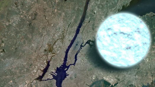
[NASA compares Manhattan to a neutron star. The infographic is a dimensional comparison — if scaled for density instead, Manhattan wouldn’t be visible. From wikipedia: “[the] density [of a neutron star] is approximately equivalent to the mass of the entire human population compressed to the size of a sugar cube”; link via Alex Ogle.]

“landscape infrastructure” at harvard gsd


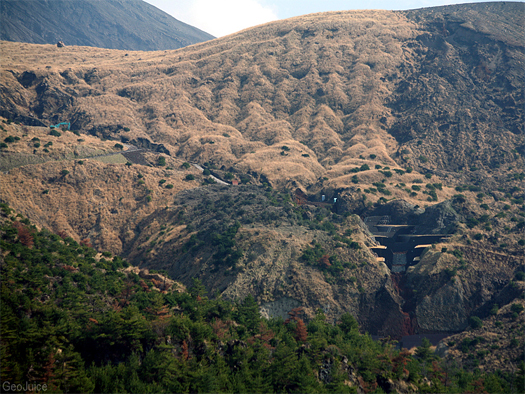
[“Reclamation and slope stabilization on a volcanic ash hillside” in Japan; photograph by flickr user GeoJuice.]

If I weren’t going to be in California March 23rd and 24th, I’m pretty sure I’d be in Boston at the GSD’s “Landscape Infrastructure” symposium, which promises a fascinating range of discussion on “the future of infrastructure and urbanization beyond the dogma of civil engineering and transportation planning”, organized and curated (obviously) by Pierre Bélanger:

“Urban life is sustained by technological infrastructure. Highways, harbours, airports, power lines, landfills and mines largely figure as the dominant effigies of contemporary urbanization. The sheer size of these elements renders their understanding as a single system practically impossible, yet their operations depend precisely on their continuity to support the flow of capital and cultural mobility. Often found underground, or beyond the periphery of cities, the presence of urban infrastructure remains largely invisible until the precise moment at which it fails or breaks down. Floods, blackouts and shortages serve as a few reminders of the limited capacity and fragility of this large operating structure that unilaterally depends on constant control and micro-management for its sustenance.

As the invisible background of contemporary society, the smooth functioning of infrastructure has literally naturalized the processes of urbanization whereas less than a century ago, a basic level of collective, essential services barely existed. Rarely, do we stop to interrogate the functioning, let alone the effects – geospatially, metabolically, or semiotically – of this Taylorist, technological superstructure. Yet recent events – from the sudden collapse of highway bridges, the rise and fall of water levels, the growing hazards of coastal storms and coastal eutrophication, the accumulating effects of carbon emissions, the surge in foreign oil prices and spike in food prices, the drop in credit markets, to the increase in population mobility and dispersal – are instigating a critical review of the basic foundation upon which urban economies depend on.

Emerging from current economic exigencies and environmental imperatives, this symposium engages these challenges by re-examining the precepts of infrastructure – the basic system of essential services that support a city, a region, a nation, a continent– as well as the patterns of urbanization from which they originated. Responding to the overexertion of civil engineering and the inertia of urban planning vis-à-vis the pace and complexity of urbanization at the turn of the 21st century, the symposium challenges the technocratic role of engineers, transportation planners and policy makers who have profoundly shaped the urban environment that we move through and live in today. Drawing from the growing agency of contemporary urbanists – ecologists, geographers, historians, designers, conservationists and social groups – who are rethinking the predominance of centralized infrastructures, guest speakers employ a telescopic vantage to bring forth alternative models, methods and measures across a range of scales, that seek to decouple the Fordist economies of scale from the paradigm of economic growth.”

I don’t have much more to say about this than yes, but I would like to excitedly note that Peter del Tredici will be giving a talk entitled “Plants as Megastructure”. Plants as Megastructure.

drylands design conference


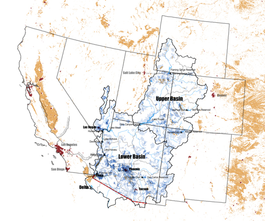
[The Colorado River Basin as a hydrological mega-object; image by the Commonwealth Approach project team: Alex Gonski, Rob Holmes, Rebecca May, and Laurel McSherry.]

I mentioned a little while ago that Laurel McSherry and I would be presenting our work on “The Commonwealth Approach” at the Arid Lands Institute’s Drylands Design Conference near the end of March. I thought I would post the official conference announcement:

The Arid Lands Institute at Woodbury University, in partnership with the California Architectural Foundation (CAF), hosts the Drylands Design Conference from March 22–24, 2012 on the Woodbury University campus in Burbank, California. Shifts in the economy, demographics and climate are causing westerners to rethink the centralized, energy-intensive water systems of the 20th century. Retrofitting the West: Adaptation by Design brings together architects, landscape architects, artists and engineers with leading environmental thinkers, scientists, and renowned conservationists to debate a range of design strategies for the future. More than 225 educators, design professionals and students are expected at the conference where the arid and semi-arid west will be re-examined as a vast field of opportunities for water-smart design innovation at a range of scales, from building systems to infrastructure and landscape spaces.

The Drylands Design Conference kicks off with an opening reception at the Architecture + Design Museum (A+D) in Los Angeles on Thursday, March 22. On view at the museum is Drylands Design, featuring selected work from CAF’s William Turnbull Drylands Design Competition (www.drylandscompetition.org). The exhibition showcases work by architects, landscape architects, engineers, artists, and urban designers responding to the challenges of water scarcity in the face of climate change. With a focus on the US West, the exhibition presents a portfolio of adaptive strategies large and small, rural and urban, high tech and low-carbon. Since no single solution will meet the complex needs of the US West, the exhibition explores a range of approaches for how buildings and parks, houses and streets, industry and agriculture, cities and neighborhoods might adapt to a water-stressed future. Following its run from March 22-April 26, 2012, the exhibition is scheduled to travel in the US and abroad.

In an innovative cross-disciplinary collaboration, ALI and UCLA’s Institute of the Environment and Sustainability provided technical and policy advising to five research award winners chosen from the CAF William Turnbull Drylands Design Competition. At the conference on Friday, March 23, the five award-winning teams will present their design proposals and discuss the policy implications they suggest.

These design case studies and the panel discussions they inform raise important questions about de-coupling energy and water, localizing resources, restructuring watershed governance, the scaleability of small systems, the relationship between water infrastructure and public architectures, and the role of the arts and design in shaping a working public landscape.

The conference puts both young and established design leaders in dialog with thinkers from an array of disciplines, including Wiliam DeBuys, Ph.D., writer and conservationist, author of seven books, the most recent A Great Aridness; Paul Bunje, Ph.D., Managing Director, Los Angeles Regional Collaborative for Climate Action and Sustainability, supported by the UCLA Institute of the Environment and Sustainability; Stephanie Pincetl, Director, Center for Sustainable Urban Systems, UCLA; James Workman, award-winning journalist and author of Heart of Dryness; and Barry Taylor, Ph.D., Professor at Fuller Theological Seminary and Art Center College of Design in Pasadena, California.

On Saturday March 24th, design educators are invited to a workshop on interdisciplinary methods for advancing Drylands Design regionally and globally.

Schools, NGOs, and design firms are encouraged to engage the conference from remote locations by subscribing to live-streaming.

Full details about the conference can be found here, including registration.

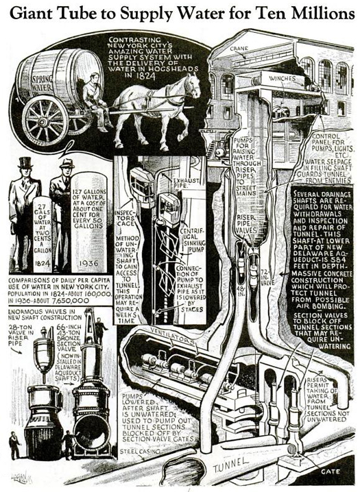
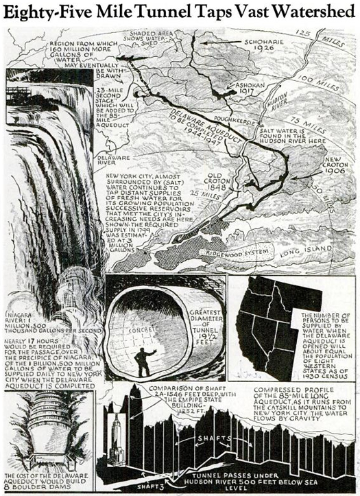
giant tube to supply water for ten millions

The wonder of inter-basin transfer, in the August 1937 issue of Popular Mechanics:

(The cover of that same issue, which wonders at the electrical power produced by and transmitted from Lake Mead, is also worth a look.)